Category: News

Parent category of all content that could be considered as news (as opposed to blog)

  • Aldridge Creek – 2015

    Aldridge Creek – 2015

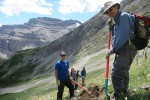
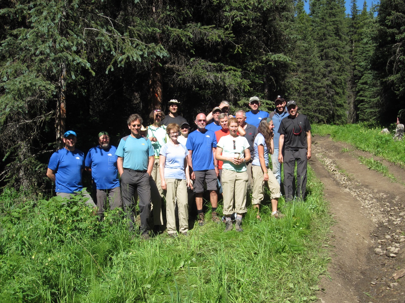
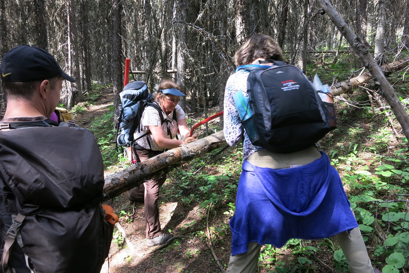
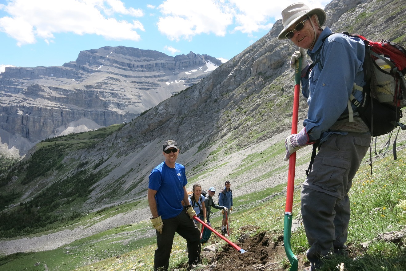
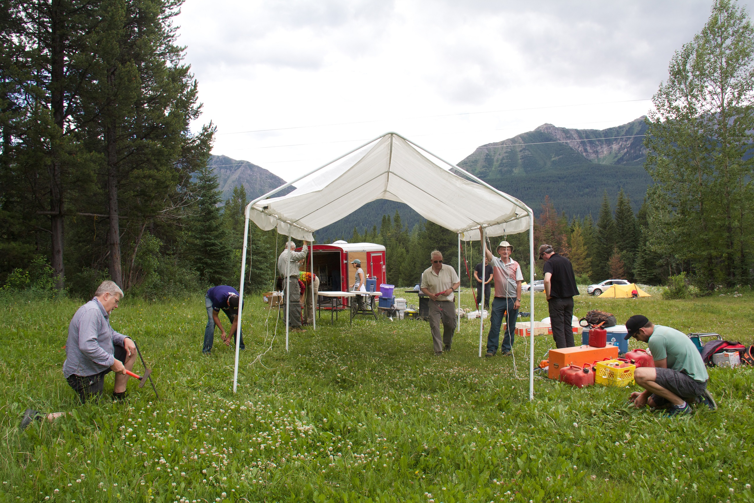
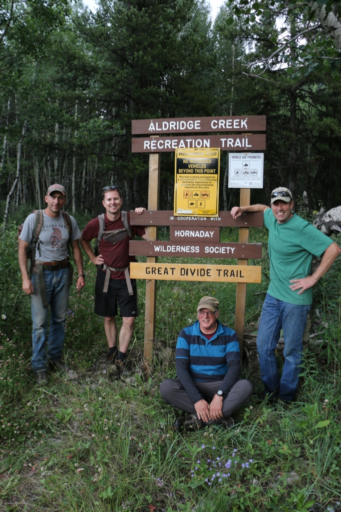
    From July 15-19, the Great Divide Trail Association partnered with the Hornaday Wilderness Society, the trail operator for the Aldridge Creek Trail. 18 volunteers worked to re-establish the trail from the Aldridge Creek trailhead to Fording River Pass, repairing and building trail tread, and removing brush and fallen trees. [Photos by Jean-Francois, Evan, Bill and Brad]

    Bill from the Hornaday Wilderness Society
    Bill from the Hornaday Wilderness Society
    Smokey and Bandit (Bill's dogs)
    Smokey and Bandit (Bill’s dogs)

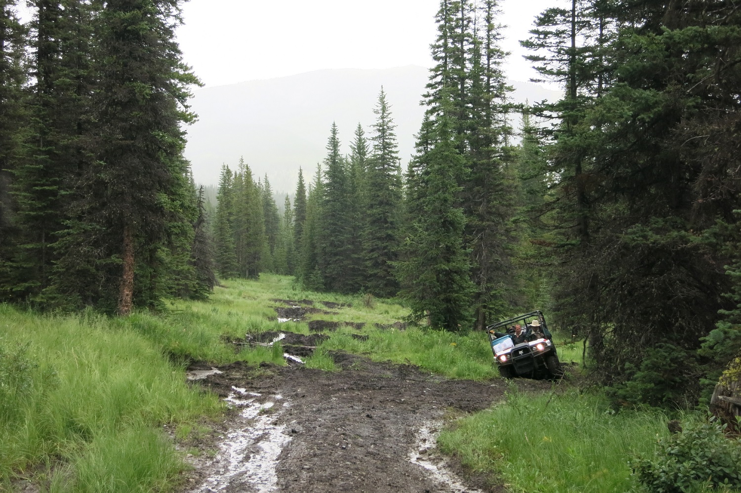
    A washout on the Kananaskis Powerline Road necessitated a last minute relocation of our basecamp but the new site proved to be even better.

    Setting up camp
    Setting up camp
    Our basecamp (and the vintage GDTA badge)
    Our basecamp (and the vintage GDTA badge)
    Transporting water to camp
    Transporting water to camp

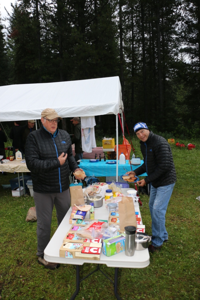
    Dan, our kitchen coordinator and camp chef, thought that ice cream would be a good idea on this year’s trip. But when all of the ice cream started melting on Day 1, everyone chipped in to make sure none went to waste.

    Dan's ice cream
    Dan’s ice cream


    Tools of the trade
    Tools of the trade
    Making lunches for the work day
    Making lunches for the work day
    The stare down
    The stare down

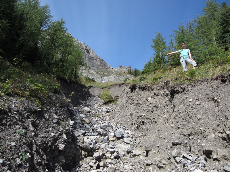
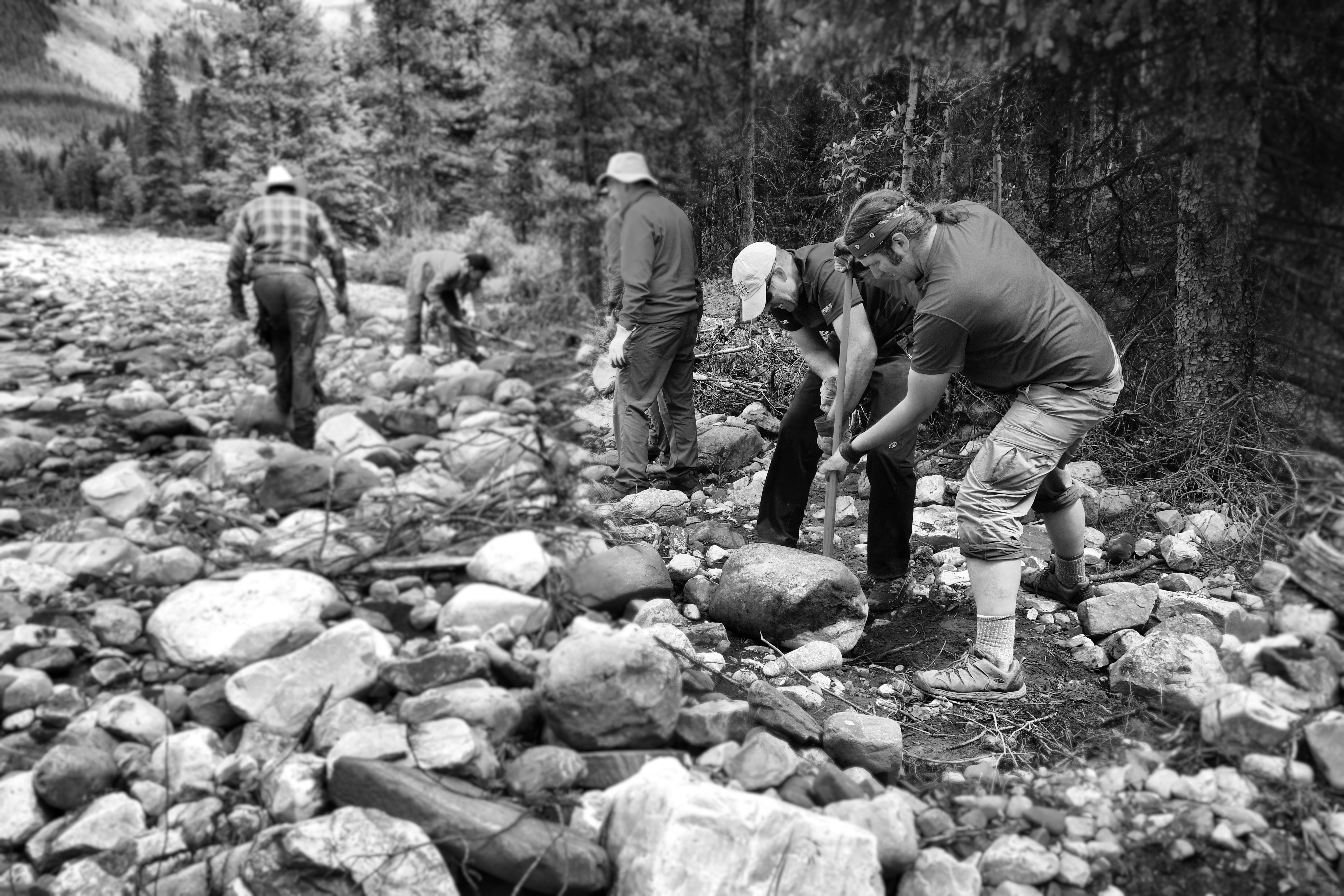
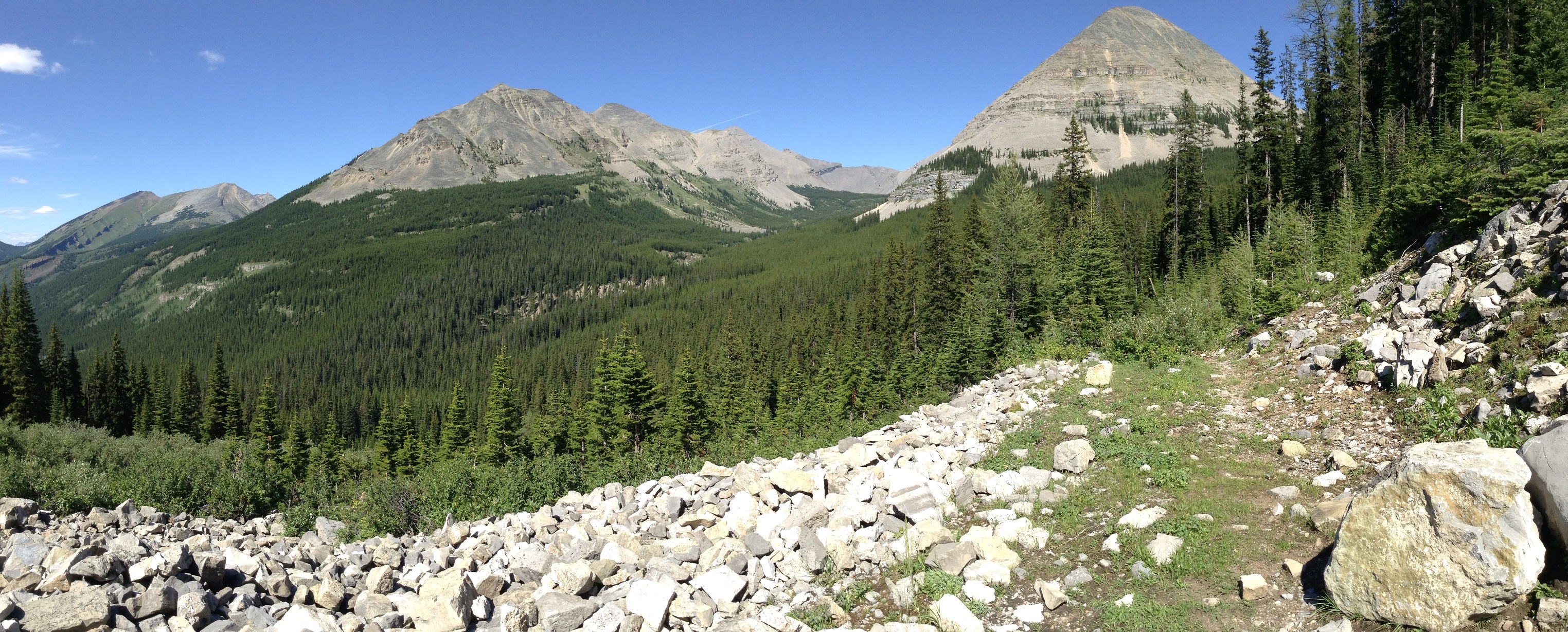
    The lower section of the Aldridge Creek Trail was washed out in 2013 when a massive flood increased the flow of the creek exponentially. After the flood, only remnants of the original trail remained on the huge gravel floodplain.

    Lower Aldridge Creek
    Aldridge Creek floodplain

    Our crew cleared boulders and debris and re-established the trail in the lower valley. This work involved the use of shovels, mattocks, saws and loppers.

    Trail building on the floodplain
    Trail building on the floodplain
    Boulder rolling
    Boulder rolling

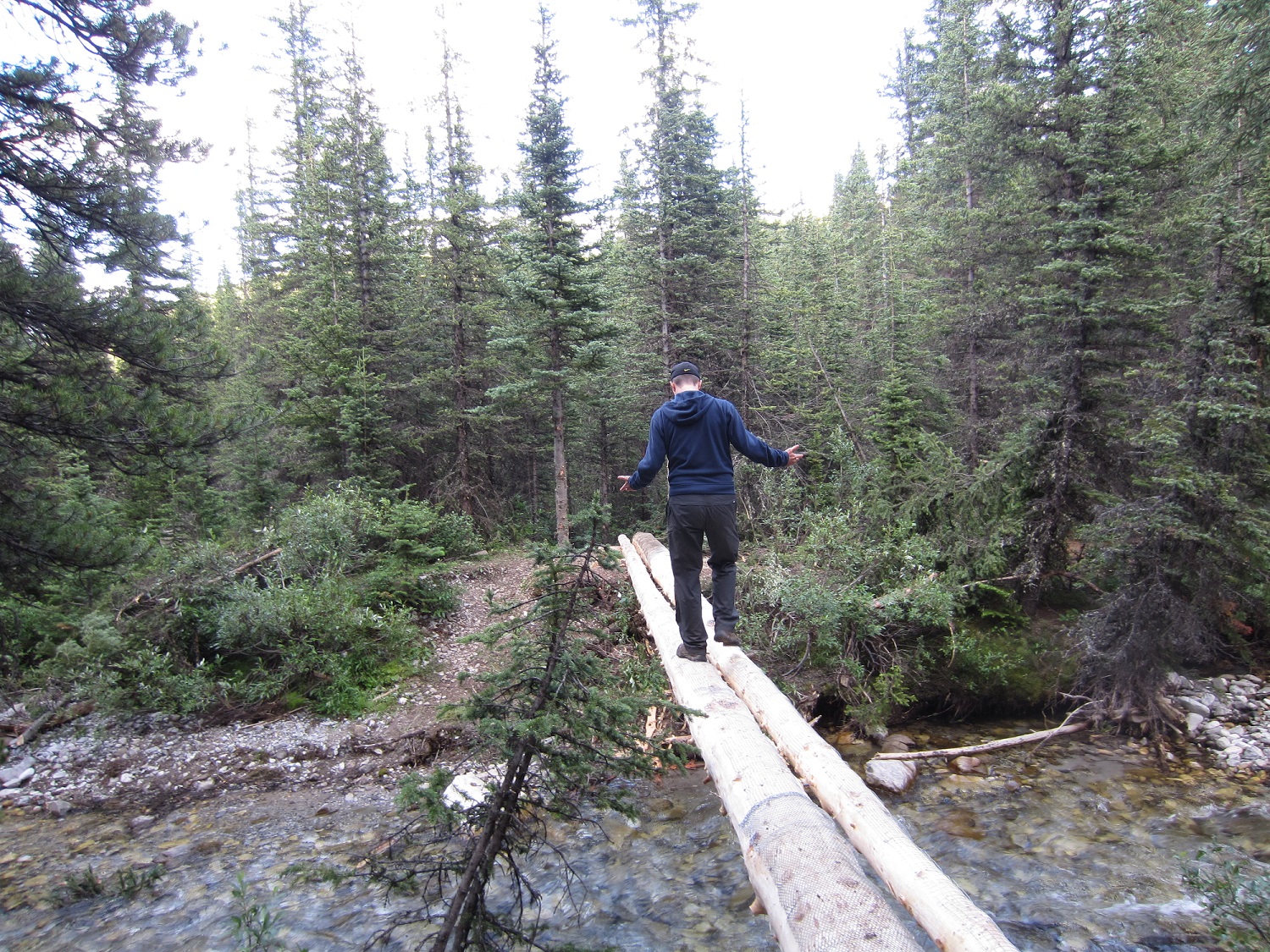
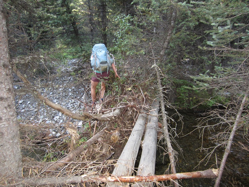
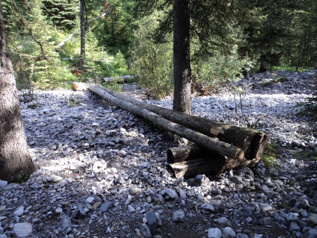
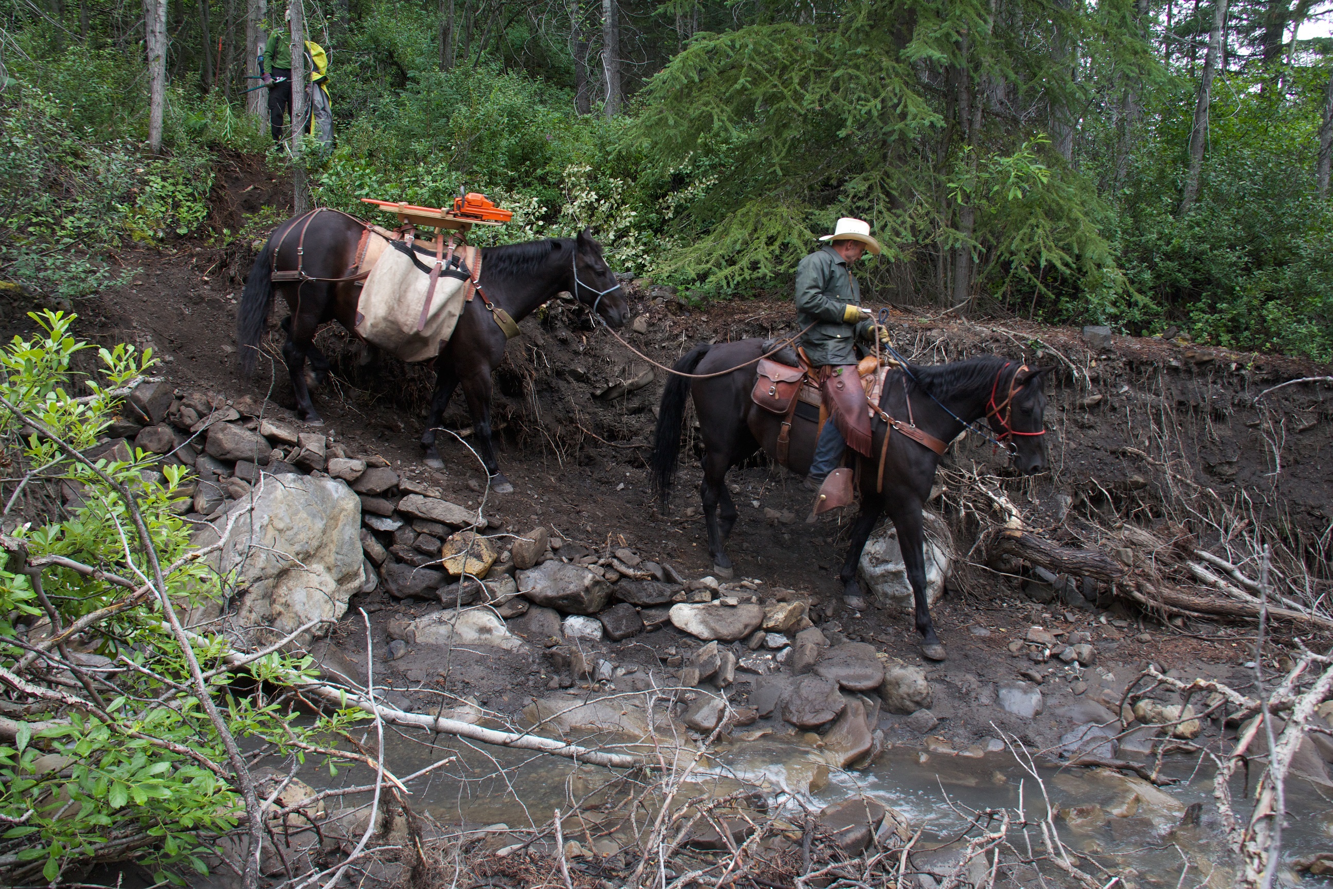
    A new crossing of Mud Creek was built, good for hikers and horses.

    Building new trail
    Building new trail at Mud Creek
    New trail at Mud Creek
    New trail at Mud Creek

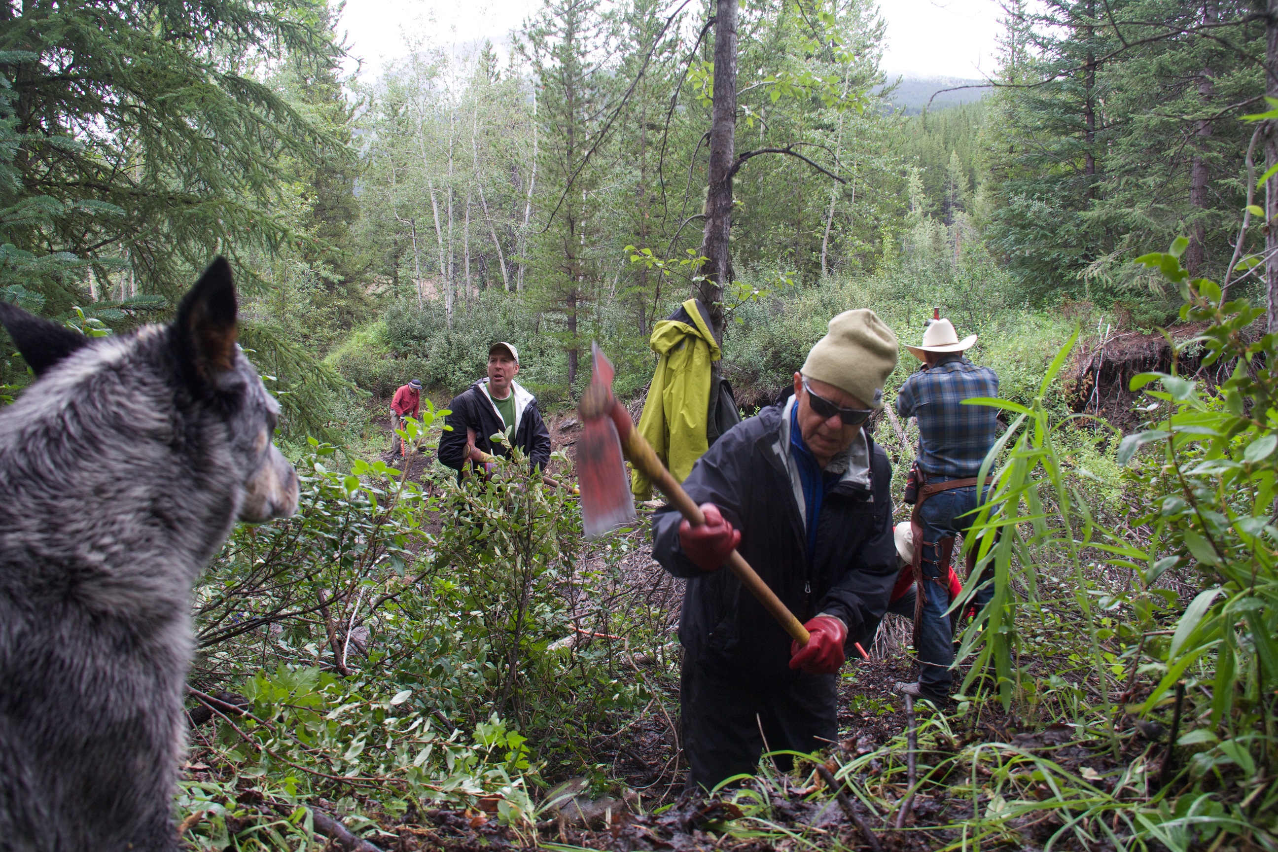
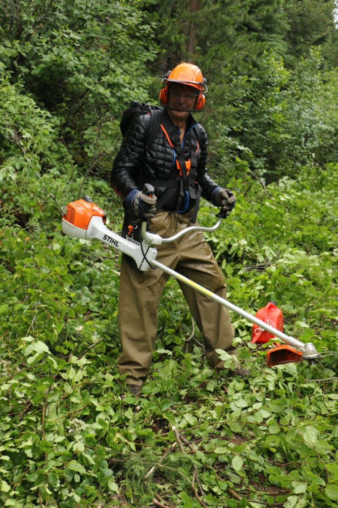
    The upper section of the Aldridge Creek Trail was overgrown with alder, often completely disappearing beneath the encroaching brush. Two Stihl brush saws and hours of sweat and hard work were needed to clear more than 3 kilometres of trail corridor.

    Ready to tackle the alder
    Ready to tackle the alder
    Alder clearing with the brush saws
    Alder clearing with the brush saws
    Re-establishing the trail corridor
    Re-establishing the trail corridor
    The soaking wet trail clearing crew
    The soaking wet trail clearing crew

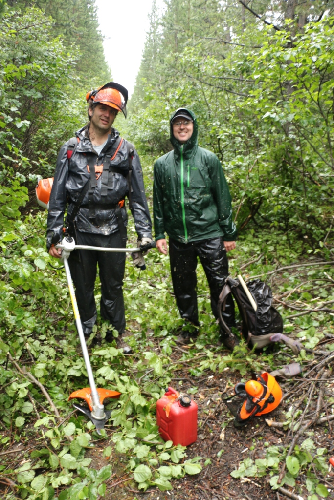
    We had expected it to take 2 days to clear the overgrown trail but it ended up taking 3 full days to re-establish the trail up to Fording River Pass.

    Nearing Fording River Pass
    Nearing Fording River Pass
    Larch trees near Fording River Pass
    Larch trees near Fording River Pass

    On Days 2 and 3 of our trip, we were greeted by 4 happy thru-hikers, all excited to see us clearing and repairing what had been a notoriously bad section of the GDT. We met Gian and Laura on Thursday and Erin and Elizabeth on Friday. Check out Erin’s blog where she writes about her experience meeting our GDTA Trail Crew.

    GDT thru-hikers, Laura and Gian (from Switzerland)
    GDT thru-hikers, Laura and Gian (from Switzerland)
    GDT thru-hikers Erin and Elizabeth with the GDTA crew
    GDT thru-hikers Erin and Elizabeth with the GDTA crew

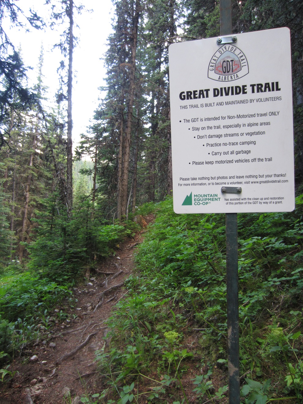
    And at the trailhead we installed our first ever routered GDT sign!

    The trailhead sign
    The trailhead sign

    Thanks to all of our dedicated volunteers who participated in this year’s GDT Trail Maintenance Trip. Your hard work and enthusiasm made for a hugely successful trip!

    The GDTA Volunteer Trail Crew
    The GDTA Volunteer Trail Crew

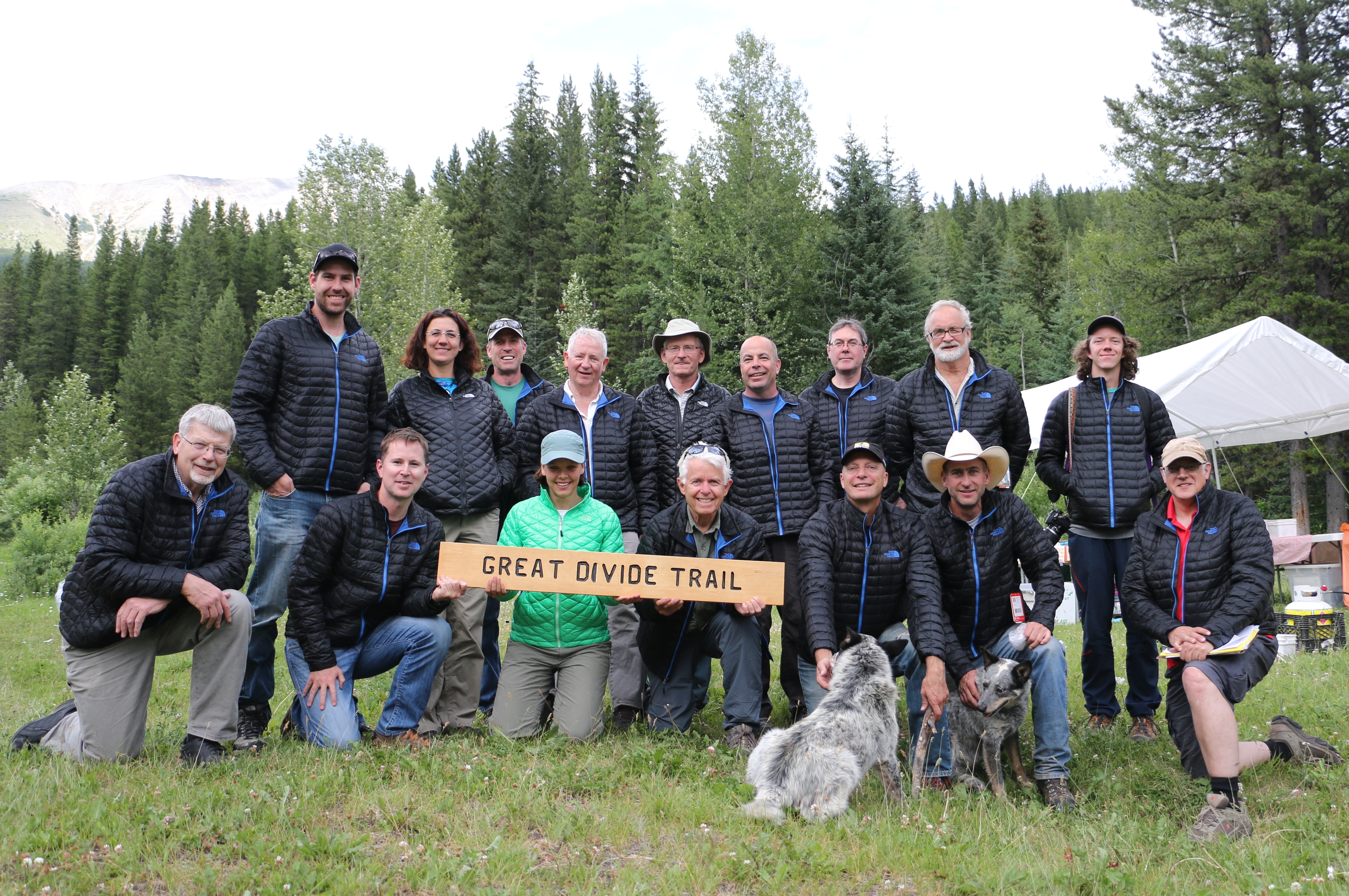
    Special thanks to our sponsors for making our trip possible: The North Face, MEC, the Yellowstone to Yukon Conservation Initiative, Stihl, Spray Lake Sawmills and Superstore – Thank you!

  • August 2015 Trail and Road Conditions

    August 2015 Trail and Road Conditions

    Trail Conditions Update – August 24, 2015

    TRAILS: Conditions are good on most of the GDT. Trails are mainly dry and snowfree. It’s berry season! Your chances of running into a bear on the trail are higher at this time of year. Berry bushes are found throughout the GDT, often bordering the trail and near campgrounds, so be aware.

    WILDFIRE UPDATES: Campfires are permitted in designated fire pits on the GDT in all of Alberta and in Mount Robson and Kakwa Provincial Parks in BC. Campfires are still prohibited on all other sections of the GDT in south-eastern BC.

    • The Waterton wildfire on the east slopes of Campbell Mountain is now 100% contained and is considered under control. The Lakeshore Trail has re-opened but fire crews are still working in the area.  Please be careful when walking on the Lakeshore Trail between Boundary Bay and Goat Haunt, and do not disturb any of the fire fighting equipment in the area.
    • The Excelsior Creek wildfire in Jasper National Park is considered under control and all sections of the GDT have re-opened.
    • The Kakwa Park wildfire burning in the Jarvis Creek Valley is out. The Jarvis Creek Valley is once again open to the public.

    TRAIL CLOSURES:

    • Elk Lakes Provincial Park: Extensive repairs and construction on the trail between Lower and Upper Elk Lakes to be carried out throughout 2015 hiking season. Detour to West Elk Pass by taking the Elkan Creek trail from the parking lot trailhead. Lower Elk Lake campground is still accessible but hikers are asked to exercise caution in this area during construction.
    • Banff National Park: Og Pass trail and Upper Assiniboine Pass trail within Banff National Park are closed from August 1 to September 30, to increase public safety, and to minimize displacement of grizzly bears from prime food sources at a critical time of the year. Hikers are permitted to access Mount Assiniboine Provincial Park via the lower Assiniboine Pass trail or the Wonder Pass trail.

    BEAR WARNINGS:

    • Jasper National Park: Grizzly bears are frequenting the Bald Hills area near the Skyline trailhead and Maligne Lake. Extra caution and bear spray is recommended when hiking in this area. Please report all bear sightings to 780-852-6155. (17AUG2015)
    • Jasper National Park: The Brazeau Loop, Nigel Pass and Poboktan Creek trails are open but a bear warning is in effect. Two grizzly bears have broken into cabins along the South Boundary trail to access horse feed. While they are no longer appearing at cabins and have not shown aggression to people, they may return to the area. Recommendations to minimize the potential of a bear encounter:  Travel in tight groups of 4 or more; make noise to alert bears of your presence; carry bear spray; and keep a clean campsite, secure all food and garbage on designated bear cables or in bear storage lockers.  Please report all bear sightings to 780-852-6155. (30JUL2015)
    • Waterton Lakes National Park: Special caution is recommended while travelling or camping along the Lakeshore Trail from Boundary Bay to the Waterton townsite as a black bear is frequenting the area and has obtained unsecured human food. Be prepared to encounter a bear at anytime in and around this area. (10AUG2015)

    TRAIL NOTICES:

    • The trail from Sage Pass (a17) to Scarpe Pass (a24) was cleared and blazed last year and is in good shape. From Scarpe Pass, the trail disappears up to La Coulotte Ridge and the hiking becomes significantly more difficult until you reach the ATV track (a27) heading down to the West Castle Road.
    • The Aldridge Creek Trail between Fording River Pass (b31) and the Kananaskis Power Line Road (b32) was cleared and restored in July 2015.
    • Cairnes Creek (d9): The bridge is washed out making this a potentially dangerous ford. It is recommended to cross early in the morning when glacial melt is lowest.
    • The Lambe Creek bridge (d10) is badly damaged so it is recommended to ford the creek further downstream and avoid using the broken bridge.
    • The Howse Pass Trail from Conway Creek (d12) to the Glacier Lake trail junction (d14, 15 km) is in very poor condition. The trail is overgrown, with hundreds of wind-fallen trees across the trail. Hiking in the Howse River floodplain is a viable alternative if the Howse River is low enough to ford.
    • The Owen Creek Trail was cleared in July 2015 up to km 5. Beyond that point, the trail is in poor shape with several washed out sections. Expect challenging hiking for 3 or 4 km including skirting along steep creek-side cliffs and rock-hopping in the creek itself. At km 6, do not take the trail heading up away from the creek (it is a deadend). Look for orange blazes marking the correct route staying near the creek.
    • The Maligne Pass trail in Jasper National Park has been decommissioned and is in poor shape. The trail from Pobokton Creek (e20) to Maligne Lake (e25, approx 42 km) is no longer being maintained by Parks Canada so expect deteriorating and overgrown trail conditions; long pants are recommended. The Maligne River bridge has been removed but the river can be easily forded (knee deep in mid-summer). Most other bridges are still in place.
    • The Yates Torrent Bridge is gone at the crossing of the Coleman Glacier outflow (near f16) so attempt to cross early in the morning when glacial melt is the lowest or be prepared for a fast and dangerous creek ford. Thanks to Christine Friesen for the update!

    ACCESS TRAIL CLOSURES:

    • Kootenay National Park – Due to washed out bridges, access to Numa Creek Falls and Trail remains closed.

    Access Roads Update:

    • Construction work on Highway 40 continues from south of the winter gate to Junction Highway 541; expect delays.
    • Access to the northern terminus of the GDT in Kakwa Provincial Park is via the Walker Creek Forest Service Road. The Walker Creek FSR has been repaired from Highway 16 to km 33.5. While travelling the remaining 50 kilometres on the Walker Creek FSR, attention is required to navigate the surface as it is uneven, rutted, slippery and very rough. The road is not recommended for anything other than a 4×4 high clearance vehicle. The last 10km from Bastille Creek to Buchanan Creek are particularly rough and muddy and might not be driveable by vehicle so be prepared to walk this distance on foot. Thanks to Canadoug for the update!
    • The Elk River FSR will be closed periodically at 123km, 142km, and 145km for bridge replacements between September 1 to September 30.
    • The Red Rock Parkway in Waterton Lakes National Park will be closed for the season starting September 8 until approximately May 2016.
  • July 2015 Trail and Road Conditions

    July 2015 Trail and Road Conditions

    Trail Conditions Update – July 27, 2015

    TRAILS: Conditions are good on most of the GDT. Trails are mainly dry with some wet and muddy sections and possible snow patches at higher elevations. The wildflower bloom is early this year!

    WILDFIRE UPDATE: Rain and cooler temperatures have decreased fire danger in much of the Canadian Rockies so the fire ban has been lifted in Banff and Jasper National Parks as well as in Mount Robson and Kakwa Provincial Parks. Campfires are permitted in designated fire pits on the GDT in Alberta and in Mount Robson and Kakwa Provincial Parks in BC. Campfires are still prohibited on all other sections of the GDT in south-eastern BC.

    • The Excelsior Creek Wildfire burning in Jasper National Park is now considered under control and all sections of the GDT have re-opened.
    • The Kakwa Park wildfire burning in the Jarvis Creek Valley has not resulted in the closure of the GDT in the area.

    TRAIL CLOSURE:

    • Elk Lakes Provincial Park: Extensive repairs and construction on the trail between Lower and Upper Elk Lakes to be carried out throughout 2015 hiking season. Detour to West Elk Pass by taking the Elkan Creek trail from the parking lot trailhead. Lower Elk Lake campground is still accessible but hikers are asked to exercise caution in this area during construction.

    BEAR WARNING:

    • Jasper National Park: The Brazeau Loop, Nigel Pass and Poboktan Creek trails have re-opened but a bear warning is in effect. Two grizzly bears have broken into cabins along the South Boundary trail to access horse feed. While they are no longer appearing at cabins and have not shown aggression to people, they may return to the area. Recommendations to minimize the potential of a bear encounter:  Travel in tight groups of 4 or more; make noise to alert bears of your presence; carry bear spray; and keep a clean campsite, secure all food and garbage on designated bear cables or in bear storage lockers.  Please report all bear sightings, incidents and animal carcasses to 780-852-6155.

    TRAIL NOTICES:

    • The trail from Sage Pass (a17) to Scarpe Pass (a24) was cleared and blazed last year and is in good shape. From Scarpe Pass, the trail disappears up to La Coulotte Ridge and the hiking becomes significantly more difficult until you reach the ATV track (a27) heading down to the West Castle Road.
    • The Aldridge Creek Trail between Fording River Pass (b31) and the Kananaskis Power Line Road (b32) was cleared and restored in July 2015.
    • The Wonder Pass trail (alternate route) has several large mudslides on the Marvel Lake section. It is recommended to go in and out via Assiniboine Pass to access Mount Assiniboine Provincial Park.
    • Cairnes Creek (d9): The bridge is washed out making this a potentially dangerous ford. It is recommended to cross early in the morning when glacial melt is lowest.
    • The Lambe Creek bridge (d10) is badly damaged so it is recommended to ford the creek further downstream and avoid using the broken bridge.
    • The Howse Pass Trail from Conway Creek (d12) to the Glacier Lake trail junction (d14, 15 km) is in very poor condition. The trail is overgrown, with hundreds of wind-fallen trees across the trail. Hiking in the Howse River floodplain is a viable alternative if the Howse River is low enough to ford.
    • The Owen Creek Trail was cleared in July 2015 up to km 5. Beyond that point, the trail is in poor shape with several washed out sections. Expect challenging hiking for 3 or 4 km including skirting along steep creek-side cliffs and rock-hopping in the creek itself. At km 6, do not take the trail heading up away from the creek (it is a deadend). Look for orange blazes marking the correct route.
    • The Maligne Pass trail in Jasper National Park has been decommissioned and is in poor shape. The trail from Pobokton Creek (e20) to Maligne Lake (e25, approx 42 km) is no longer being maintained by Parks Canada so expect deteriorating and overgrown trail conditions; long pants are recommended. The Maligne River bridge has been removed but the river can be easily forded (knee deep in mid-summer). Most other bridges are still in place.

    ACCESS TRAIL CLOSURES:

    • Kootenay National Park – UPDATE: Tumbling Creek Trail is now open. Due to washed out bridges, access to Numa Creek Falls and Trail remains closed.

    Access Roads Update:

    • Construction work on Highway 40 continues from south of the winter gate to Junction Highway 541; expect delays.
    • Access to the northern terminus of the GDT in Kakwa Provincial Park is via the Walker Creek Forest Service Road which has been repaired from Highway 16 to 33.5km on the Walker Creek FSR. The remaining 50 kilometres vary in condition from OK to very rough. The last 10km from Bastille Creek to Buchanan Creek are particularly rough and can be muddy so a 4×4 is recommended.
  • April 2015 Trail and Road Conditions

    April 2015 Trail and Road Conditions

    Trail Conditions Update – APRIL 17, 2015

    mountains-springtime
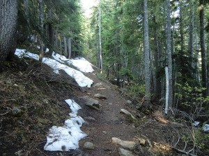
Spring is transition time on the GDT. Hiking trails at lower elevations vary from bare and muddy to slushy and icy, while trails at higher elevation remain snowbound with potential avalanche risk. Trails can be icy in the morning but warm daytime temperatures are creating slushy and slippery conditions. Snowshoes, cleats and/or poles are recommended for hikers.

    There has been some recent snowfall in April and avalanche conditions still exist, especially at higher elevations so always check the latest avalanche bulletins before setting out.

    Tick season has started. Be extra careful when in areas with a lot of underbrush and check yourself and your clothing after your hike.


    Access Roads Update:

    • Annual Winter Closure of Forestry Trunk Road 940 from December 1 to April 30, from Cataract Creek Campground to the junction with the Plateau Mountain access road.
    • Annual Winter Closure of Highway 40 from the Kananaskis Lakes Trail to the junction of Highway 541 between December 1 and June 15. Construction work continues from South of the winter gate to Junction Highway 541.
    • Annual Winter Closure of Highway 532 from December 1 to April 30, west of the staging area of the Indian Graves Campground to the intersection of the Forestry Trunk Road 940.


  • November 2014 Trail and Road Conditions

    November 2014 Trail and Road Conditions

    Trail Conditions Update – NOVEMBER 18, 2014

    Snowy trail
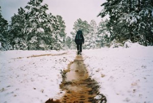
Winter has arrived in the Rocky Mountains! Snow has fallen on all of the GDT with significant accumulation at higher elevations. Expect snowy, slippery, wet or muddy trail conditions. Snow cleats or snowshoes are recommended. Temperatures are below freezing so be prepared for all weather conditions when travelling into the backcountry.

    Trail Closures and Notices:

    • TEMPORARY TRAIL CLOSURE (November 1, 2014 to February 28, 2015) – Jasper National Park: The GDT is closed from Four Point Campground to Poboktan Creek to prevent trails from facilitating an unnatural level of predator access to threatened woodland caribou.
    • TRAIL CLOSURE – Elk Lakes Provincial Park: Lower Elk Lakes trail beyond the campground (between Lower and Upper Lakes) and the trail from Upper Elk Lakes to West Elk Pass remain closed due to washed out bridges and sections of trail. DETOUR: Use Elkan Creek trail from the parking lot to Elk Pass (4km).
    • ACCESS TRAIL CLOSURE – Kootenay National Park: Tumbling Creek Trail remains closed.
    • NOTICES – Cairnes Creek: The bridge is washed out making this a potentially dangerous ford. It is recommended to cross early in the morning when glacial melt is lowest.
    • The Lambe Creek bridge is badly damaged so it is recommended to ford the creek further downstream and avoid using the broken bridge.
    • The Maligne Pass trail in Jasper National Park has been decommissioned and is in poor shape. The trail from Poboktan Creek to Maligne Lake (approx 42 km) is no longer being maintained by Parks Canada so expect deteriorating and overgrown trail conditions; long pants are recommended. The Maligne River bridge has been removed but the river can be easily forded (knee deep in mid-summer). Most other bridges are still in place.
    • The Aldridge Creek Trail between Fording River Pass and the Kananaskis Power Line is in very poor shape. The upper part of the trail is very overgrown. The creek has washed away much of the lower section of trail but it is still passable by following the rocky banks of the creek.

    Access Roads Update

    Winter conditions exist on most mountain highways and roads. Roads can be snowy and icy so check for the latest conditions before you travel and carry chains and/or winter tires. For more information, check out Alberta 511 and Drive BC.

    Alberta:

    • Construction continues on the Forestry Trunk Road 940, from the Junction highway 532 to the Junction highway 541. Outdoor enthusiasts may still access the Forestry Trunk Road during construction but through traffic will not be permitted as the entire roadway must be excavated. Barricades will be placed at convenient turnaround spots.
    • Highway 40 will be seasonally closed from Peter Lougheed Provincial Park to Highwood House beginning December 1.
    •  Forestry Trunk Road 940 will be seasonally closed south of Cataract Creek and northwest of Plateau Mountain Road beginning December 1.
    • Road 532 between Highway 22 and Road 940 is not maintain during the winter.

    BC:

    • The Blaeberry FSR is closed to non-industrial traffic at 11.5 km and washed out completely at 19.1 km. From this point, you can still travel the additional 22 km on foot or bike to the David Thompson Heritage Trailhead (on the GDT) near the Cairnes Creek Recreation site, which is deteriorated and partially flooded.
  • October 2014 Trail and Road Conditions

    October 2014 Trail and Road Conditions

    Fall on the GDTTrail Conditions Update – OCTOBER 7, 2014

    Fall colours are here! Fresh snow has fallen on most of the GDT and has begun accumulating at higher elevations. Expect slippery, wet and muddy trail conditions but most trails are still passable. Nighttime and early morning temperatures are below freezing so be prepared for all weather conditions when travelling into the backcountry.

    Trail Closures and Notices:

    • TRAIL CLOSURE – Elk Lakes Provincial Park: Lower Elk Lakes trail beyond the campground (between Lower and Upper Lakes) and the trail from Upper Elk Lakes to West Elk Pass remain closed due to washed out bridges and sections of trail. DETOUR: Use Elkan Creek trail from the parking lot to Elk Pass (4km).
    • ACCESS TRAIL CLOSURE – Kootenay National Park: Tumbling Creek Trail remains closed.
    • NOTICES – Cairnes Creek: The bridge is washed out making this a potentially dangerous ford. It is recommended to cross early in the morning when glacial melt is lowest.
    • The Lambe Creek bridge is badly damaged so it is recommended to ford the creek further downstream and avoid using the broken bridge.
    • The Maligne Pass trail in Jasper National Park has been decommissioned and is in poor shape. The trail from Pobokton Creek to Maligne Lake (approx 42 km) is no longer being maintained by Parks Canada so expect deteriorating and overgrown trail conditions; long pants are recommended. The Maligne River bridge has been removed but the river can be easily forded (knee deep in mid-summer). Most other bridges are still in place.
    • The Aldridge Creek Trail between Fording River Pass and the Kananaskis Power Line is in very poor shape. The upper part of the trail is very overgrown. The creek has washed away much of the lower section of trail but it is still passable by following the rocky banks of the creek.

    Access Roads Update

    Alberta:

    • Highway 40 is open from Highway 1 to Highway 541 but traffic is detoured or limited to one-lane in some areas due to construction work, in particular near Lineham Creek and Cat Creek where new bridges are being constructed. For more information, check out Alberta 511.
    • Construction continues on the Forestry Trunk Road 940, from the Junction highway 532 to the Junction highway 541. The road is scheduled to be closed Sept. 30 – Oct. 9 for culvert replacements from 6.5km north of the Jct. of Hwy 532 to 10.5km. Outdoor enthusiasts may still access the Forestry Trunk Road on those dates but through traffic will not be permitted as the entire roadway must be excavated. Barricades will be placed at convenient turnaround spots.
    • Highway 532 from junction of Forestry Trunk Road 940 to Highway 22 remains open during road repairs.
    • The Oldman River Road is washed out approximately 10 kilometres from the junction with Forestry Trunk Road 940 with no timetable for repair/re-opening.

    BC:

    • The Blaeberry FSR is closed to non-industrial traffic at 11.5 km and washed out completely at 19.1 km. From this point, you can still travel the additional 22 km on foot or bike to the David Thompson Heritage Trailhead (on the GDT) near the Cairnes Creek Recreation site, which is deteriorated and partially flooded but there is still a reasonably dry, flat area for camping
  • September 2014 Trail and Road Conditions

    September 2014 Trail and Road Conditions

    GDT AutumnTrail Conditions Update – SEPTEMBER 10, 2014

    Autumn is fast approaching, the leaves are changing and fresh snow has fallen on the southern portion of the GDT! Expect nighttime and early morning temperatures below freezing and fresh snowfall at higher elevations at anytime.

    The elk rutting season has begun and will last until mid-October.  Warning signs that read “ATTENTION – Elk Mating” have been posted at areas where elk herds often gather. Be aware that bull elk become extremely aggressive during rutting season so keep at least 30 metres away from all elk and never get between a male and female elk.

    As a result of last summer’s flood damage to the trail and bridges, some trails remain closed in 2014 (see below). It is recommended that anyone planning to hike the GDT this year research the status of any trails you wish to use and exercise additional caution and allow adequate time to route-find and safely navigate unforeseen obstacles.

    Trail Closures and Notices:

    • TRAIL CLOSURE – Elk Lakes Provincial Park: Lower Elk Lakes trail beyond the campground (between Lower and Upper Lakes) and the trail from Upper Elk Lakes to West Elk Pass remain closed due to washed out bridges and sections of trail. DETOUR: Use Elkan Creek trail from the parking lot to Elk Pass (4km).
    • ACCESS TRAIL CLOSURE – Kootenay National Park: Tumbling Creek Trail remains closed.
    • NOTICES – Cairnes Creek: The bridge is washed out making this a potentially dangerous ford. It is recommended to cross early in the morning when glacial melt is lowest.
    • The Lambe Creek bridge is badly damaged so it is recommended to ford the creek further downstream and avoid using the broken bridge.
    • The Maligne Pass trail in Jasper National Park has been decommissioned and is in poor shape. The trail from Pobokton Creek to Maligne Lake (approx 42 km) is no longer being maintained by Parks Canada so expect deteriorating and overgrown trail conditions; long pants are recommended. The Maligne River bridge has been removed but the river can be easily forded (knee deep in mid-summer). Most other bridges are still in place.

    Access Roads Update

    Alberta:

    • Highway 40 is open from Highway 1 to Highway 541 but traffic is detoured or limited to one-lane in some areas due to construction work, in particular near Lineham Creek and Cat Creek where new bridges are being constructed. For more information, check out Alberta 511.
    • Construction continues on Forestry Trunk Road 940 south of Cataract Creek to the Hwy 532 junction. The road will be open every Friday through Monday for recreational users but closed for construction activities from Tuesday to Thursday each week until further notice.
    • Highway 532 eastbound and westbound from junction of Forestry Trunk Road 940 to Highway 22 remains open during road repairs.
    • The Oldman River Road is washed out approximately 10 kilometres from the junction with Forestry Trunk Road 940 with no timetable for repair/re-opening.

    BC:

    • The Blaeberry FSR is closed to non-industrial traffic at 11.5 km and washed out completely at 19.1 km. From this point, you can still travel the additional 22 km on foot (or possibly bike) to the David Thompson Heritage Trailhead (on the GDT) near the Cairnes Creek Recreation site, which is deteriorated and partially flooded but there is still a reasonably dry, flat area for camping.
  • Hidden Creek – 2014

    Hidden Creek – 2014

    Twenty-one volunteers spent four days (July 24 to 27, 2014) working to repair damage to the Great Divide Trail caused by the June 2013 floods and re-established the trail from Tornado Saddle to the ridge crest north of Hidden Creek. Two bridges over South Hidden Creek were built, trail and cairns were constructed up to Tornado Saddle and the entire 16 kilometre section of trail was cleared and re-blazed. Volunteer crew

    The trip got off to a rocky start on Day 1 when the Bobcat carrying much of the camp gear got stuck in a bog and took the work of a dozen volunteers and almost two hours to get it unstuck.
    Stuck

    At the same time, it started to rain and the temperature dropped, resulting in some icy sleet and a cold, wet trail crew. But the situation quickly improved when the Bobcat returned with a load full of dry, warm clothing, a fire was started and steaks were grilled for dinner!

    After tool use and safety orientation in the morning on Day 2, the volunteers were divided into three separate trail crews:

    Bridge Crew – built two bridges over South Hidden Creek. This work involved strong backs and creative minds to get the logs across the 12 metre span over the creek. The logs were stripped clear of bark, secured to the sills, and covered in linseed oil and wire mesh. new bridge

    Clearing/Blazing Crew – removed brush and fallen trees, and blazed the trail to the ridge crest north of Hidden Creek. This work involved using a chainsaw to cut fallen trees, polesaws and loppers to remove brush and re-establish the trail corridor, and painting blazes on trees to mark the route. Clearing trail

    Saddle Crew – established the trail from South Hidden Creek to Tornado Saddle. This work involved using mattocks and shovels to build switchbacks up the steep slope below Tornado Saddle, piling of rocks to create cairns, and paint blazing of the cairns to mark the route.Building trail

    Three GDT signs were placed on the trail at junctions with ATV tracks. New sign
    Thanks to all of our hard-working and enthusiastic volunteers who participated in this year’s GDT Trail Maintenance Trip!

    Special thanks to our sponsors for making our trip possible: The North Face, MEC, Cervus Equipment, Stihl – Thank you!

  • July 2014 Trail and Road Conditions


    trail-conditions

    Trail Conditions Update – JULY 22, 2014

    High elevation sections of the GDT still have some snow patches but trail conditions are improving quickly. As a result of last summer’s flood damage to the trail and bridges, some trails remain closed in 2014 (see below). It is recommended that anyone planning to hike the GDT this year research the status of any trails you wish to use and exercise additional caution and allow adequate time to route-find and safely navigate unforeseen obstacles.

    Trail Closures and Notices:

    • TRAIL CLOSURE – As per Ministerial Order 43/2014, the GDT is closed at the Owen Creek trailhead to Pinto Lake due to the Spreading Creek Wildfire burning on the eastern boundary of Banff National Park about 10 kilometres east of the Saskatchewan River Crossing. The wildfire is being held but there is still significant smoke in the area. Highway 11 and Highway 93 are open but expect delays. Check the Alberta Wildfire Report for the latest information. DETOUR: Use Sunset Pass trail or Nigel Pass trail, 16 and 38 km north of the Saskatchewan River Crossing respectively.
    • TRAIL CLOSURE – Banff National Park: The Howse River/Pass Trail is closed due to the Spreading Creek Wildfire. No detour is available at this time due to the large size of backcountry area closed due to the wildfire.
    • TRAIL CLOSURE – Elk Lakes Provincial Park: Lower Elk Lakes trail beyond the campground (between Lower and Upper Lakes) and the trail from Upper Elk Lakes to West Elk Pass are closed due to washed out bridges and sections of trail. DETOUR: Use Elkan Creek trail and Elk Pass (east).
    • ACCESS TRAIL CLOSURES – Kootenay National Park: Numa Creek trail is temporarily closed due to a washed-out bridge. Tumbling Creek Trail remains closed for the summer.
    • Cairnes Creek: The bridge is washed out making this a potentially dangerous ford. It is recommended to cross early in the morning when glacial melt is lowest.
    • Highwood House store and gas bar are currently closed.

    Access Roads Update

    Alberta:

    • Highway 11 and Highway 93 are open but expect delays due to the Spreading Creek Wildfire.
    • Highway 40 is open from Highway 1 to Highway 541 but traffic is detoured or limited to one-lane in some areas due to construction work south of Lost Lemon Lookout to the junction with Highway 541, in particular near Lineham Creek where a new bridge is being constructed. For more information, check out Alberta 511.
    • Forestry Trunk Road 940 is now open from Highwood House to Highway 532. The section south of Cataract Creek is under construction so expect delays and rough conditions; caution is advised.
    • Highway 532 from junction Forestry Trunk Road 940 to Johnson Creek Bridge remains closed.
    • The Oldman River Road is washed out approximately 10 kilometres from the junction with Forestry Trunk Road 940 with no timetable for repair/re-opening.

    BC:

    • The Elk River Road accessing Elk Lakes Provincial Park is now open.


  • The Flood of 2013

    Unfortunately due to road and trail damage from the severe flooding in south-western Alberta in June 2013, our 2013 GDT Trail Maintenance trip was cancelled.

    From August 30 to September 1, 2013, three members of the Great Divide Trail Association hiked from Hidden Creek to Baril Creek, assessing damage to the GDT caused by the extreme flooding. In general the GDT in this section is still in good shape and hikeable but most creeks show some signs of severe flooding and associated damage, e.g. rock and tree debris, mud deposits and in a few extreme cases complete re-routing of the water channel. Several bridges have washed away but all creek crossings can still be forded. There are a few short sections where the trail has washed away but detours exist where necessary.

    Flood debris on the Cataract Creek bridge
    Flood debris on the Cataract Creek bridge
    Flood damaged gully
    Flood damaged gully

    As a result of damage to the trail and bridges it is recommended that hikers on the GDT exercise additional caution and allow adequate time to route-find and safely navigate unforeseen obstacles.

    Former ‘high-level’ bridge over Baril Creek

    Highwood House and Baril Creek trailhead are accessible via Highway 541 but other road closures have made access to the GDT difficult or impossible.