Category: News

Parent category of all content that could be considered as news (as opposed to blog)

  • October 2016 Trail and Road Conditions

    October 2016 Trail and Road Conditions

    Trail Conditions Update – October 14, 2016

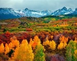
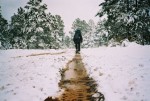
    Fall colours are here, and so is the snow! Fresh snow has fallen on most of the GDT. Expect snow above 1500 metres with wet, icy and slippery trail conditions, and wet and muddy sections at lower elevations with recent rainfall or snow melt. Nighttime and early morning temperatures are below freezing, and significant snow has accumulated at higher elevations. Be prepared for early winter weather conditions when travelling into the backcountry this fall.

    ELK RUTTING SEASON WARNING: It is elk rutting season until mid-October. Warning signs that read “ATTENTION – Elk Mating” have been posted at areas where elk herds often gather. Be aware that bull elk become extremely aggressive during rutting season so keep at least 30 metres away from all elk and never get between a male and female elk.

    BEAR WARNINGS: It’s pre-hibernation feeding season for both black and grizzly bears which increases the chances of running into a bear on the trail. It is easy to surprise a bear that is focussed on feeding so make noise while hiking in bear territory. Carry bear spray, watch for fresh bear signs, and if you see a bear, back away slowly and leave the area. Never run.

    • Jasper National Park – Two grizzly bears are frequenting the area between Nigel Pass and Maligne Pass. The bears have broken into cabins along the South Boundary trail to access horse feed. While they are no longer appearing at the cabins and have not shown aggression to people, they may return to the area. Pay extra attention when hiking in the area, make noise, and carry bear spray.

    TRAIL CLOSURES:

    • Waterton National Park – The Akamina Pass Trail is closed due to a black bear that has exhibited defensive behaviour towards people.

    WATERTON HIKER SHUTTLE SERVICE IS NOW CLOSED. Due to the construction at Cameron Lake Day-Use Area from April to November 2016, the Cameron Lake Day-Use Area and Akamina Parkway are closed to all traffic – including pedestrians and cyclists. The shuttle concluded service on September 18.

    WILDFIRE UPDATE: There are no campfire bans on the GDT. If you must have a campfire in the backcountry, ensure you follow the rules.

    TRAIL NOTICES:

    • The trail from Sage Pass (a17) to Scarpe Pass (a24) was cleared and blazed in August 2014 and is in good shape. From Scarpe Pass, the trail disappears up to La Coulotte Ridge and the hiking becomes significantly more difficult until you reach the ATV track (a27) heading down to the West Castle Road.
    • The Aldridge Creek Trail between Fording River Pass (b31) and the Kananaskis Power Line Road (b32) was cleared and restored in July 2015.
    • Cairnes Creek (d9): The bridge is washed out making this a potentially dangerous ford. It is recommended to cross early in the morning when glacial melt is lowest.
    • The damaged Lambe Creek bridge (d10) was removed in September 2015. It is recommended to ford the creek farther downstream and cross early in the morning when glacial melt is lowest.
    • The Howse Pass Trail from Conway Creek (d12) to the Glacier Lake trail junction (d14, 15 km) is in very poor condition. The trail is overgrown, with hundreds of wind-fallen trees across the trail. Hiking in the Howse River floodplain is a viable alternative if the Howse River is low enough to ford.
    • The Owen Creek Trail was cleared in July 2015 up to km 6. Beyond that point, the trail is in poor shape with several washed out sections. Expect challenging hiking for 3 km including skirting along steep creek-side cliffs and rock-hopping in the creek itself. At km 6, do not take the trail heading up away from the creek (it is a deadend). Look for orange blazes marking the correct route staying near the creek.
    • The trail from Pinto Pass (e5) to Pinto Lake (e6) was cleared and blazed in August 2016. A new toilet and bear hang were installed at the Pinto Lake North (main) campground.
    • The Maligne Pass trail in Jasper National Park has been decommissioned and is in poor shape. The trail from Pobokton Creek (e20) to Maligne Lake (e25, approx 42 km) is no longer being maintained by Parks Canada so expect deteriorating and overgrown trail conditions; long pants are recommended. The Maligne River bridge has been removed but the river can be easily forded in normal summer conditions (knee deep in mid-summer). Most other bridges are still in place. Read Nathan Dahl’s August 30, 2015 Maligne Pass trail update here.
    • The trail from Colonel Pass (f9) to Upright Creek (f12) was cleared and blazed in August 2016. The trail has been moved back to the east side of the Moose River between Colonel Creek and Upright Creek and the ford of Upright Creek is marked. Colonel Creek campground (f11) has been restored.
    • The Yates Torrent Bridge is out at the crossing of the Coleman Glacier outflow (near f16). Do not attempt to cross at the old bridge location. Instead, ford the Smoky River farther down the valley. Attempt to cross early in the morning when glacial melt is the lowest or be prepared for a fast and potentially dangerous creek ford.
    • The bridges across Gendarme and Carcajou creeks are out on the Jasper North Boundary Trail. These two creeks are smaller than the Smoky River, but can still be treacherous. Cross Gendarme at the horse crossing just below the old bridge. Carcajou can be forded where the trail crosses the creek, unless the water level is high, then cross about 100m below the trail.
    • The trail north of Jackpine Pass (f21) all the way to Kakwa Pass (f42), is not marked and frequently disappears in meadows and boggy river valleys. Follow the GPS track to stay on route.
    • The bridge across Buchanan Creek, near the Kakwa Lake trailhead, has been removed. The crossing here can be hazardous early in the year or after heavy rains. In 2015, a gravel bar about 50 metres across the creek upstream provided the best crossing. The 10 km of road from Buchanan Creek to Bastille Creek is closed to vehicles as it is no longer driveable due to washouts so be prepared to walk this distance on foot.

    ACCESS TRAILS:

    • Kootenay National Park – Numa Creek Trail remains closed due to a washed out bridge.

    ACCESS ROADS:

    • Due to the construction at Cameron Lake Day-Use Area from April to November 2016, the Cameron Lake Day-Use Area and Akamina Parkway are closed to all traffic – including pedestrians and cyclists. For more information and updates, check out Parks Canada’s website.
    • Access to the northern terminus of the GDT in Kakwa Provincial Park is via the Walker Creek Forest Service Road. The Walker Creek FSR has been repaired from Highway 16 to km 33.5. While travelling the remaining 40 kilometres on the Walker Creek FSR, attention is required to navigate the surface as it is uneven, rutted and slippery. The road is not recommended for anything other than a 4×4 high clearance vehicle. The last 10 km from Bastille Creek to Buchanan Creek is closed due to washouts and is not driveable by vehicle so be prepared to walk this distance on foot.
  • High Rock Trail – 2016

    High Rock Trail – 2016

    From July 20-24, 2016, the Great Divide Trail Association sent in our largest crew ever to begin construction of the first new section of the GDT in thirty years. 26 hard-working volunteers worked to clear the forested corridor, establish tread and flag future trail in what will become the High Rock Trail section of the GDT.

    Over 2 km of new trail was constructed over five days. This GDTA Signature Trip embarked on what will be a 5 year project to build 40 km of new trail and move the Great Divide Trail away from the Line Creek Mine in British Columbia into Alberta. (Photos by Jean-Francois Cianci, Jocelyn Wood, and Brad Vaillancourt)

    Cutting ribbon on the first new section of the GDT in 30 years!
    Cutting ribbon on the first new section of the GDT in 30 years!

    The GDTA Volunteer Crew spent their first day travelling from Calgary to Dutch Creek where the Signature Trip base camp was set up.

    Base camp from above
    Base camp from above

    The crew received introductory training to tool safety, learned more about the trail building objectives for the next four days, received jackets courtesy of GDTA sponsor, The North Face, and ate an incredible steak dinner with ice cream for dessert – fuel for the hard work that would start on Day 2.

    Dessert!
    Dessert!

    Day 2 began with a hike down the end of the road, tools in tow, to the start of what will become the High Rock Trail. The morning was spent training the crew in the art of building new trail. CBC joined our crew on Day 2 to film and interview several of our volunteers.

    CBC interview
    CBC interview

    After learning and practicing, the volunteers split into crews and began tackling actual trail construction. Quickly the crews began demonstrating their newly acquired trail building skills, clearing the large trees with Stihl chainsaws, and shrubs using Stihl brush saws, loppers and handsaws to open up the corridor along a flagged route.

    Brushing the trail corridor
    Brushing the trail corridor
    Clearing the trail corridor
    Clearing the trail corridor

    As the corridor opened, a tread building crew followed behind with shovels and mattocks.

    Tread building
    Tread building

    All the while, a crew of four volunteers worked on ditching a lower section of trail that sees constant flooding.

    Ditch digging
    Ditch digging

    A great first day of work wrapped up with a good meal and relaxation around the campfire.

    Relaxing back at camp
    Relaxing back at camp

    Day 3 began bright and early as the crews hiked back out for a full day of trail building. As rain came down, the two crews connected and 2 km of trail corridor was opened.

    Father and daughter connect the new trail
    Father and daughter connect the new trail

    From here, crews focussed on creating a sustainable trail tread. The incredible GDTA volunteers completed the final touches on the brand new 2 km of trail at the end of Day 4.

    Brand new GDT
    Brand new GDT
    The "Stairway to Evan"
    The “Stairway to Evan”

    This trail building trip was a success for the GDTA in large part due to the donations and support by sponsors including Mountain Equipment Co-op, The North Face, Stihl, Spray Lake Sawmills, Wi-Com and Great Canadian Superstore.

    The GDTA Volunteer Trail Crew in North Face blue
    The GDTA Volunteer Trail Crew in North Face blue

    The enthusiastic volunteers worked hard because they had the fuel to keep them going, the tools to do the job and the passion for volunteering in such a spectacular place with other like-minded people. Thanks to all of our dedicated volunteers who participated in this year’s GDT Trail Building Trip and made it such a huge success!

    Making s'mores around the campfire
    Making s’mores around the campfire
  • September 2016 Trail and Road Conditions

    September 2016 Trail and Road Conditions

    Trail Conditions Update – September 22, 2016

    Fall is here and that means shorter days and quickly changing weather conditions in the mountains. Temperatures are dropping below freezing, and fresh snow has fallen and started to accumulate at higher elevations. Most trails have wet and muddy sections in areas with recent rainfall or snowfall. Creek crossings may be higher than normal during periods of significant rainfall.

    ELK RUTTING SEASON WARNING: It is elk rutting season until mid-October. Warning signs that read “ATTENTION – Elk Mating” have been posted at areas where elk herds often gather. Be aware that bull elk become extremely aggressive during rutting season so keep at least 30 metres away from all elk and never get between a male and female elk.

    BEAR WARNINGS: It’s pre-hibernation feeding season for both black and grizzly bears which increases the chances of running into a bear on the trail. It is easy to surprise a bear that is focussed on feeding so make noise while hiking in bear territory. Carry bear spray, watch for fresh bear signs, and if you see a bear, back away slowly and leave the area. Never run.

    • Banff National Park – To protect sensitive habitat and improve habitat security for grizzly bears, hiking is only permitted on designated trails and roads in the Sunshine Meadows, Citadel Pass, and Healy Pass areas of Banff National Park. Any off-trail use is prohibited without a restricted activity permit.
    • Jasper National Park – Two grizzly bears are frequenting the area between Nigel Pass and Maligne Pass. The bears have broken into cabins along the South Boundary trail to access horse feed. While they are no longer appearing at the cabins and have not shown aggression to people, they may return to the area. Pay extra attention when hiking in the area, make noise, and carry bear spray.

    TRAIL CLOSURES:

    • Waterton National Park – The Akamina Pass Trail is closed due to a black bear that has exhibited defensive behaviour towards people.
    • Jasper National Park – Trail #7 is closed to hikers at the junction with Trail #4g to Old Fort Point trailhead due to grizzly bears frequenting the area, and displaying aggressive behaviour. Detour is available by taking Trail #4g to Annette Lake where you can connect with Trails #4 or the Athabasca River trail to reach the Old Fort Point bridge (e34).
    • Banff National Park – To increase public safety and minimize displacement of grizzly bears from prime food sources at a critical time of the year, the Og Pass and Upper Assiniboine Pass trails are closed. Hikers are permitted to access Mount Assiniboine Provincial Park through Banff National Park via the lower Assiniboine Pass trail or the Wonder Pass trail.

    WATERTON HIKER SHUTTLE SERVICE IS NOW CLOSED. Due to the construction at Cameron Lake Day-Use Area from April to November 2016, the Cameron Lake Day-Use Area and Akamina Parkway are closed to all traffic – including pedestrians and cyclists. The shuttle concluded service on September 18.

    WILDFIRE UPDATE: There are no campfire bans on the GDT. If you must have a campfire in the backcountry, ensure you follow the rules.

    TRAIL NOTICES:

    • The trail from Sage Pass (a17) to Scarpe Pass (a24) was cleared and blazed in August 2014 and is in good shape. From Scarpe Pass, the trail disappears up to La Coulotte Ridge and the hiking becomes significantly more difficult until you reach the ATV track (a27) heading down to the West Castle Road.
    • The Aldridge Creek Trail between Fording River Pass (b31) and the Kananaskis Power Line Road (b32) was cleared and restored in July 2015.
    • Cairnes Creek (d9): The bridge is washed out making this a potentially dangerous ford. It is recommended to cross early in the morning when glacial melt is lowest.
    • The damaged Lambe Creek bridge (d10) was removed in September 2015. It is recommended to ford the creek farther downstream and cross early in the morning when glacial melt is lowest.
    • The Howse Pass Trail from Conway Creek (d12) to the Glacier Lake trail junction (d14, 15 km) is in very poor condition. The trail is overgrown, with hundreds of wind-fallen trees across the trail. Hiking in the Howse River floodplain is a viable alternative if the Howse River is low enough to ford.
    • The Owen Creek Trail was cleared in July 2015 up to km 6. Beyond that point, the trail is in poor shape with several washed out sections. Expect challenging hiking for 3 km including skirting along steep creek-side cliffs and rock-hopping in the creek itself. At km 6, do not take the trail heading up away from the creek (it is a deadend). Look for orange blazes marking the correct route staying near the creek.
    • The trail from Pinto Pass (e5) to Pinto Lake (e6) was cleared and blazed in August 2016. A new toilet and bear hang were installed at the Pinto Lake North (main) campground.
    • The Maligne Pass trail in Jasper National Park has been decommissioned and is in poor shape. The trail from Pobokton Creek (e20) to Maligne Lake (e25, approx 42 km) is no longer being maintained by Parks Canada so expect deteriorating and overgrown trail conditions; long pants are recommended. The Maligne River bridge has been removed but the river can be easily forded in normal summer conditions (knee deep in mid-summer). Most other bridges are still in place. Read Nathan Dahl’s August 30, 2015 Maligne Pass trail update here.
    • The trail from Colonel Pass (f9) to Upright Creek (f12) was cleared and blazed in August 2016. The trail has been moved back to the east side of the Moose River between Colonel Creek and Upright Creek and the ford of Upright Creek is marked. Colonel Creek campground (f11) has been restored.
    • The Yates Torrent Bridge is out at the crossing of the Coleman Glacier outflow (near f16). Do not attempt to cross at the old bridge location. Instead, ford the Smoky River farther down the valley. Attempt to cross early in the morning when glacial melt is the lowest or be prepared for a fast and potentially dangerous creek ford.
    • The bridges across Gendarme and Carcajou creeks are out on the Jasper North Boundary Trail. These two creeks are smaller than the Smoky River, but can still be treacherous. Cross Gendarme at the horse crossing just below the old bridge. Carcajou can be forded where the trail crosses the creek, unless the water level is high, then cross about 100m below the trail.
    • The trail north of Jackpine Pass (f21) all the way to Kakwa Pass (f42), is not marked and frequently disappears in meadows and boggy river valleys. Follow the GPS track to stay on route.
    • The bridge across Buchanan Creek, near the Kakwa Lake trailhead, has been removed. The crossing here can be hazardous early in the year or after heavy rains. In 2015, a gravel bar about 50 metres across the creek upstream provided the best crossing. The 10 km of road from Buchanan Creek to Bastille Creek is closed to vehicles as it is no longer driveable due to washouts so be prepared to walk this distance on foot.

    ACCESS TRAILS:

    • Kootenay National Park – Numa Creek Trail remains closed due to a washed out bridge.

    ACCESS ROADS:

    • Due to the construction at Cameron Lake Day-Use Area from April to November 2016, the Cameron Lake Day-Use Area and Akamina Parkway are closed to all traffic – including pedestrians and cyclists. For more information and updates, check out Parks Canada’s website.
    • Access to the northern terminus of the GDT in Kakwa Provincial Park is via the Walker Creek Forest Service Road. The Walker Creek FSR has been repaired from Highway 16 to km 33.5. While travelling the remaining 40 kilometres on the Walker Creek FSR, attention is required to navigate the surface as it is uneven, rutted and slippery. The road is not recommended for anything other than a 4×4 high clearance vehicle. The last 10 km from Bastille Creek to Buchanan Creek is closed due to washouts and is not driveable by vehicle so be prepared to walk this distance on foot.
  • August 2016 Trail and Road Conditions

    August 2016 Trail and Road Conditions

    Trail Conditions Update – August 29, 2016

    Trails are mostly in good condition, bare and dry with some muddy sections in areas with recent rainfall or snowfall (yes, snow has fallen at higher elevations in the north!).

    BEAR WARNINGS: It’s berry season on the GDT which increases the chances of running into a bear on the trail. Berry bushes are found throughout the Canadian Rockies, often bordering trails, roads and campgrounds. Both black and grizzly bears utilize this critical food source. It is easy to surprise a bear that is focussed on eating berries so make noise while hiking in berry territory. Carry bear spray, watch for fresh bear signs, and if you see a bear, back away slowly and leave the area. Never run.

    • Banff National Park – To protect sensitive habitat and improve habitat security for grizzly bears, hiking is only permitted on designated trails and roads in the Sunshine Meadows, Citadel Pass, and Healy Pass areas of Banff National Park. Any off-trail use is prohibited without a restricted activity permit.
    • Jasper National Park – Two grizzly bears are frequenting the area between Nigel Pass and Maligne Pass. The bears have broken into cabins along the South Boundary trail to access horse feed. While they are no longer appearing at the cabins and have not shown aggression to people, they may return to the area. Pay extra attention when hiking in the area, make noise, and carry bear spray.

    TRAIL CLOSURES:

    • Jasper National Park – Trail #7 is closed to hikers at the junction with Trail #4g to the junction with Trail #7a due to grizzly bears frequenting the area, and displaying aggressive behaviour. Detour is available by taking Trail #4g to Annette Lake where you can connect with Trails #4, #7b or the Athabasca River trail to reach the Old Fort Point bridge (e34).
    • Banff National Park – To increase public safety and minimize displacement of grizzly bears from prime food sources at a critical time of the year, the Og Pass and Upper Assiniboine Pass trails are closed. Hikers are permitted to access Mount Assiniboine Provincial Park through Banff National Park via the lower Assiniboine Pass trail or the Wonder Pass trail.

    WILDFIRE UPDATE: There are no campfire bans on the GDT. If you must have a campfire in the backcountry, ensure you follow the rules.

    WATERTON HIKER SHUTTLE SERVICE: Due to the construction at Cameron Lake Day-Use Area from April to November 2016, the Cameron Lake Day-Use Area and Akamina Parkway are closed to all traffic – including pedestrians and cyclists. GDT Hikers are not allowed to walk on the Akamina Parkway during construction, however Parks Canada is providing a complimentary shuttle service for hikers to safely access trailheads for the duration of the work.  The shuttle departs from Cameron Lake at the Summit Lake/Carthew-Alderson trailhead daily at 8:15am, 9:15am, 11:15am, 2:15pm, 4:00pm and 6:00pm. From Cameron Lake to Waterton townsite, shuttle stops include Akamina Pass, Rowe/Tamarack, Lineham, and Crandell Lake trailheads. Hikers are advised to be at the trailhead pickup locations 10 minutes prior to the scheduled departure time.

    TRAIL NOTICES:

    • The trail from Sage Pass (a17) to Scarpe Pass (a24) was cleared and blazed in August 2014 and is in good shape. From Scarpe Pass, the trail disappears up to La Coulotte Ridge and the hiking becomes significantly more difficult until you reach the ATV track (a27) heading down to the West Castle Road.
    • The Aldridge Creek Trail between Fording River Pass (b31) and the Kananaskis Power Line Road (b32) was cleared and restored in July 2015.
    • Cairnes Creek (d9): The bridge is washed out making this a potentially dangerous ford. It is recommended to cross early in the morning when glacial melt is lowest.
    • The damaged Lambe Creek bridge (d10) was removed in September 2015. It is recommended to ford the creek further downstream and cross early in the morning when glacial melt is lowest.
    • The Howse Pass Trail from Conway Creek (d12) to the Glacier Lake trail junction (d14, 15 km) is in very poor condition. The trail is overgrown, with hundreds of wind-fallen trees across the trail. Hiking in the Howse River floodplain is a viable alternative if the Howse River is low enough to ford.
    • The Owen Creek Trail was cleared in July 2015 up to km 6. Beyond that point, the trail is in poor shape with several washed out sections. Expect challenging hiking for 3 km including skirting along steep creek-side cliffs and rock-hopping in the creek itself. At km 6, do not take the trail heading up away from the creek (it is a deadend). Look for orange blazes marking the correct route staying near the creek.
    • NEW: The trail from Pinto Pass (e5) to Pinto Lake (e6) was cleared and blazed in August 2016. A new toilet and bear hang were installed at the Pinto Lake North (main) campground.
    • The Maligne Pass trail in Jasper National Park has been decommissioned and is in poor shape. The trail from Pobokton Creek (e20) to Maligne Lake (e25, approx 42 km) is no longer being maintained by Parks Canada so expect deteriorating and overgrown trail conditions; long pants are recommended. The Maligne River bridge has been removed but the river can be easily forded in normal summer conditions (knee deep in mid-summer). Most other bridges are still in place. Read Nathan Dahl’s August 30, 2015 Maligne Pass trail update here.
    • NEW: The trail from Colonel Pass (f9) to Upright Creek (f12) was cleared and blazed in August 2016. The trail has been moved back to the east side of the Moose River between Colonel Creek and Upright Creek and the ford of Upright Creek is well marked. Colonel Creek campground (f11) has been restored.
    • The Yates Torrent Bridge is out at the crossing of the Coleman Glacier outflow (near f16). Do not attempt to cross at the old bridge location. Instead, ford the Smoky River further down the valley. Attempt to cross early in the morning when glacial melt is the lowest or be prepared for a fast and potentially dangerous creek ford.
    • The bridges across Gendarme and Carcajou creeks are out on the Jasper North Boundary Trail. These two creeks are smaller than the Smoky River, but can still be treacherous. Cross Gendarme at the horse crossing just below the old bridge. Carcajou can be forded where the trail crosses the creek, unless the water level is high, then cross about 100m below the trail.
    • The trail north of Jackpine Pass (f21) all the way to Kakwa Pass (f42), is not marked and frequently disappears in meadows and boggy river valleys. Follow the GPS track to stay on route.
    • The bridge across Buchanan Creek, near the Kakwa Lake trailhead, has been removed. The crossing here can be hazardous early in the year or after heavy rains. In 2015, a gravel bar about 50 metres across the creek upstream provided the best crossing. The 10 km of road from Buchanan Creek to Bastille Creek is closed to vehicles as it is no longer driveable due to washouts so be prepared to walk this distance on foot.

    ACCESS TRAILS:

    • Kootenay National Park – Numa Creek Trail remains closed due to a washed out bridge.

    ACCESS ROADS:

    • Due to the construction at Cameron Lake Day-Use Area from April to November 2016, the Cameron Lake Day-Use Area and Akamina Parkway are closed to all traffic – including pedestrians and cyclists. Parks Canada is providing a complimentary shuttle service for hikers to safely access trailheads for the duration of the work. Shuttle stops include Cameron Lake/Carthew-Alderson, Akamina Pass, Rowe/Tamarack, Lineham, Crandell Lake trailheads. Note that some trailheads along the parkway may be temporarily closed for reconfiguration and then reopened sequentially as work is completed throughout the summer. For more information and updates, check out Parks Canada’s website.
    • Access to the northern terminus of the GDT in Kakwa Provincial Park is via the Walker Creek Forest Service Road. The Walker Creek FSR has been repaired from Highway 16 to km 33.5. While travelling the remaining 40 kilometres on the Walker Creek FSR, attention is required to navigate the surface as it is uneven, rutted and slippery. The road is not recommended for anything other than a 4×4 high clearance vehicle. The last 10 km from Bastille Creek to Buchanan Creek is closed due to washouts and is not driveable by vehicle so be prepared to walk this distance on foot.
  • Photo Contest: Greatest of the Great Divide Trail!

    Photo Contest: Greatest of the Great Divide Trail!

    PARTICIPATE IN OUR GDTA PHOTO CONTEST!

    The GDTA wants to see the greatest of the Great Divide Trail in 2016! Whether it be a summit selfie, camp at sunset, meandering trail into wilderness or a wildlife shot, we want to share your divide adventure in the Canadian Rocky Mountains with our photo contest.

    TO PARTICIPATE: Post your top pictures (limit of 3 entries per person) from the 2016 hiking season on the Great Divide Trail (day, section or thru-hiker entries all welcome) in the comments section of our Photo Contest post on our Great Divide Trail Association Facebook page with a short caption of location and time. The TOP THREE most liked shots will be eligible to receive cool PRIZES from the GDTA and our sponsors!

    DEADLINES: The window for photo entry submissions will close Sunday, September 18 & the last chance to cast your like votes will be Sunday, September 25, 2016 at 11:00pm PST. The top three winners will be announced and showcased the following day at our AGM in Calgary, Monday, September 26, 2016.

    If you have additional photos that you would like to share with us, we would be happy to receive them to update our website and share the beauty in our Pathfinder newsletter and promotional materials with your permission.

  • July 2016 Trail and Road Conditions

    July 2016 Trail and Road Conditions

    Trail Conditions Update – July 29, 2016

    Wildflowers are blooming! Trails are mostly bare and dry with some muddy sections in areas with recent rainfall.

    WATERTON HIKER SHUTTLE SERVICE: Due to the construction at Cameron Lake Day-Use Area from April to November 2016, the Cameron Lake Day-Use Area and Akamina Parkway are closed to all traffic – including pedestrians and cyclists. GDT Hikers are not allowed to walk on the Akamina Parkway during construction, however Parks Canada is providing a complimentary shuttle service for hikers to safely access trailheads for the duration of the work.  The shuttle departs from Cameron Lake at the Summit Lake/Carthew-Alderson trailhead daily at 8:15am, 9:15am, 11:15am, 2:15pm, 4:00pm and 6:00pm. From Cameron Lake to Waterton townsite, shuttle stops include Akamina Pass, Rowe/Tamarack, Lineham, and Crandell Lake trailheads. Hikers are advised to be at the trailhead pickup locations 10 minutes prior to the scheduled departure time.

    WILDFIRE UPDATE: There are no campfire bans on the GDT. If you must have a campfire in the backcountry, ensure you follow the rules.

    BEAR WARNINGS: It’s berry season on the GDT which increases the chances of running into a bear on the trail. Berry bushes are found throughout the Canadian Rockies, often bordering trails, roads and campgrounds. Both black and grizzly bears utilize this critical food source. It is easy to surprise a bear that is focussed on eating berries so make noise while hiking in berry territory. Carry bear spray, watch for fresh bear signs, and if you see a bear, back away slowly and leave the area. Never run.

    Waterton Lakes National Park – A female black bear and her cubs are frequenting the area around the Rowe Lake Trail.  Pay extra attention when hiking in the area, make noise, and carry bear spray.

    Peter Lougheed Provincial Park – Bear warnings on the entire length of the Upper Kananaskis Lakes Trail and at Point, Forks and Interlakes campgrounds.

    Jasper National Park – Two grizzly bears are frequenting the area between Nigel Pass and Maligne Pass. The bears have broken into cabins along the South Boundary trail to access horse feed. While they are no longer appearing at the cabins and have not shown aggression to people, they may return to the area. Pay extra attention when hiking in the area, make noise, and carry bear spray.

    TRAIL CLOSURES:

    • Jasper National Park – Trail #7 is closed to hikers at the junction with Trail #7e to the junction with Trail #7a due to grizzly and black bears frequenting the area. Detour is available by taking Trail #7e to Mildred Lake where you can follow the east side of Beauvert Lake on Trail #7b or the Athabasca River trail to reach the Old Fort Point bridge (e34).
    • Peter Lougheed Provincial Park – Bear closures of the Shoreline Trail between Upper Lakes boat launch and North Interlakes day use areas, and the White Spruce day use area and the 1982 Canadian Mount Everest Expedition Trail.

    TRAIL NOTICES:

    • The trail from Sage Pass (a17) to Scarpe Pass (a24) was cleared and blazed in August 2014 and is in good shape. From Scarpe Pass, the trail disappears up to La Coulotte Ridge and the hiking becomes significantly more difficult until you reach the ATV track (a27) heading down to the West Castle Road.
    • The Aldridge Creek Trail between Fording River Pass (b31) and the Kananaskis Power Line Road (b32) was cleared and restored in July 2015.
    • Cairnes Creek (d9): The bridge is washed out making this a potentially dangerous ford. It is recommended to cross early in the morning when glacial melt is lowest.
    • The damaged Lambe Creek bridge (d10) was removed in September 2015. It is recommended to ford the creek further downstream and cross early in the morning when glacial melt is lowest.
    • The Howse Pass Trail from Conway Creek (d12) to the Glacier Lake trail junction (d14, 15 km) is in very poor condition. The trail is overgrown, with hundreds of wind-fallen trees across the trail. Hiking in the Howse River floodplain is a viable alternative if the Howse River is low enough to ford.
    • The Owen Creek Trail was cleared in July 2015 up to km 6. Beyond that point, the trail is in poor shape with several washed out sections. Expect challenging hiking for 3 km including skirting along steep creek-side cliffs and rock-hopping in the creek itself. At km 6, do not take the trail heading up away from the creek (it is a deadend). Look for orange blazes marking the correct route staying near the creek.
    • The Maligne Pass trail in Jasper National Park has been decommissioned and is in poor shape. The trail from Pobokton Creek (e20) to Maligne Lake (e25, approx 42 km) is no longer being maintained by Parks Canada so expect deteriorating and overgrown trail conditions; long pants are recommended. The Maligne River bridge has been removed but the river can be easily forded in normal summer conditions (knee deep in mid-summer). Most other bridges are still in place. Read Nathan Dahl’s August 30, 2015 Maligne Pass trail update here.
    • The Yates Torrent Bridge is out at the crossing of the Coleman Glacier outflow (near f16). Do not attempt to cross at the old bridge location. Instead, ford the Smoky River further down the valley. Attempt to cross early in the morning when glacial melt is the lowest or be prepared for a fast and potentially dangerous creek ford.The bridges across Gendarme and Carcajou Creeks are out on the Jasper North Boundary Trail. These two creeks are smaller than the Smoky River, but can still be treacherous. Cross Gendarme at the horse crossing just below the old bridge (marked), and Carcajou about 100m below the trail.
    • The bridge across Buchanan Creek, near the Kakwa Lake trailhead, has been removed. The crossing here can be hazardous early in the year or after heavy rains. In 2015, a gravel bar about 50 metres across the creek upstream provided the best crossing. The 10 km of road from Buchanan Creek to Bastille Creek is closed to vehicles as it is no longer driveable due to washouts so be prepared to walk this distance on foot.

    ACCESS TRAILS:

    • Kootenay National Park – Numa Creek Trail remains closed due to a washed out bridge.
    • Kootenay National Park – Be advised that the suspension bridge at the 12-km mark on the Helmet Creek trail has been removed until further notice. The creek can still be forded or crossed on a log upstream of the bridge location.

    ACCESS ROADS:

    • Due to the construction at Cameron Lake Day-Use Area from April to November 2016, the Cameron Lake Day-Use Area and Akamina Parkway are closed to all traffic – including pedestrians and cyclists. Parks Canada is providing a complimentary shuttle service for hikers to safely access trailheads for the duration of the work. Shuttle stops include Cameron Lake/Carthew-Alderson, Akamina Pass, Rowe/Tamarack, Lineham, Crandell Lake trailheads. Note that some trailheads along the parkway may be temporarily closed for reconfiguration and then reopened sequentially as work is completed throughout the summer. For more information and updates, check out Parks Canada’s website.
    • Access to the northern terminus of the GDT in Kakwa Provincial Park is via the Walker Creek Forest Service Road. The Walker Creek FSR has been repaired from Highway 16 to km 33.5. While travelling the remaining 40 kilometres on the Walker Creek FSR, attention is required to navigate the surface as it is uneven, rutted and slippery. The road is not recommended for anything other than a 4×4 high clearance vehicle. The last 10 km from Bastille Creek to Buchanan Creek is closed due to washouts and is not driveable by vehicle so be prepared to walk this distance on foot.
  • June 2016 Trail and Road Conditions

    June 2016 Trail and Road Conditions

    Trail Conditions Update – June 29, 2016

    Wildflowers are blooming! Most of the snow from the freak snowstorm last week has melted and trails are mostly bare and dry with patches of snow lingering at higher elevations. Warm daytime temperatures means the snow is melting quickly and creating muddy and slippery conditions.

    WATERTON HIKER SHUTTLE SERVICE: Due to the construction at Cameron Lake Day-Use Area from April to November 2016, the Cameron Lake Day-Use Area and Akamina Parkway are closed to all traffic – including pedestrians and cyclists. GDT Hikers are not allowed to walk on the Akamina Parkway during construction, however Parks Canada is providing a complimentary shuttle service for hikers to safely access trailheads for the duration of the work.  The shuttle departs from Cameron Lake at the Summit Lake/Carthew-Alderson trailhead daily at 8:15am, 9:15am, 11:15am, 2:15pm, 4:00pm and 6:00pm. From Cameron Lake to Waterton townsite, shuttle stops include Akamina Pass, Rowe/Tamarack, Lineham, and Crandell Lake trailheads. Hikers are advised to be at the trailhead pickup locations 10 minutes prior to the scheduled departure time.

    TICKS: It’s tick season so be extra careful when in areas with a lot of underbrush and check yourself and your clothing after your hike.

    BEAR WARNING: Jasper National Park – Two grizzly bears are frequenting the area between Nigel Pass and Maligne Pass. The bears have broken into cabins along the South Boundary trail to access horse feed. While they are no longer appearing at the cabins and have not shown aggression to people, they may return to the area. Pay extra attention when hiking in the area, make noise, and carry bear spray.

    WILDFIRE UPDATE: Currently there are no campfire bans on the GDT, but due to warm and dry conditions a fire advisory is in effect from Sage Pass to Peter Loughheed Provincial Park. Small campfires are allowed but if you must have a campfire in the backcountry, ensure you follow the rules.

    TRAIL CLOSURES:

    • Jasper National Park – Trail #7 is closed to hikers at the junction with Trail #7e to the junction with Trail #7a due to grizzly and black bears frequenting the area. Detour is available by taking Trail #7e to Mildred Lake where you can follow the east side of Beauvert Lake on Trail #7b or the Athabasca River trail to reach the Old Fort Point bridge (e34).
    • Elk Lakes Provincial Park – Elk Lakes Trail to Upper Elk Lake is closed beyond the Lower Elk Lake campground during construction of a new bridge over the Elk River. Detour to West Elk Pass by taking the Elkan Creek trail from the parking lot trailhead. Lower Elk Lake campground is still open and accessible but hikers are asked to exercise caution in this area during construction.

    TRAIL NOTICES:

    • The trail from Sage Pass (a17) to Scarpe Pass (a24) was cleared and blazed in August 2014 and is in good shape. From Scarpe Pass, the trail disappears up to La Coulotte Ridge and the hiking becomes significantly more difficult until you reach the ATV track (a27) heading down to the West Castle Road.
    • The Aldridge Creek Trail between Fording River Pass (b31) and the Kananaskis Power Line Road (b32) was cleared and restored in July 2015, but we have received reports of a small landslide covering the trail near the first ford of Aldridge Creek.
    • Cairnes Creek (d9): The bridge is washed out making this a potentially dangerous ford. It is recommended to cross early in the morning when glacial melt is lowest.
    • The damaged Lambe Creek bridge (d10) was removed in September 2015. It is recommended to ford the creek further downstream.
    • The Howse Pass Trail from Conway Creek (d12) to the Glacier Lake trail junction (d14, 15 km) is in very poor condition. The trail is overgrown, with hundreds of wind-fallen trees across the trail. Hiking in the Howse River floodplain is a viable alternative if the Howse River is low enough to ford.
    • The Owen Creek Trail was cleared in July 2015 up to km 6. Beyond that point, the trail is in poor shape with several washed out sections. Expect challenging hiking for 3 km including skirting along steep creek-side cliffs and rock-hopping in the creek itself. At km 6, do not take the trail heading up away from the creek (it is a deadend). Look for orange blazes marking the correct route staying near the creek.
    • The Maligne Pass trail in Jasper National Park has been decommissioned and is in poor shape. The trail from Pobokton Creek (e20) to Maligne Lake (e25, approx 42 km) is no longer being maintained by Parks Canada so expect deteriorating and overgrown trail conditions; long pants are recommended. The Maligne River bridge has been removed but the river can be easily forded in normal summer conditions (knee deep in mid-summer). Most other bridges are still in place. Read Nathan Dahl’s August 30, 2015 Maligne Pass trail update here.
    • The Yates Torrent Bridge is out at the crossing of the Coleman Glacier outflow (near f16). Do not attempt to cross at the old bridge location. Instead, ford the Smoky River further down the valley. Attempt to cross early in the morning when glacial melt is the lowest or be prepared for a fast and potentially dangerous creek ford.
    • The bridges across Gendarme and Carcajou Creeks are out on the Jasper North Boundary Trail. These two creeks are smaller than the Smoky River, but can still be treacherous. Cross Gendarme at the horse crossing just below the old bridge (marked), and Carcajou about 100m below the trail.
    • The bridge across Buchanan Creek, near the Kakwa Lake trailhead, has been removed. The crossing here can be hazardous early in the year or after heavy rains. In 2015, a gravel bar about 50 metres across the creek upstream provided the best crossing. The 10 km of road from Buchanan Creek to Bastille Creek is closed to vehicles as it is no longer driveable due to washouts so be prepared to walk this distance on foot.

    ACCESS TRAILS:

    • Kootenay National Park – Numa Creek Trail remains closed due to a washed out bridge.
    • Kootenay National Park – Be advised that the suspension bridge at the 12-km mark on the Helmet Creek trail has been removed until further notice. The creek can still be forded or crossed on a log upstream of the bridge location.

    ACCESS ROADS:

    • Due to the construction at Cameron Lake Day-Use Area from April to November 2016, the Cameron Lake Day-Use Area and Akamina Parkway are closed to all traffic – including pedestrians and cyclists. Parks Canada is providing a complimentary shuttle service for hikers to safely access trailheads for the duration of the work. Shuttle stops include Cameron Lake/Carthew-Alderson, Akamina Pass, Rowe/Tamarack, Lineham, Crandell Lake trailheads. Note that some trailheads along the parkway may be temporarily closed for reconfiguration and then reopened sequentially as work is completed throughout the summer. For more information and updates, check out Parks Canada’s website.
    • Access to the northern terminus of the GDT in Kakwa Provincial Park is via the Walker Creek Forest Service Road. The Walker Creek FSR has been repaired from Highway 16 to km 33.5. While travelling the remaining 40 kilometres on the Walker Creek FSR, attention is required to navigate the surface as it is uneven, rutted and slippery. The road is not recommended for anything other than a 4×4 high clearance vehicle. The last 10 km from Bastille Creek to Buchanan Creek is closed due to washouts and is not driveable by vehicle so be prepared to walk this distance on foot.
  • Spring 2016 Trail and Road Conditions Update

    Spring 2016 Trail and Road Conditions Update

    Trail Conditions Update – April 30, 2016

    Spring is in the air! This is transition time on the GDT. Hiking trails at lower elevations vary from bare and muddy to slushy and icy, while trails at higher elevation remain snowbound with potential avalanche risk. Trails can be icy in the morning but warmer daytime temperatures are creating slushy and slippery conditions. Plan for varying conditions – warm layers and snowshoes, cleats and/or poles are recommended.

    Spring avalanche conditions still exist, especially at higher elevations so always check the latest avalanche bulletins before setting out.

    Tick season has started. Be extra careful when in areas with a lot of underbrush and check yourself and your clothing after your hike.

    TRAIL CLOSURES:

    • Jasper National Park – Trail #7 is closed to hikers at the junction with Trail #7e to the junction with Trail #7a due to grizzly and black bears frequenting the area. Detour is available by taking Trail #7e to Mildred Lake where you can follow the Beauvert Lake Trail or Athabasca River Trail to reach the Old Fort Point bridge (e34).

    TRAIL NOTICES:

    • The trail from Sage Pass (a17) to Scarpe Pass (a24) was cleared and blazed in August 2014 and is in good shape. From Scarpe Pass, the trail disappears up to La Coulotte Ridge and the hiking becomes significantly more difficult until you reach the ATV track (a27) heading down to the West Castle Road.
    • The Aldridge Creek Trail between Fording River Pass (b31) and the Kananaskis Power Line Road (b32) was cleared and restored in July 2015.
    • Cairnes Creek (d9): The bridge is washed out making this a potentially dangerous ford. It is recommended to cross early in the morning when glacial melt is lowest.
    • The damaged Lambe Creek bridge (d10) was removed in September 2015. It is recommended to ford the creek further downstream.
    • The Howse Pass Trail from Conway Creek (d12) to the Glacier Lake trail junction (d14, 15 km) is in very poor condition. The trail is overgrown, with hundreds of wind-fallen trees across the trail. Hiking in the Howse River floodplain is a viable alternative if the Howse River is low enough to ford.
    • The Owen Creek Trail was cleared in July 2015 up to km 6. Beyond that point, the trail is in poor shape with several washed out sections. Expect challenging hiking for 3 km including skirting along steep creek-side cliffs and rock-hopping in the creek itself. At km 6, do not take the trail heading up away from the creek (it is a deadend). Look for orange blazes marking the correct route staying near the creek.
    • The Maligne Pass trail in Jasper National Park has been decommissioned and is in poor shape. The trail from Pobokton Creek (e20) to Maligne Lake (e25, approx 42 km) is no longer being maintained by Parks Canada so expect deteriorating and overgrown trail conditions; long pants are recommended. The Maligne River bridge has been removed but the river can be easily forded in normal summer conditions (knee deep in mid-summer). Most other bridges are still in place. Read Nathan Dahl’s August 30, 2015 Maligne Pass trail update here.
    • The Yates Torrent Bridge is out at the crossing of the Coleman Glacier outflow (near f16). Do not attempt to cross at the old bridge location. Instead, ford the Smoky River further down the valley. Attempt to cross early in the morning when glacial melt is the lowest or be prepared for a fast and potentially dangerous creek ford.
    • The bridges across Gendarme and Carcajou Creeks are out on the Jasper North Boundary Trail. These two creeks are smaller than the Smoky River, but can still be treacherous. Cross Gendarme at the horse crossing just below the old bridge (marked), and Carcajou about 100m below the trail.
    • The bridge across Buchanan Creek, near the Kakwa Lake trailhead, has been removed. The crossing here can be hazardous early in the year or after heavy rains. In 2015, a gravel bar about 50 metres across the creek upstream provided the best crossing.

    ACCESS ROADS:

    • Annual Winter Closure of Highway 40 from the Kananaskis Lakes Trail to the junction of Highway 541 between December 1 and June 15.
    • 8:00 pm to 8:00 am closure of the Bow Valley Parkway (Highway 1A) from March 1 to June 25 on the 17 kilometre section of the parkway from Johnston Canyon Campground to the Fireside Picnic Area, to reduce disturbance and increase habitat security for sensitive wildlife species during critical times.
    • The Red Rock Parkway in Waterton Lakes National Park is closed to allow for reconstruction of the parkway and the lower parking lot at Red Rock Canyon. Starting May 6 until June 17, 2016, the Red Rock Parkway will reopen for public use on weekends only, from 2:00pm Friday until 4:00pm Sunday. Full re-opening will occur on June 17, 2016.
    • Due to the construction at Cameron Lake Day-Use Area from April to November 2016, the Cameron Lake Day-Use Area and Akamina Parkway will be closed to all traffic – including pedestrians and cyclists. Parks Canada is pursuing a complimentary shuttle service for hikers to safely access trailheads for the duration of the work. Some trailheads along the parkway may be temporarily closed for reconfiguration and then reopened sequentially as work is completed throughout the summer. The Carthew-Alderson Trail will remain open. For more information and updates, check out Parks Canada’s website.
    • Access to the northern terminus of the GDT in Kakwa Provincial Park is via the Walker Creek Forest Service Road. The Walker Creek FSR has been repaired from Highway 16 to km 33.5. While travelling the remaining 40 kilometres on the Walker Creek FSR, attention is required to navigate the surface as it is uneven, rutted, slippery and very rough. The road is not recommended for anything other than a 4×4 high clearance vehicle. The last 10km from Bastille Creek to Buchanan Creek is closed due to washouts and is not driveable by vehicle so be prepared to walk this distance on foot.


  • November 2015 Trail and Road Conditions

    November 2015 Trail and Road Conditions

    Trail Conditions Update – November 1, 2015

    Winter is coming! The GDT has experienced an unusually long fall hiking season with some lower elevation trails still snowfree. At higher elevations expect fresh snow and wet or icy trail conditions, with temperatures falling below freezing. Conditions can change quickly so be prepared for all weather conditions when travelling into the backcountry this fall.

    SEASONAL CLOSURES:

    • Jasper National Park: The GDT is closed from Four Point Campground to Signal Mountain Trailhead from November 1, 2015 to February 28, 2016, to prevent trails from facilitating an unnatural level of predator access to threatened woodland caribou.
    • Peter Lougheed Visitor Information Centre is under a seasonal closure from October 13 until November 18, 2015.
    • The Lake Magog campground is currently closed due to safety concerns caused by a Grizzly bear in the area. Camping is only permitted at O’Brien Meadows within the Core Area of Mount Assiniboine Provincial Park at this time.

    TRAIL CLOSURES:

    • Elk Lakes Provincial Park: Extensive repairs and construction on the trail between Lower and Upper Elk Lakes to be carried out throughout 2015 hiking season. Detour to West Elk Pass by taking the Elkan Creek trail from the parking lot trailhead. Lower Elk Lake campground is still accessible but hikers are asked to exercise caution in this area during construction.

    TRAIL NOTICES:

    • The trail from Sage Pass (a17) to Scarpe Pass (a24) was cleared and blazed in August 2014 and is in good shape. From Scarpe Pass, the trail disappears up to La Coulotte Ridge and the hiking becomes significantly more difficult until you reach the ATV track (a27) heading down to the West Castle Road.
    • The Aldridge Creek Trail between Fording River Pass (b31) and the Kananaskis Power Line Road (b32) was cleared and restored in July 2015.
    • On October 7, 2015, a large landslide occurred on the relatively low angle western slopes of Mount Cautley, above the Lake Magog area in Mount Assiniboine Provincial Park. For public safety, BC Parks requests that visitors to the area stay well away from the site and stay clear of the slide’s run out downslope.
    • Cairnes Creek (d9): The bridge is washed out making this a potentially dangerous ford. It is recommended to cross early in the morning when glacial melt is lowest.
    • The damaged Lambe Creek bridge (d10) was removed in September 2015. It is recommended to ford the creek further downstream.
    • The Howse Pass Trail from Conway Creek (d12) to the Glacier Lake trail junction (d14, 15 km) is in very poor condition. The trail is overgrown, with hundreds of wind-fallen trees across the trail. Hiking in the Howse River floodplain is a viable alternative if the Howse River is low enough to ford.
    • The Owen Creek Trail was cleared in July 2015 up to km 6. Beyond that point, the trail is in poor shape with several washed out sections. Expect challenging hiking for 3 km including skirting along steep creek-side cliffs and rock-hopping in the creek itself. At km 6, do not take the trail heading up away from the creek (it is a deadend). Look for orange blazes marking the correct route staying near the creek.
    • The Maligne Pass trail in Jasper National Park has been decommissioned and is in poor shape. The trail from Pobokton Creek (e20) to Maligne Lake (e25, approx 42 km) is no longer being maintained by Parks Canada so expect deteriorating and overgrown trail conditions; long pants are recommended. The Maligne River bridge has been removed but the river can be easily forded in normal summer conditions (knee deep in mid-summer). Most other bridges are still in place. Read Nathan Dahl’s August 30, 2015 Maligne Pass trail update here.
    • The Yates Torrent Bridge is out at the crossing of the Coleman Glacier outflow (near f16). Attempt to cross early in the morning when glacial melt is the lowest or be prepared for a fast and potentially dangerous creek ford.

    ACCESS TRAIL CLOSURES:

    • Kootenay National Park – Due to washed out bridges, access to Numa Creek Falls and Trail remains closed.

    ACCESS ROADS UPDATE:

    Winter conditions exist on many mountain highways and roads. Roads can be snowy and icy so check for the latest conditions before you travel and carry chains and/or winter tires. For more information, check out Alberta 511 and Drive BC.

    • Highway 40 will be seasonally closed from Peter Lougheed Provincial Park to Highwood House beginning December 1.
    • Forestry Trunk Road 940 will be seasonally closed south of Cataract Creek and northwest of Plateau Mountain Road beginning December 1.
    • The Red Rock Parkway in Waterton Lakes National Park is closed for the season until approximately May 2016 to allow for reconstruction of the parkway and the lower parking lot at Red Rock Canyon.
    • Access to the northern terminus of the GDT in Kakwa Provincial Park is via the Walker Creek Forest Service Road. The Walker Creek FSR has been repaired from Highway 16 to km 33.5. While travelling the remaining 50 kilometres on the Walker Creek FSR, attention is required to navigate the surface as it is uneven, rutted, slippery and very rough. The road is not recommended for anything other than a 4×4 high clearance vehicle. The last 10km from Bastille Creek to Buchanan Creek are particularly rough and muddy and might not be driveable by vehicle so be prepared to walk this distance on foot.
  • Owen Creek to Pinto Lake – 2015

    Owen Creek to Pinto Lake – 2015

    After an amazing signature trail maintenance trip on the Aldridge Creek Trail in BC, five keen volunteers continued the trail maintenance spree on the Alberta side of the Divide from July 22-25. The small, but enthusiastic crew hiked for four days from Owen Creek Canyon to Pinto Lake and out over Sunset Pass, clearing trail that had seen recent fire, wind and flood damage and adding blazes and cairns to guide hikers through the wilderness. Covering a distance of about 40 kilometres on the Great Divide Trail, the trail crew hiked over four high alpine passes, along cascading creeks and next to classic Rocky Mountain rock walls, while they performed significant maintenance on about half of this section of trail along the way.

    Enthusiastic Trail Crew at the Owen Creek Canyon Trailhead
    Enthusiastic Trail Crew at the Owen Creek Canyon Trailhead

    Our first day began with a thunderstorm wake-up call but fortunately the rain subsided by the time we were gearing up for the day. We began our work with a gradual climb alongside Owen Creek Canyon, clearing 6 km of trail from built up wind and deadfall from a previous wildfire in the area.

    Burned trees in the Owen Creek canyon
    Burnt forest in the Owen Creek canyon
    Before...
    Before…
    ...and after!
    …and after!

    After a full day’s work the crew decided to put the saws and loppers away and hike to camp below the first of three passes ahead of us. After blazing a confusing junction at kilometre 6 (future hikers: go left at the junction and hug the creek!) we discovered the upper section of Owen Creek trail had been badly washed out. With a bit of rock hopping and scrambling alongside the creek we settled in an elusive alpine meadow camp with beautiful views.

    Blazing the trail in the Owen Creek Canyon
    Blazing the trail in the Owen Creek Canyon
    Owen Creek washout
    Owen Creek washout

    Our second day was focused on hiking through the alpine where there is no trail to maintain. We made it over the first pass (2460 m) and down the other side to have lunch at the spectacular upper Michele Lake.

    Upper Owen Creek Canyon
    Upper Owen Creek Canyon


    Michele Lakes, along with several other alpine lakes on the Great Divide Trail, happen to be some of last remaining refuges for the Golden Trout. The fish is a native of the Sierra Nevada mountains in California and was introduced into the alpine lakes along the GDT. Now that it has been fished out down south, it makes our northern lakes all the more precious.

    Upper Michele Lake
    Upper Michele Lake

    After lunch we made the trek over the second pass of the day to the highest point on the Great Divide Trail at 2590 metres!

    The highest point on the GDT
    The highest point on the GDT (2590m)

    There are a few cairns placed on this section to guide hikers and the route-finding is fairly straight forward. After running down the other side, we made camp at Waterfalls Creek. As we hung out by the fire in the former outfitters camp, we were treated to rainbow views as rain showers and sunshine took turns passing over us.

    Rainbow
    Rainbow

    Our third day was a bit grey, but still saw us hiking through magical wilderness. We marked the crossing of Waterfalls Creek where the established trail continues and cleared the trail up until it fades away above the treeline.

    The trail crew
    The GDTA Trail Crew

    After a morning of clearing trail in the subalpine, we broke through to alpine hiking over the third pass (2460 m) under the watchful eyes of two Rocky Mountain Bighorn Sheep. After scurrying down the other side for lunch, the rain settled in as we headed towards Pinto Lake.

    Under the watchful eyes of Bighorn Sheep
    Under the watchful eyes of Bighorn Sheep

    The rain continued all afternoon as the crew cleared deadfall and brush on seven kilometres of trail until they were soaked to the bone. The rain let up as we made it to the established campground at Pinto Lake and we spent the evening discussing with pride all we had accomplished over the past three days around a cozy campfire.

    Warming toes at Pinto Lake campground
    Warming toes at Pinto Lake campground

    On day 4, we strapped on our packs for a final day of hiking out over Sunset Pass into Banff National Park. It was a lovely bit of trail up graded switchbacks over the pass. On the other side, we contended with overgrown willows, but barely noticed as we were struck by the mountains surrounding us. After a few more switchbacks down to the trailhead and a bit of car swapping, we said our good byes and headed back to civilization.

    The GDTA Trail Crew on Sunset Pass, still happy after days of rain, clearing and mountains
    The GDTA Trail Crew on Sunset Pass, still happy after days of rain, clearing and mountains

    It was a productive trail maintenance trip with many scenic rewards to keep us motivated. Our three days from Owen Creek to Pinto Lake is typically completed by thru-hikers in a single day and we hope our efforts made it a little bit smoother for future hikers straddling the Great Divide. Happy trails!