Category: Uncategorized

  • October 2015 Trail and Road Conditions

    October 2015 Trail and Road Conditions

    Trail Conditions Update – October 17, 2015

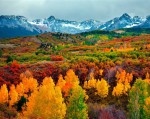
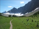
    TRAILS: Fall colours are here! The GDT is experiencing good late season trail conditions with mainly dry trails at lower elevations. Expect snow above 2000 metres, some wet and slippery trail conditions, and nighttime and early morning temperatures below freezing. Be prepared for all weather conditions when travelling into the backcountry.

    ELK RUTTING SEASON WARNING: It is elk rutting season until mid-October. Warning signs that read “ATTENTION – Elk Mating” have been posted at areas where elk herds often gather. Be aware that bull elk become extremely aggressive during rutting season so keep at least 30 metres away from all elk and never get between a male and female elk.

    TRAIL CLOSURES:

    • Elk Lakes Provincial Park: Extensive repairs and construction on the trail between Lower and Upper Elk Lakes to be carried out throughout 2015 hiking season. Detour to West Elk Pass by taking the Elkan Creek trail from the parking lot trailhead. Lower Elk Lake campground is still accessible but hikers are asked to exercise caution in this area during construction.

    BEAR WARNINGS:

    • Yoho National Park: Special caution is recommended while travelling or camping in the Field townsite and surrounding areas due to a large adult black bear that is frequenting the Field townsite, attracted to the fruit of Mountain Ash and Crab Apple trees. Report all bear sightings to Banff Dispatch: 403-762-1473. (29SEP2015)
    • Jasper National Park: A grizzly bear is frequenting the Skyline Trail and campgrounds in the area. Extra caution and bear spray is recommended when hiking in this area. Please report all bear sightings to 780-852-6155. (1SEP2015)
    • Jasper National Park: The Brazeau Loop, Nigel Pass and Poboktan Creek trails are open but a bear warning is in effect. Two grizzly bears have broken into cabins along the South Boundary trail to access horse feed. While they are no longer appearing at cabins and have not shown aggression to people, they may return to the area. Recommendations to minimize the potential of a bear encounter: Travel in tight groups of 4 or more; make noise to alert bears of your presence; carry bear spray; and keep a clean campsite, secure all food and garbage on designated bear cables or in bear storage lockers. Please report all bear sightings to 780-852-6155. (30JUL2015)

    TRAIL NOTICES:

    • The trail from Sage Pass (a17) to Scarpe Pass (a24) was cleared and blazed in August 2014 and is in good shape. From Scarpe Pass, the trail disappears up to La Coulotte Ridge and the hiking becomes significantly more difficult until you reach the ATV track (a27) heading down to the West Castle Road.
    • The Aldridge Creek Trail between Fording River Pass (b31) and the Kananaskis Power Line Road (b32) was cleared and restored in July 2015.
    • Cairnes Creek (d9): The bridge is washed out making this a potentially dangerous ford. It is recommended to cross early in the morning when glacial melt is lowest.
    • The damaged Lambe Creek bridge (d10) was removed in September 2015. It is recommended to ford the creek further downstream.
    • The Howse Pass Trail from Conway Creek (d12) to the Glacier Lake trail junction (d14, 15 km) is in very poor condition. The trail is overgrown, with hundreds of wind-fallen trees across the trail. Hiking in the Howse River floodplain is a viable alternative if the Howse River is low enough to ford.
    • The Owen Creek Trail was cleared in July 2015 up to km 5. Beyond that point, the trail is in poor shape with several washed out sections. Expect challenging hiking for 3 km including skirting along steep creek-side cliffs and rock-hopping in the creek itself. At km 6, do not take the trail heading up away from the creek (it is a deadend). Look for orange blazes marking the correct route staying near the creek.
    • The Maligne Pass trail in Jasper National Park has been decommissioned and is in poor shape. The trail from Pobokton Creek (e20) to Maligne Lake (e25, approx 42 km) is no longer being maintained by Parks Canada so expect deteriorating and overgrown trail conditions; long pants are recommended. The Maligne River bridge has been removed but the river can be easily forded in normal summer conditions (knee deep in mid-summer). Most other bridges are still in place. Read Nathan Dahl’s August 30, 2015 Maligne Pass trail update here.
    • The Yates Torrent Bridge is gone at the crossing of the Coleman Glacier outflow (near f16) so attempt to cross early in the morning when glacial melt is the lowest or be prepared for a fast and potentially dangerous creek ford.

    ACCESS TRAIL CLOSURES:

    • Kootenay National Park – Due to washed out bridges, access to Numa Creek Falls and Trail remains closed.

    Access Roads Update:

    • Construction work on Highway 40 continues from south of the winter gate to Junction Highway 541; expect delays.
    • Access to the northern terminus of the GDT in Kakwa Provincial Park is via the Walker Creek Forest Service Road. The Walker Creek FSR has been repaired from Highway 16 to km 33.5. While travelling the remaining 50 kilometres on the Walker Creek FSR, attention is required to navigate the surface as it is uneven, rutted, slippery and very rough. The road is not recommended for anything other than a 4×4 high clearance vehicle. The last 10km from Bastille Creek to Buchanan Creek are particularly rough and muddy and might not be driveable by vehicle so be prepared to walk this distance on foot. Thanks to Canadoug for the update!
    • The Red Rock Parkway in Waterton Lakes National Park is closed for the season until approximately May 2016 to allow for reconstruction of the parkway and the lower parking lot at Red Rock Canyon.
  • GDTA Annual General Meeting

    The Great Divide Trail Association’s Annual General Meeting will take place on September 29, 2015 at 7:00 pm at the Alberta Wilderness Association office in Calgary.

    Join us for an evening of storytelling with Dustin Lynx, author of Hiking Canada’s Great Divide Trail, as he describes his solo adventure packrafting and hiking the Muskwa-Kechika wilderness of the Northern Rockies. Exploring the option of extending the Great Divide Trail to the Yukon, Dustin will entertain with stories of big rivers, remoteness and aggressive bears while sharing his passion for hiking long distance wilderness trails.

    Meet the Great Divide Trail Association volunteers to learn more about their dedication to maintaining, protecting and promoting the GDT. We welcome the public as well as our membership to take part in our Annual General Meeting following the presentation. Become involved and enjoy refreshments and good company as we make decisions regarding the future of this special wilderness trail.

    GDTA AGM Invitation

    RSVP to greatdividetrail@gmail.com


  • September 2015 Trail and Road Conditions

    September 2015 Trail and Road Conditions

    Trail Conditions Update – September 23, 2015

    TRAILS: Fall is here! Expect snow above 1500 metres, some wet and slippery trail conditions, and night and early morning temperatures below freezing.

    ELK RUTTING SEASON WARNING: It is elk rutting season until mid-October. Warning signs that read “ATTENTION – Elk Mating” have been posted at areas where elk herds often gather. Be aware that bull elk become extremely aggressive during rutting season so keep at least 30 metres away from all elk and never get between a male and female elk.

    WILDFIRE UPDATES: There are no fire bans on the GDT. Campfires are permitted in designated fire pits.

    TRAIL CLOSURES:

    • Elk Lakes Provincial Park: Extensive repairs and construction on the trail between Lower and Upper Elk Lakes to be carried out throughout 2015 hiking season. Detour to West Elk Pass by taking the Elkan Creek trail from the parking lot trailhead. Lower Elk Lake campground is still accessible but hikers are asked to exercise caution in this area during construction.
    • Banff National Park: Og Pass trail and Upper Assiniboine Pass trail within Banff National Park are closed from August 1 to September 30, to increase public safety, and to minimize displacement of grizzly bears from prime food sources at a critical time of the year. Hikers are permitted to access Mount Assiniboine Provincial Park via the lower Assiniboine Pass trail or the Wonder Pass trail.

    BEAR WARNINGS:

    • Waterton Lakes National Park: Special caution is recommended while travelling or camping in the Waterton townsite as a black bear is frequenting the area and has obtained unsecured human food. Be prepared to encounter a bear at anytime in and around this area. (04SEP2015)
    • Jasper National Park: A grizzly bear is frequenting the Skyline Trail and campgrounds in the area. Extra caution and bear spray is recommended when hiking in this area. Please report all bear sightings to 780-852-6155. (1SEP2015)
    • Jasper National Park: The Brazeau Loop, Nigel Pass and Poboktan Creek trails are open but a bear warning is in effect. Two grizzly bears have broken into cabins along the South Boundary trail to access horse feed. While they are no longer appearing at cabins and have not shown aggression to people, they may return to the area. Recommendations to minimize the potential of a bear encounter: Travel in tight groups of 4 or more; make noise to alert bears of your presence; carry bear spray; and keep a clean campsite, secure all food and garbage on designated bear cables or in bear storage lockers. Please report all bear sightings to 780-852-6155. (30JUL2015)

    TRAIL NOTICES:

    • The trail from Sage Pass (a17) to Scarpe Pass (a24) was cleared and blazed last year and is in good shape. From Scarpe Pass, the trail disappears up to La Coulotte Ridge and the hiking becomes significantly more difficult until you reach the ATV track (a27) heading down to the West Castle Road.
    • The Aldridge Creek Trail between Fording River Pass (b31) and the Kananaskis Power Line Road (b32) was cleared and restored in July 2015.
    • Cairnes Creek (d9): The bridge is washed out making this a potentially dangerous ford. It is recommended to cross early in the morning when glacial melt is lowest.
    • The Lambe Creek bridge (d10) is badly damaged so it is recommended to ford the creek further downstream and avoid using the broken bridge.
    • The Howse Pass Trail from Conway Creek (d12) to the Glacier Lake trail junction (d14, 15 km) is in very poor condition. The trail is overgrown, with hundreds of wind-fallen trees across the trail. Hiking in the Howse River floodplain is a viable alternative if the Howse River is low enough to ford.
    • The Owen Creek Trail was cleared in July 2015 up to km 5. Beyond that point, the trail is in poor shape with several washed out sections. Expect challenging hiking for 3 km including skirting along steep creek-side cliffs and rock-hopping in the creek itself. At km 6, do not take the trail heading up away from the creek (it is a deadend). Look for orange blazes marking the correct route staying near the creek.
    • The Maligne Pass trail in Jasper National Park has been decommissioned and is in poor shape. The trail from Pobokton Creek (e20) to Maligne Lake (e25, approx 42 km) is no longer being maintained by Parks Canada so expect deteriorating and overgrown trail conditions; long pants are recommended. The Maligne River bridge has been removed but the river can be easily forded in normal summer conditions (knee deep in mid-summer). Most other bridges are still in place. Read Nathan Dahl’s August 30, 2015 Maligne Pass trail update here.
    • The Yates Torrent Bridge is gone at the crossing of the Coleman Glacier outflow (near f16) so attempt to cross early in the morning when glacial melt is the lowest or be prepared for a fast and dangerous creek ford. Thanks to Christine Friesen for the update!

    ACCESS TRAIL CLOSURES:

    • Kootenay National Park – Due to washed out bridges, access to Numa Creek Falls and Trail remains closed.


    Access Roads Update:

    • Construction work on Highway 40 continues from south of the winter gate to Junction Highway 541; expect delays.
    • Access to the northern terminus of the GDT in Kakwa Provincial Park is via the Walker Creek Forest Service Road. The Walker Creek FSR has been repaired from Highway 16 to km 33.5. While travelling the remaining 50 kilometres on the Walker Creek FSR, attention is required to navigate the surface as it is uneven, rutted, slippery and very rough. The road is not recommended for anything other than a 4×4 high clearance vehicle. The last 10km from Bastille Creek to Buchanan Creek are particularly rough and muddy and might not be driveable by vehicle so be prepared to walk this distance on foot. Thanks to Canadoug for the update!
    • The Elk River FSR will be closed periodically at 123km, 142km, and 145km for bridge replacements between September 1 to September 30. Use the Round Prairie FSR (4WD required) on the east side of the Elk River as a detour.
    • The Red Rock Parkway in Waterton Lakes National Park is closed for the season until approximately May 2016 to allow for reconstruction of the parkway and the lower parking lot at Red Rock Canyon.
  • Maligne Pass Trail Update

    Maligne Pass Trail Update

    Update from Nathan Dahl, Association of Canadian Mountain Guides:

    I just got back from the decommissioned Maligne Pass trail, coming in at the Sunwapta Station and exiting at Maligne Lake. The trail alongside Poboktan Creek is in excellent shape and you should expect no difficulties. After you hit the Poboktan / Poligne junction and head upstream, you will cross 7 small bridges before reaching Avalanche Campground. All bridges are still in place although the 5th bridge is quite damaged and should be used with caution. Avalanche camp is in good shape with 4 bear hang cables, a green throne, 2 fire pits & tables, and three generally good tent pads, although they are starting to becoming quite rounded over.

    From Avalanche camp heading to the pass, the trail is faint but easy to follow until just after the 8th and final bridge over the Poligne. At that point the trail is quite good all the way down to Mary Vaux Camp. Mary Vaux camp was the same as Avalanche camp in regards to bear hangs, tent pads, etc.

    The trail deteriorates past Mary Vaux camp, becoming occasionally faint through the forest and with a moderate amount of deadfall on the trail. Some of the drainages coming off Llysfran Peak & Mt. Unwin have washed out the trail but it is easy to pick up on the other side. About 1 km away from Schaffer Camp we entered a large meadow of willows about shoulder height, which we continued to hike through on and off through the remainder of the trip. A good argument for long pants. The trail in these sections is well rutted so while it’s not easily visible, just follow your feet. About 800 metres south of Schaffer camp the trail appears to ford the Maligne River. Instead, hike about 50 metres downstream on the same side of the river, and the trail will reappear in the willows to your right, heading towards a small rise of land. Schaffer camp is in fair shape, although one of the tables is missing some planks.

    The bridge over the Maligne River about 4 km north of Schaffer camp is washed away so this will require a ford. Rather than fording at the old bridge site where the signage still directs you, we forded about 100 metres downstream where the river is a little wider. At the time and point of our crossing the river was only 30 cm deep and presented no difficulty. The trail is also significantly damaged in the drainage around GR591355. However there is some modest signage on either side to help you along.

    Finally, Trapper Creek campsite is in good shape but two of the bear hang cables are missing clips so you may want to bring an accessory carabiner. The bridge over Trapper Creek is also damaged but passable.

    All signage is still in place. No wildlife sighted but lots of elk, deer and bear tracks and scat along the trail and in the campsites. A very beautiful and historic trail to hike if you get the opportunity.

  • June 2015 Trail and Road Conditions

    June 2015 Trail and Road Conditions

    Trail Conditions Update – June 17, 2015

    WILDFIRE UPDATE: Currently there are no fire bans for the GDT but there is a wildfire burning near the southern boundary of the Willmore Wilderness Area about 15 km northeast of the GDT.

    TRAILS: Conditions are continuing to improve. Hiking trails at lower elevations vary from bare and dry to wet and muddy, but many trails are still snowbound above 2,000 metres. Trails can be icy in the morning but warm daytime temperatures means the snow is melting quickly and creating muddy and slippery conditions. Traction cleats or poles are recommended for hikers at higher elevations.

    TRAIL CLOSURE:

    • Jasper National Park: The GDT is closed from Cataract Pass to Poboktan Creek trailhead due to a grizzly bear becoming food conditioned and causing property damage at several sites throughout the closure area. Currently the only available detour is Highway 93.

    TRAIL CONSTRUCTION:

    • Elk Lakes Provincial Park: Extensive repairs and construction on the trail between Lower and Upper Elk Lakes to be carried out throughout 2015 hiking season. Please exercise caution in this area during construction.
    • Restoration of the Aldridge Creek Trail between Fording River Pass and the Kananaskis Power Line Road will take place July 15-18. Please exercise caution in this area during construction.

    TRAIL NOTICES:

    • Cairnes Creek: The bridge is washed out making this a potentially dangerous ford. It is recommended to cross early in the morning when glacial melt is lowest.
    • The Lambe Creek bridge is badly damaged so it is recommended to ford the creek further downstream and avoid using the broken bridge.
    • The Maligne Pass trail in Jasper National Park has been decommissioned and is in poor shape. The trail from Pobokton Creek to Maligne Lake (approx 42 km) is no longer being maintained by Parks Canada so expect deteriorating and overgrown trail conditions; long pants are recommended. The Maligne River bridge has been removed but the river can be easily forded (knee deep in mid-summer). Most other bridges are still in place.
    • The Howse Pass Trail from Conway Creek to the Glacier Lake trail junction (15km) is in very poor condition. The trail is overgrown, with hundreds of wind-fallen trees across the trail. Hiking in the Howse River floodplain is a viable alternative if the Howse River is low enough to ford.

    ACCESS TRAIL CLOSURES:

    • Kootenay National Park: Due to washed out bridges, Tumbling Creek Trail is closed and access to Numa Creek Trail is closed.
    • Jasper National Park: Nigel Pass Trail and Poboktan Creek Trail are both closed due to a grizzly bear becoming food conditioned and causing property damage at several sites throughout the closure area.

    BEAR WARNING – Bears are frequenting valleys at lower elevations in search of food so caution is recommended when travelling on trails in those areas. Pay attention, make noise and carry bear spray.

    ELK: Calving season is May 15 to June 30. Protective mother elk can be aggressive during this time so exercise caution. Keep at least 30 metres away and avoid lone female elk or calves.

    TICKS: It’s tick season so be extra careful when in areas with a lot of underbrush and check yourself and your clothing after your hike.


    Access Roads Update:

    • Construction work on Highway 40 continues from south of the winter gate to Junction Highway 541; expect delays.
    • Access to the northern terminus of the GDT in Kakwa Provincial Park is via the Walker Creek Forest Service Road which has been repaired from Highway 16 to 33.5km on the Walker Creek FSR. The remaining 50 kilometres vary in condition from OK to very rough. The last 10km from Bastille Creek to Buchanan Creek are particularly rough and can be muddy so a 4×4 is recommended.
  • MEC Community Contributions Grant

    MEC Community Contributions Grant

    MECThe Great Divide Trail Association has received a MEC Community Contributions Grant to help fund this summer’s trail maintenance trip at Aldridge Creek!

    Thank you to MEC for continuing to support our efforts to establish our trail along Canada’s Great Divide!

  • Yellowstone to Yukon Conservation Initiative Grant

    Yellowstone to Yukon Conservation Initiative Grant

    Y2YThank you to the Yellowstone to Yukon Conservation Initiative for supporting our 2015 Aldridge Creek Trail Maintenance Trip with a grant! We are honoured and appreciate the help connecting our wilderness trail in the Y2Y corridor.

  • April 28, 2015 – Alberta Wilderness Association

    April 28, 2015 – Alberta Wilderness Association

    Alberta Wilderness AssociationCheck out the GDT presentation at the Alberta Wilderness Association at 7:00pm on April 28th at the AWA Office, 455-12 St. NW, Calgary.

  • April 8, 2015 – Alpine Club of Canada, Calgary Section

    April 8, 2015 – Alpine Club of Canada, Calgary Section

    Alpine Club of CanadaCheck out the GDT presentation at the Alpine Club of Canada, Calgary Section at 7:30pm on April 8th in the Hearth Room at the Hillhurst Sunnyside Community Centre, 1320 5 Avenue NW, Calgary.

  • Pacific Crest Trail inspires long-distance hikes in BC

    Pacific Crest Trail inspires long-distance hikes in BC

    Vancouver’s Georgia Straight promotes British Columbia’s long distance trails, including our Great Divide Trail, for those looking for PCT-esque wilderness adventures! Check out the article here.

    Georgia Straight