The idea for this historical look into mountains named for WWI people and events was inspired by a book given to me by friends, Canmore and Kananaskis History Explorer by Ernie Lakusta. The centenary of WWI is an opportunity to look at this world changing event, and no doubt those people who were exploring our Rockies felt that its monumental effect on the world should be memorialized in stone — thus the many Kananaskis peaks of the British Military Group. North of Mount Indefatigable, discussed in the Spring Pathfinder, along The Great Divide Trail you will see Mount Sir Douglas and Mount Birdwood, our Veteran Peaks discussed in this Summer edition.
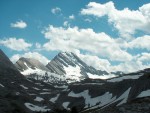
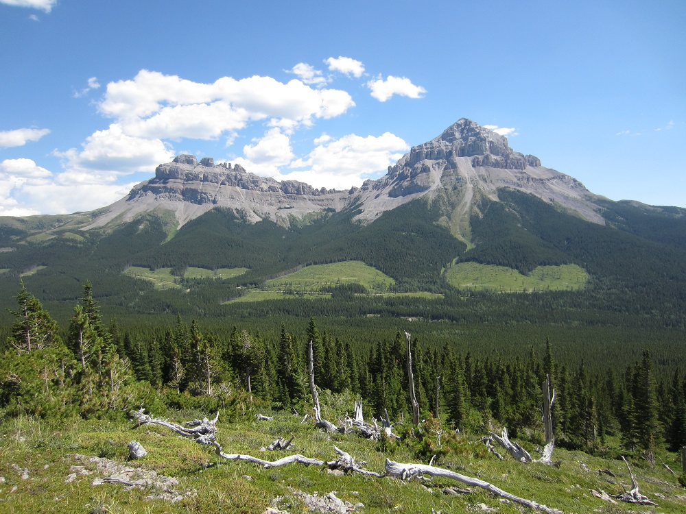
Mount Sir Douglas, in the Spray Range, was named for Sir Douglas Haig. This imposing peak, which you will encounter between the Palliser and North Kananaskis passes, is 3411 m. Haig, commander of the British forces in France from 1915 to 1918, was the 1st Earl Haig of Bemersyde and the son of a wealthy Edinburgh distiller—his early advancement a result of patronage, and marriage to Queen Victoria’s maid of honour also helped! This mountain and Haig Glacier are named for a man who said ‘every position must be held to the last man…each one of us must fight to the end.’ And so they did. Under his command at the Battle of the Somme, 620,000 British and French men lost their lives. Haig’s ‘attack at all costs’ mentality was criticized by many, even by the British Prime Minister at the time, Lloyd-George.
Mount Sir Douglas – Photo by Wiki
The first ascent of Mount Sir Douglas was in 1919 when Dr. J W Hickson hired Ed Feuz, a local Swiss guide, to join him in the ascent. They navigated to the twin summits handily by 5pm and left two cairns on each summit which can still be seen from Palliser Pass today. At the same time, another party, lead by Swiss guide Rudolph Aemmer, and including a colleague of Feuz’s, Val Fynn, was in the area hoping to be first to the top. Passing by the Aemmer/Fynn camp next day, Feuz commented to Fynn’s wife “I wonder why they didn’t go our way, where we went yesterday?” Feuz responded to the dumbfounded wife with a cheeky “Don’t worry, that ridge Rudolph and your husband are on will make a fine second ascent.”
Mount Birchwood – Photo by William Marler 2006
Had Dr. Hickson and Feuz looked north from the twin summits, they would have seen a spectacular looking mountain perched along the Spray River Valley: Mount Birdwood. Ah, finally a name that conjures the picturesque and natural; however, it was named for Sir William Riddell Birdwood. Known as ‘Birdy,’ this British commander lead the Australian and New Zealand corps in WWI. The first ascent of the 3097 m peak was in July 1922 and led by a familiar name, Rudolph Aemmer. Near the top they reached a chimney with smooth sides and few handholds. After 7 ½ hours, Rudolph summited Mount Birdwood by standing on a fellow adventurers back, perching on his shoulders, and finally reaching the top with a supporting shove. Some times you just need that extra friendly push to go the distance on the Great Divide Trail!
Don’t have time to hike the entire GDT and looking for the best day, weekend or week on the Great Divide that isn’t completely booked up (like the Rockwall and Skyline trails)? Check out these outstanding trails that showcase the Best of the GDT! (Note these are all one-way trails that begin and end at different trailheads so two vehicles or a shuttle will be required.)
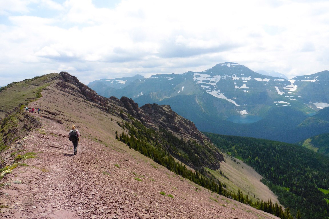
DAY HIKE:Peaks, Lakes and Waterfalls – The Carthew-Alderson Trail in Waterton Lakes National Park
With breathtaking vistas, crystal clear lakes, cascading waterfalls and wildlife viewing opportunities, on the reward-for-effort scale it doesn’t get much better than this. Beginning on the shores of stunning Cameron Lake, the Carthew-Alderson trail quickly starts gaining elevation on long, sweeping switchbacks. Catch your breath at Summit Lake at kilometre 4, before continuing the climb into the alpine to the trail’s high point at Carthew Summit (2310 m) at kilometre 7.5. Take an extended break to enjoy the spectacular views in every direction including the towering peaks of Glacier National Park to the south in Montana.
From Carthew Summit the trail descends to the east, where in the far distance you can see the Rocky Mountains suddenly end and the flat plains of the prairies begin. As you descend towards Carthew Lakes on the red rock slopes of Mount Alderson you might feel more like you are walking on Mars. Continue around upper Carthew Lake where snow patches can linger late into the summer, and keep your eyes open for Rocky Mountain Bighorn Sheep and Grizzly Bear as you are walking through their backyard.
Descend the steep trail from lower Carthew Lake past the cascading outflow from the lake, down a couple switchbacks to Alderson Lake. A short side trail takes you to the shores of this emerald lake set in a huge natural amphitheatre surrounded by mountain peaks on all sides. This is the site of the inviting Alderson Lake campground. 6.5 kilometres from Alderson Lake, the trail ends at Cameron Falls on the western edge of Waterton townsite (1280 m).
Trip-planning:
Trailhead directions: Take the hiker’s shuttle (free in 2016) from Waterton townsite to Cameron Lake and begin the hike at the Carthew-Alderson trailhead (1660 m).
Permits: Not required for a day hike.
Distance: 20 km
Difficulty: Moderate. The trail is excellent but the elevation gain is significant.
Elevation gain: 650 m
WEEKEND HIKE:The Summit of the Great Divide – David Thompson Highway to Pinto Lake
Begin at the Owen Creek trailhead just east of the Banff National Park gate on the David Thompson Highway (Highway 11). After a short climb you will come to an incredible slot canyon. Owen Creek has carved a deep ravine that you can straddle and view cascading 30 metres below your feet. A short walk farther will take you back to the banks of the now more placid creek where you can picnic and get great views of the Wilson Icefield.
Continue on up the creek bed, scrambling over boulders and small waterfalls, to the first of three high passes. Cross-country travel across a scree slope brings you to Michele Lakes. Before you head down to the lake, climb the 30 metre berm to the cliffs above the lakes to marvel at Michele Lakes deep aquamarine beauty from high above. Bring a fishing pole to try your luck for the elusive California Golden Trout for which these lakes are renowned.
After a break lakeside, climb to the highest point on the GDT at 2590 metres, where there is a rumour of a bottle of fine Canadian rye whiskey hidden somewhere in the cairn at the top of the lofty pass. Sign the summit trail register and then head down the steep scree to Waterfalls Creek where there is a good campsite before attempting to find the hidden route up the next high pass (look for orange blazes).
From the third pass, it’s an easy trek on good trail down to Pinto Lake. The main campground on Pinto Lake is on the north shore but the best campground is on the south-east shore, where in the morning you can enjoy your coffee watching the sun melt the mist off this almost always serene shoreline. If you are lucky you may find the geo cache from the Calgary Olympics. This was cached over 20 years ago and contains some really neat stuff. It’s near the shoreline at the base of a giant spruce which is broken and burnt from a lightning strike a couple of years ago. Finish the weekend by heading over Sunset Pass back into Banff National Park to the Sunset Pass trailhead on the Icefields Parkway (Highway 93).
Trip-planning:
Trailhead directions: The Owen Creek trailhead is 6 kilometres east of Saskatchewan River Crossing on the David Thompson Highway, 80 kilometres north of Lake Louise. The Sunset Pass trailhead is 16 km north of Saskatchewan River Crossing on the Icefields Parkway.
Permits: A National Park Wilderness Pass is required if you plan to camp in Banff National Park (on the Owen Creek trail or the Sunset Pass trail)
Distance: 40 km
Difficulty: Difficult. Portions of this route involve cross-country travel (i.e. no trail) so good route-finding skills, and a map and a compass are required.
Elevation gain: This route climbs 4 high passes with elevation gains of 1065 m, 240 m, 310 m, and 415 m.
BONUS: This trip can be extended by continuing down the Cline River from Pinto Lake to Cataract Creek in the Whitegoat Wilderness. Follow the primitive Cataract Creek trail to its headwaters, passing some ancient pictographs along the way. A steep, cross-country climb will bring you to the top of Cataract Pass where you will cross into Jasper National Park and be treated to amazing 360 degree views of a massive col surrounded by glaciers and waterfalls. Descend from the pass and follow the Brazeau River to Nigel Pass, where a trail junction leads to the trailhead parking lot on the Icefields Parkway. Additional distance: 40 km and one additional pass with an elevation gain of 740 m.
WEEK-LONG HIKE: Meadows and the Matterhorn (of the Canadian Rockies) – Mount Shark trailhead to Sunshine Village via Mount Assiniboine
This trail crosses the continental divide four times and is a wilderness highlight reel of crystal clear alpine lakes, wildflower meadows, and endless views, with the iconic beacon of Mount Assiniboine towering above.
Start from the Mount Shark trailhead (1700 m) and hike 6 kilometres on the Watridge Lake trail to reach the GDT, just inside the Banff National Park eastern boundary in the shadow of towering Cone Mountain. The trail follows Bryant Creek upstream, beginning mostly in the forest but the views improve farther up the valley as the trail breaks into open meadows. 7 kilometres from the Watridge Lake trail junction, turn left (west) onto the Marvel Lake/ Wonder Pass trail. Views just keep getting better as the trail climbs the open slopes above impressive Marvel Lake up to Wonder Pass (2280 m) on the BC-AB border and Banff-Assiniboine park boundary.
As you descend into Mount Assiniboine Provincial Park from Wonder Pass, the larch trees begin appearing in greater numbers. This area is spectacular in the fall when the larch needles turn gold. Pass by the Naiset Huts (a good place to stay if the weather turns nasty) and stop for afternoon tea at Assiniboine Lodge, soaking up the stunning views of Lake Magog and Mount Assiniboine. Magog campground is about 1 kilometre from the lodge and is a good place to set up basecamp for a couple days to allow yourself time to explore the many side trails in the area, such as Nub Peak or Sunburst and Cerulean Lakes.
After prying yourself away from the jaw-dropping beauty of the core area of Assiniboine, continue your hike through vast alpine meadows to Og Lake with its lakeside campground (a good option if the Magog campground is full). Fill up your water bottles here as it is a long (yet scenic) walk through the Valley of the Rocks and up and over Citadel Pass (2365 m) to the next reliable water source at Howard Douglas Lake. Next to Howard Douglas Lake is the last campground on the trail before reaching Sunshine Village. From the lake you’ll walk through Sunshine Meadows, famously filled with wildflowers in early summer, 6 kilometres to the trailhead at Sunshine Village (2200 m).
Trip-planning:
Trailhead directions: To get to the Mount Shark trailhead, drive about 40 km south of Canmore on Highway 742 (the Smith-Dorrien Spray Trail) and turn right (west) at the sign for Mount Shark. 5 km down this road is the trailhead parking lot. To get to the Sunshine Village trailhead, take the Sunshine Ski Area exit 9 km west of Banff on Highway 1 and follow Sunshine Road for 9 km to the parking lot. White Mountain Adventures operates a shuttle bus to Sunshine Village from the parking lot or from Banff.
Permits: A National Park Wilderness Pass is required if you plan to camp in Banff National Park. Campgrounds in Mount Assiniboine Provincial Park are available on a first-come first-served basis. Reservations are recommended if you plan to stay in the Naiset Cabins near Assiniboine Lodge.
Distance: 50 km
Difficulty: Moderate. Excellent trail with two high passes.
Elevation gain: This route climbs 2 high passes with elevation gains of 580 m and 430 m.
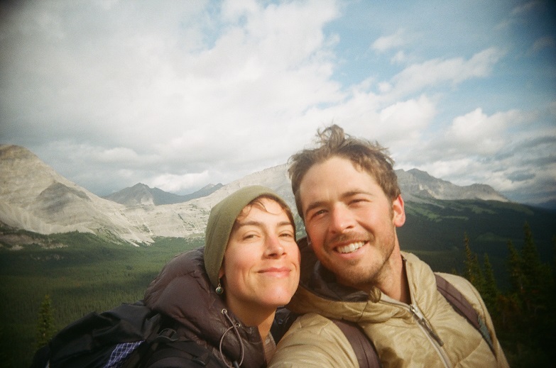
My wife Cassidy and I took to the Great Divide Trail in July 2015 for our honeymoon and had an amazing adventure.
To give you a brief background, I have been in love with long distance hiking since walking the Appalachian Trail after graduating from trade school in ’08. Serious wanderlust later took me on the Pacific Crest Trail in ’10 and Continental Divide Trail in ’12. I decided to put my education to work and took a job in Vermont building furniture. On the day of my interview I met Cass, who had just returned home after living in Costa Rica for a few years. Soon after meeting we began to date, then we moved in together, then we hiked the Long Trail, and then the Annapurna Circuit, where at 16,000′ on a snowfield heading towards Talicho Tal I proposed… and she said yes! So you get the idea, we are both have itchy feet and love adventuring, which naturally led us to the GDT.
The idea about hiking the GDT came to us while hearing a talk given at the 2013 ALDHA West gathering where I was receiving my triple crown award. Cam “Swami” Honan gave a great talk about his mega-hike he did in 2012/13. Out of all the trails he hit in North America the GDT seemed to be very near and dear to him. Cass picked up on it and was the one who really pushed for the idea of walking it for our honeymoon. I couldn’t say no.
We set off July 14, 2015 from Waterton Lakes National Park and headed north. I am a big advocate for technology-free hikes, and so we were free of cellphones, GPS, and digital cameras. There is nothing like the reward of finding yourself when navigating with map & compass, and I wanted Cass to know the feeling. She got the gist of it by the end of the hike, but I was our lead navigator for most of the trip. She was the naturalist, carrying a massive (by light-weight hiking standards) field guide to the North American Rockies. We were soon identifying all plants and animals we saw, eating Fireweed leaves and chives with dinner almost every night, Huckleberries for breakfast and lunch if we were lucky.
The trail took us through some amazing country. The views were stunning, the weather was harsh at times, and the trail was all over the map. The sections in National & Provincial Parks were great, but in between there was some grade A bushwhacking. In one section we didn’t see another soul for 5 days straight. Nobody, not even an ATV or car from far away. I had never experienced isolation like that before on any trail.
Hiking the GDT on our honeymoon was the test of all relationship tests. We experienced extreme highs; wilderness like no other, beautiful vistas, and enjoyable terrain – followed soon thereafter by some of the most difficult hiking I’ve ever known. The first three days included a triage of hardships; hail and lightning on an exposed ridge, knee crushing terrain, and getting lost in the wilderness. Pulling through in one piece, healthy and happy, made it all the more rewarding & memorable.
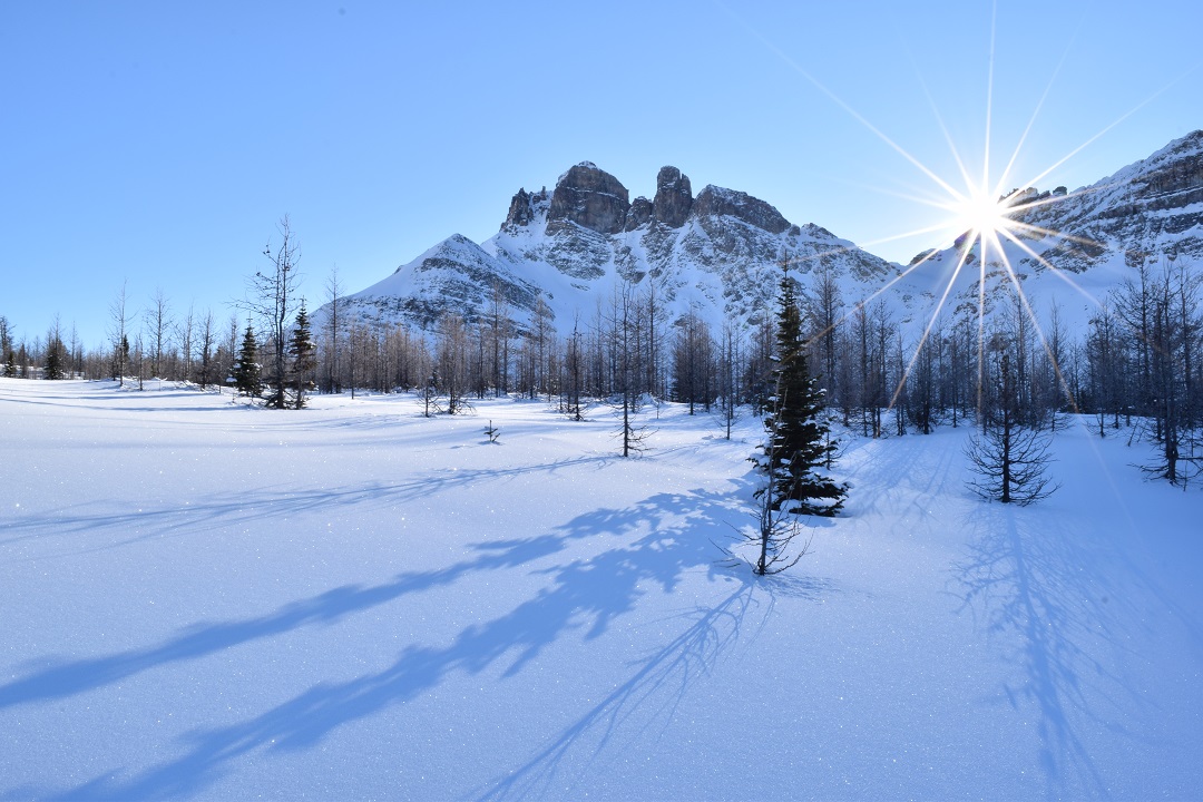
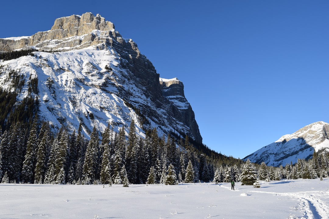
Who would think that World War One (WWI) had anything much to do with the Great Divide Trail (GDT)? When I received a copy of Canmore and Kananaskis History Explorer by Ernie Lakusta as a gift from some hiking pals, its pages brought a surprise that quite a number of Rocky Mountain peaks are named after either WWI generals or battleships. Some of these mountains appear along the GDT through Kananaskis, Smith-Dorrien and the Spray Lakes sections. With the centenary of WWI beginning in 2014, it is fitting to feature a few of these peaks in this series. Starting with the most southerly of the peaks I have chosen, we have Mt.Indefatigable.
It is one of the ‘battleship’ peaks. The 2670-metre peak was named in 1916 by A.O. Wheeler of the Boundary Commission after a ship that took part in the Battle of Jutland. In the Spray Range, it looms over Upper Kananaskis Lake. Though the Stoney Indians named it Ubithka mabi (‘mountain of the nesting eagles’), Wheeler renamed the peak Mt.Indefatigable. According to Lakusta, Wheeler disregarded the mandate of naming based on natural history and ‘in a fit of patriotism’ named most of the mountains surrounding the Upper Kananaskis after WWI generals and ships.The battleship Indefatigable was part of the British cruiser squadron at North Sea Battle of Jutland late May 1916 between the British Royal Navy and the German High Seas Fleet. The Indefatigable was commanded by Captain C.F. Sowerby and had the ominous distinction of being the first ship sunk at this battle. One of the cheapest built by the British Royal Navy, it and many sister ships suffered the same fate of lacking armour to resist attack. Indefatigable received two direct hits and sank 17 minutes after entering the battle. Only the captain and two crew of 1020 members survived. This ship was named for a more robust vessel, another Indefatigable, a 44 gun 18th century frigate which destroyed the French battleship Droits de L’Homme during the Napoleonic War in 1787.
In 1964 Geological Survey reported gypsum on Mt. Indefatigable’s slopes. It was a daunting task to build a road to the mining lease owned by Alberta Gypsum and only one carload was ever removed. The road can be seen as a thin line traversing the slope.
There is no official first ascent, but there is record of Walter Wilcox setting up a tripod on the south summit in 1901. Today it is a popular scramble and a mountain one sees traversing the GDT early in the Kananaskis to Field section in Dustin Lynx’s book (p 109) ‘Hiking Canada’s Great Divide Trail.’
What a delight to come across a booth of eager volunteers promoting the Great Divide Trail Association (GDTA) at the recent Banff Mountain Book and Film Festival. I chatted with Dave Hockey, one of the board members, while he swiped my credit card through a device on his smartphone. He demonstrated to the other volunteers how to collect an electronic payment for a membership. How amazing! I had just become part of an organization dedicated to what was a little-known wilderness route when I had hiked it almost 20 years ago.
Dave Hockey on the GDT at Beehive Mountain
Dave is a tall, middle-aged guy with a big smile and an even bigger voice. He told me a bit about his recent hike on the Pacific Crest Trail (PCT), the long trail recently brought into the public’s psyche through “Wild”, the book and, especially, the movie. He described how land managers have had to adopt a quota system for thruhikers (those hiking from point A to B). Where there used to be a dozen people camped out at a resupply and staging area like Kennedy Meadows in California, there could now be hundreds! I couldn’t imagine it. When my then girlfriend, Julia, and I hiked it in ’94, we were considered vagabonds and no one could understand what we were doing out there.
In 2016, the Great Divide Trail (GDT), or at least the idea of it, turns 50 years old. With leaders like Dave and a dedicated group of volunteers who are as adept at using a brush saw as writing letters to government authorities, the crowning trail of the Rockies is about to become reality.
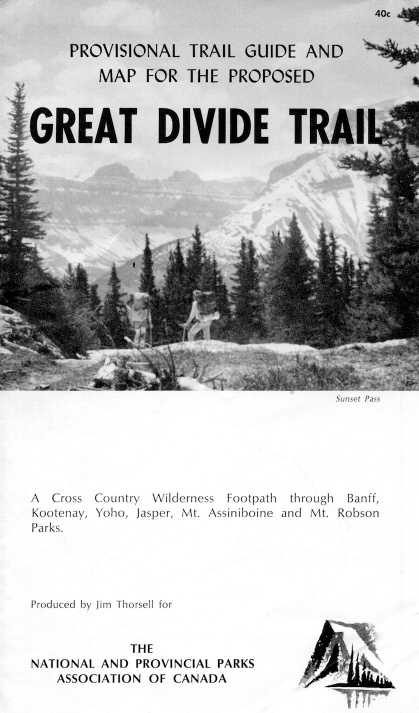
In case you had to go back and read it twice—yes, the GDT is that old! The first recorded mention that I can find of the route goes back to the minutes of a national parks standing committee meeting in 1966, in Banff and Jasper (Whyte Museum and Archives). At that time, the Girl Guides of Canada proposed that the parks create a hiking trail along the continental divide, 1,200 kilometres along the Alberta–British Columbia border in the Rockies. Soon afterward, a local architect and present-day holder of the Summit of Excellence Award, Philip DeLasalle, submitted plans to Banff National Park to build a series of shelters every 15 kilometres on the trail in three of the national parks, to spur outdoor activity and hiking as a way of life.
This was an exciting time for hikers. South of the border, the USA had passed the National Trails System Act, in late 1968, which officially mandated the founding of the Appalachian Trail on the east coast and the PCT on the west, with an additional 14 trails in the hopper. Jim Thorsell must have sensed that excitement when he published a provisional trail guide for the GDT in 1970.
His description of the trail through Jasper, Yoho, Kootenay and Banff national parks appeared in the very popular Canadian Rockies Trail Guide the following year. That guidebook, now in its ninth edition, spread the word to hundreds of thousands of people and far outside Canada.
By 1974, the USA had thousands of kilometres of continuous trail in development. Where were the long-distance trails in Canada? We had the 800-kilometre Bruce Trail in Ontario, but nothing in the west, certainly nothing to rival the PCT. That’s when a group of students at the University of Calgary got together with the Alberta Wilderness Association and received a grant from the Government of Alberta to explore and survey a potential route for the GDT south of Banff National Park all the way to Waterton Lakes National Park, near the US border.
Cliff White, a retired wildlife biologist speaks favourably of his time on that crew. In a 2001 Backpacker article, he is quoted as saying, “We got to hike all over and get paid for it—kind of. There were three groups of two. We had three old cars we wrestled down muddy back roads, then we’d spend days hiking around, surveying the terrain.” (See more at www.backpacker.com/trips/international/canada-s-great-divide-trail.)
These students went on to found the GDTA as a non-profit organization that built trail and advocated for protected areas along the corridor surrounding the trail. Their efforts produced the only existing trail built and signed as the GDT—about 100 kilometres of it, largely in Kananaskis Country, south of Highwood House. That first incarnation of the GDTA lasted for over ten years.
When I hiked the GDT in 1996 between semesters at the U of C, the word on the GDT was out there but detailed information about the route outside of the national parks was sparse. After hiking the route, I decided to hold on to all my research and write a guidebook — which became another degree all on its own! Rocky Mountain Books published the guide, describing what I called a wilderness route, in 2000. I warned would-be hikers that it’s not like the PCT and that they would need topographical maps and perhaps even a gadget called a GPS — the handheld models were new at the time.
Fast-forward a decade and the GDTA is once again in existence, and here is Dave grinning widely and talking about a rising and vibrant membership. The brochures are sleek, but the handshake is real. One of the GDTA’s goals is “to obtain formal recognition and protection of the Great Divide Trail Corridor”. Shaking Dave’s callused hand, I believe it to be true.
Now, all that remains is to look at my calendar to see if I can join the next trail maintenance gathering and meet others who are as energized about the GDT as Dave and I are. Perhaps I’ll see you there too.
Areas of Interest
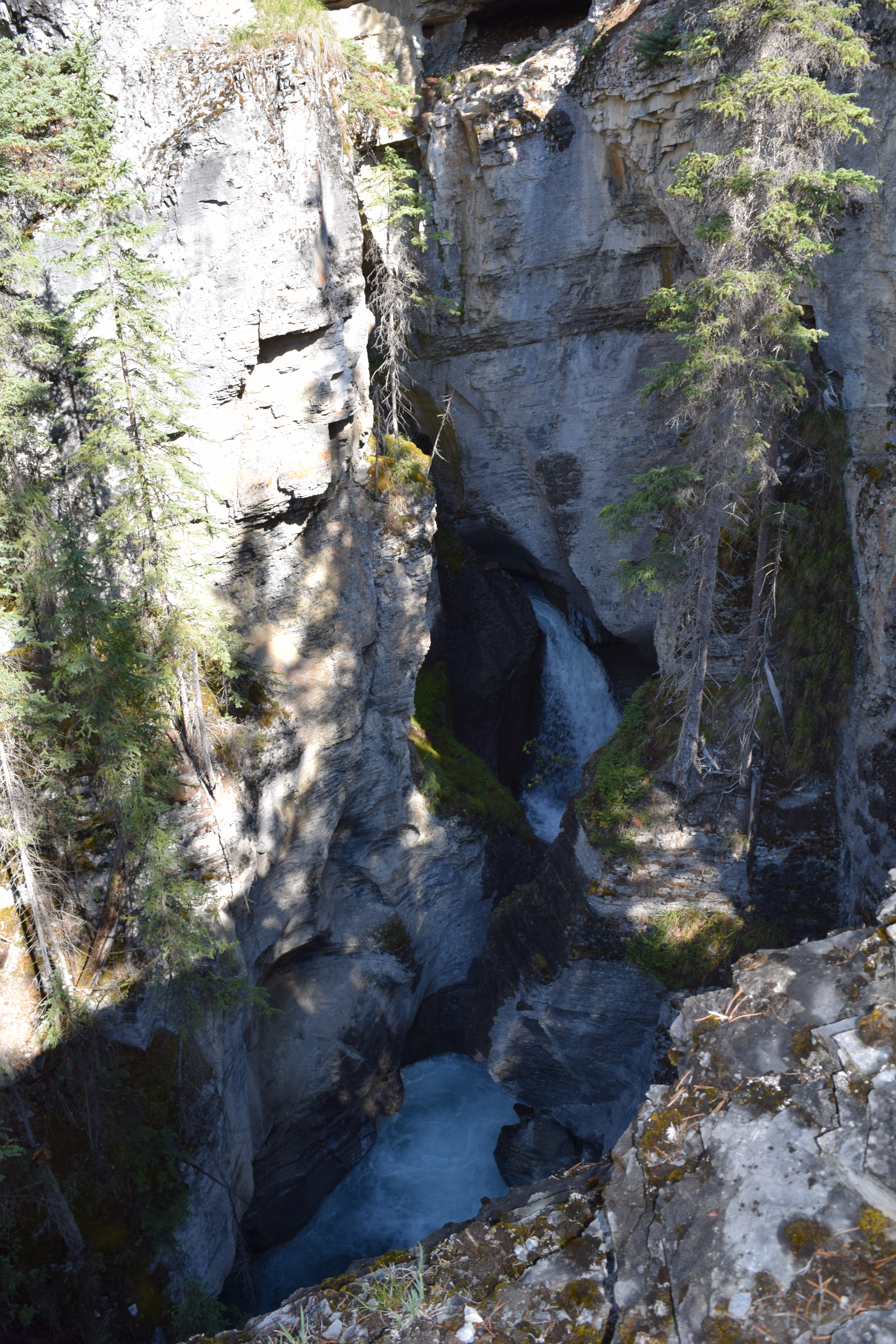
The GDT is 1,200 kilometres long and is accessible at many places. One of the most gorgeous spots is Owen Creek, the first drainage outside the Banff National Park gate on the David Thompson Highway no 11, west of Nordegg. There is a small pull-out there and you need to walk for only about 20 minutes to reach the incredibly scenic gorge north of the highway. Turn around after 20 minutes or perhaps you’ll feel the tug to continue north for another 20 days. That’s the true magic of a long wilderness trail: it beckons you.
Owen Creek canyon
Dustin Lynx is the author of Hiking Canada’s Great Divide Trail (2nd ed, Rocky Mountain Books 2007). He lives with his family in Canmore, where he can be close to the trails he loves. Recently, he started a publishing company called Imaginary Mountain Surveyors. One book was shortlisted for the Mountain Fiction and Poetry Award at the Banff Mountain Film and Book Festival in 2013, and another won that prize in 2014. Hiking is a lifelong passion for Dustin; writing and publishing are a couple of ways that he has found to share that inspiration with others. Find out more at www.imaginarymountains.com.
Crowsnest Mountain (photo by Bradley Vaillancourt)
When I asked some intrepid GDTA thru-hikers what mountain should be next in this series a resounding answer was Crowsnest Mountain. But it is not just the purview of those who hike this trail, but also lucky travellers along Highway 3 in Crowsnest Pass may gaze at its grand beauty. Specifically it lies in the Canadian Rockies in the Crowsnest River Valley between Allison Creek Valley and McGillivary Creek Valley at Latitude 49°42’20” Longitude 114°34’20” in the Municipal District of Ranchland #66, Alberta, and is found on Topo map 82G/10.
In Section 7 (Coleman to Alexander Creek) of Dustin Lynx’s Hiking the Great Divide Trail you will find much of the GDT on motorized trails and gravel roads. Ideally the route would lie nearer the Divide. But to quote Dustin Lynx, “the castellated peaks of Seven Sisters and Crowsnest Mountain are your ever present companions” giving a bit of interest to a rather uninteresting walk.
According to Place Names of the Canadian Alps, George Dawson, in his Geological Survey of Canada 1883-1884 noted that the Crowsnest mountain, pass, and river where originally named by the First Nations because of the big black birds which nested in the area. The Cree may have been referring to the ever present Common Raven, Corvus corax.
There is an interesting story about the first ascent in 1904. None other than Edward Whymper, British mountaineer who did the first ascent of The Matterhorn, was interested in bagging Crowsnest peak, a mountain claimed to be ‘impossible of ascent.’ In July of 1904 he travelled to the vicinity, hired Swiss guides and sent them out to check out the route—but these men could not resist! They summited, leaving a flag, and telegraphed Whymper at his camp in Lake Louise for further orders. Whymper was not happy his employees had stolen his distinction of first ascent. Alan Kane’s Scrambles in the Canadian Rockies confirms the “tourist route” used today is much easier and was first ascended in 1915 as a solo trip.
Crowsnest Mountain has also been called the ‘upside down mountain’ with poems written to this unique feature. It is not upside down; however, the rock at the top is older than the rock at the bottom. The upper cliffs are limestone of Paleozoic age, while lower are younger Mesozoic rock. A sheet of rock from the High Rock Range to the west, was pushed upwards and eastward riding over the younger rock. Over the eons streams have cut away the sides of Crowsnest Mountain and left the peak isolated, a beautiful island of old rocks sitting on younger rocks, a geologic, and very beautiful feature, called a ‘klippe,’ German for cliff or crag. All in all, a mountain to be revered from the Great Divide.
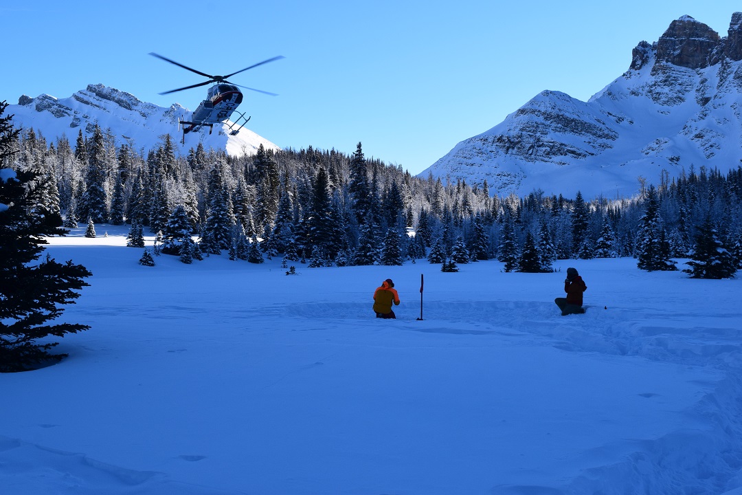
An eight minute helicopter ride above snow covered valleys and meadows, past sheer Rocky Mountain faces and a sharp left over Assiniboine Pass across the Great Divide into British Columbia and there I am stumbling out of a helicopter and post-holing my way to the cooking shelter. Little did I realize that my brief, but beautiful preview of Bryant Creek would be extended into an eight hour adventure. That was a year away.
Touchdown at Assiniboine
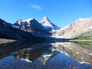
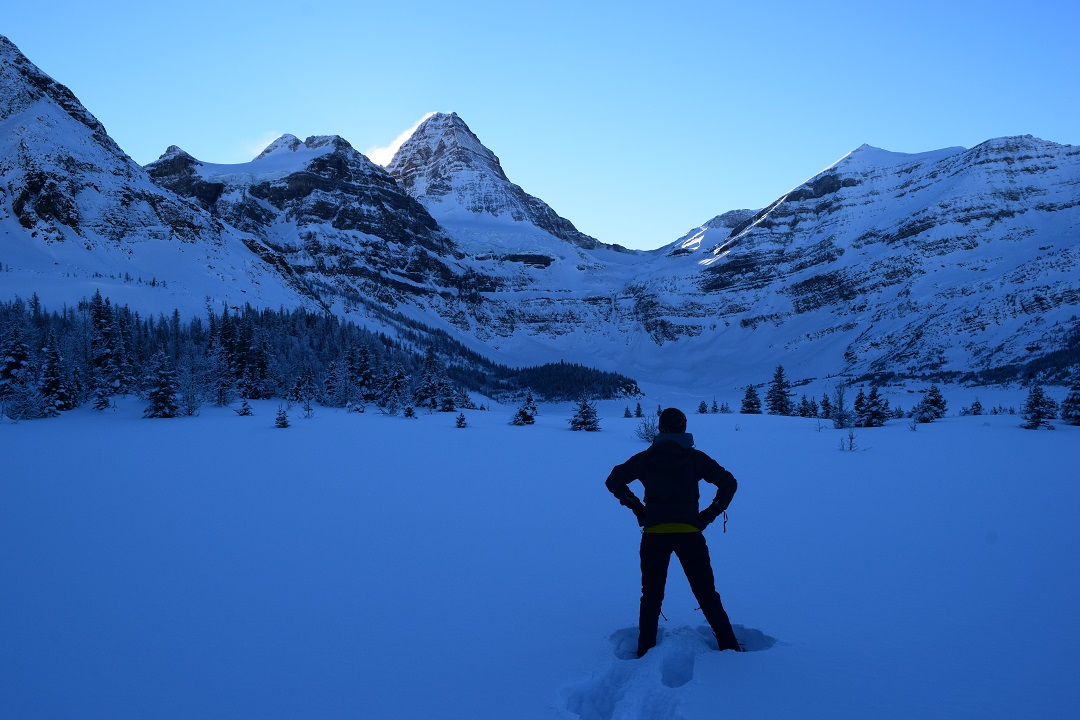
What a wonderful way to bring in the New Year with three days of exploring Mt. Assiniboine Provincial Park pristinely blanketed in a foot of snowy powder from the base camp of the cozy Naiset Huts. Mt. Assiniboine, the Matterhorn of the Canadian Rocky Mountains, greets us every morning as we set out in our snowshoes. In the shade, every part of me is so frozen I can barely feel the -30°C, so we seek out patches of sun peaking between the sister peaks of Mt. Assiniboine.
Snowy Mt. Assiniboine
On New Year’s Eve we decide to tackle the Nublet for a better vantage point of the lakes and meadows lapping at the toes of the continental divide. We switchback up in our snowshoes on top of ptarmigan tracks and enjoy frozen chicken wraps at the chilly sub-summit of Nub Peak (even our water bottles were almost frozen solid!). The way down on crazy carpets is much faster and we ruffle the feathers of snow chickens as we woo hoo our way down. Who needs skis? Cheese fondue and good conversation with new friends carries us to midnight when we all leave the warmth of the cooking hut to howl at the moon. Good-bye 2015!
Crazy carpetingPtarmigan
The New Year begins with contemplation of 2016 resolutions under the guidance of Mt. Assiniboine and a snowshoe pursuit of Wonder Pass. The short day and trail breaking results in Wonder Pass just out of reach, but we make time to create a crazy carpet luge named “Wonderful Pass.” We savour the warmth of the cooking shelter, big dinner and good company on our final night because we know that the next day on the Great Divide Trail we will be more than playing in the snow with the 28 kilometres back to our car.
New Years resolutions with Mt. AssiniboinePristine winter conditions on the way to the elusive Wonder Pass
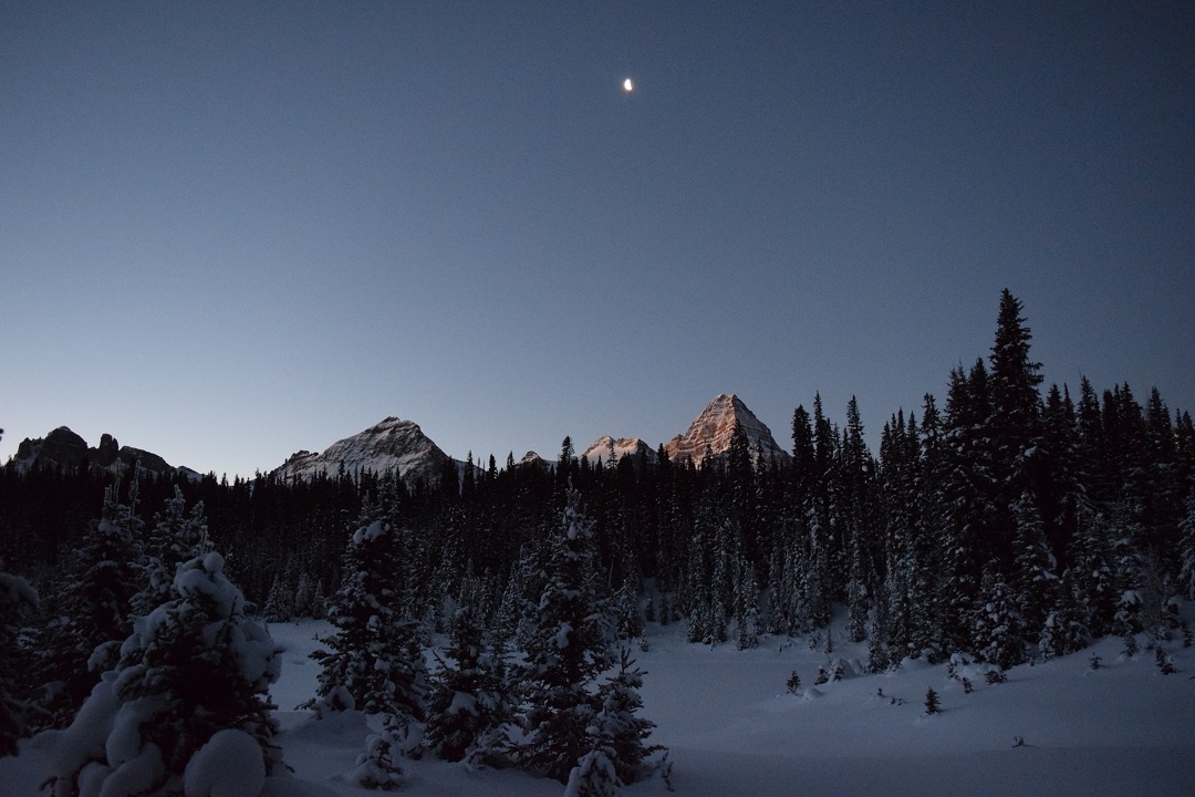
When we leave, it is still dark and my burnt out headlamp is not the deterrent you would assume it to be as the moonlight on the winter wonderland lights my way. As we connect with the Great Divide Trail at Assiniboine Pass, dawn is tickling Mt. Assiniboine’s ribs. We cross the divide back into Alberta and into Banff National Park. From there it is a power snowshoe through shady forests to patches of sun in frozen meadows. My ears are overtaken with the crunch of every step. The silence is deafening when I stop to take in the magical surroundings.
Early start for short winter daysMoon and dawn lit Mt. Assiniboine
The Great Divide Trail is quiet with only a handful of skiers which contrasts from its high summer traffic, a winter perk. The sun dips behind the Rockies just after lunch and we never feel it on our faces again as we push on past Bryant Creek Cabin, Big Springs and Mt. Shark off the Great Divide Trail and onto wide, crunchy groomed ski trails. As we leave the backcountry behind, we meet Canmore’s Nordic community all out enjoying the first ski of 2016.
Bryant Creek meadowWinter Mt. Shark
What took eight minutes by helicopter takes eight hours on foot. The power of my own two feet is maxed out and my face is numb, but I feel alive and like I have started 2016 trying to be a better me doing the things I love. The winter Great Divide Trail still boasts wilderness majesty under all the powder. I feel as if I am part of the privileged few to share in the secret rewards of adventuring on the frozen Great Divide Trail.
NEW FOR 2016: Online reservations for the 2016 hiking season (May – October) for Jasper National Park’s camping and accommodations will open on Wednesday, January 13, 2016 at 8:00 am MST.
All the recent brouhaha surrounding Volkswagens rigged to pass emissions testing brings to mind the time we had our own jury-rigged VW, which is a much happier story as it was instrumental in helping us survey the original route of the Great Divide Trail.
In the lead up to our 3-month-long trail study project in 1974 (which resulted in a final GDT routing plan between Waterton and the Kananaskis area), my five colleagues (Mary-Jane Cox, Jenny Feick, Chris Hart, Cliff White, and Dave Zevick) and I found ourselves short one suitable vehicle for transport to and from the various study areas along both sides of the continental divide. By “suitable” I mean something capable of traversing hundreds of kilometers of rough backroads, fording rushing creeks, and carrying up to four people plus backpacking gear. But I also mean something that could be had for no more than $100, which, of course, would immediately exclude anything reliable enough to do the job. Good thing we were all too young and naïve to realize that!
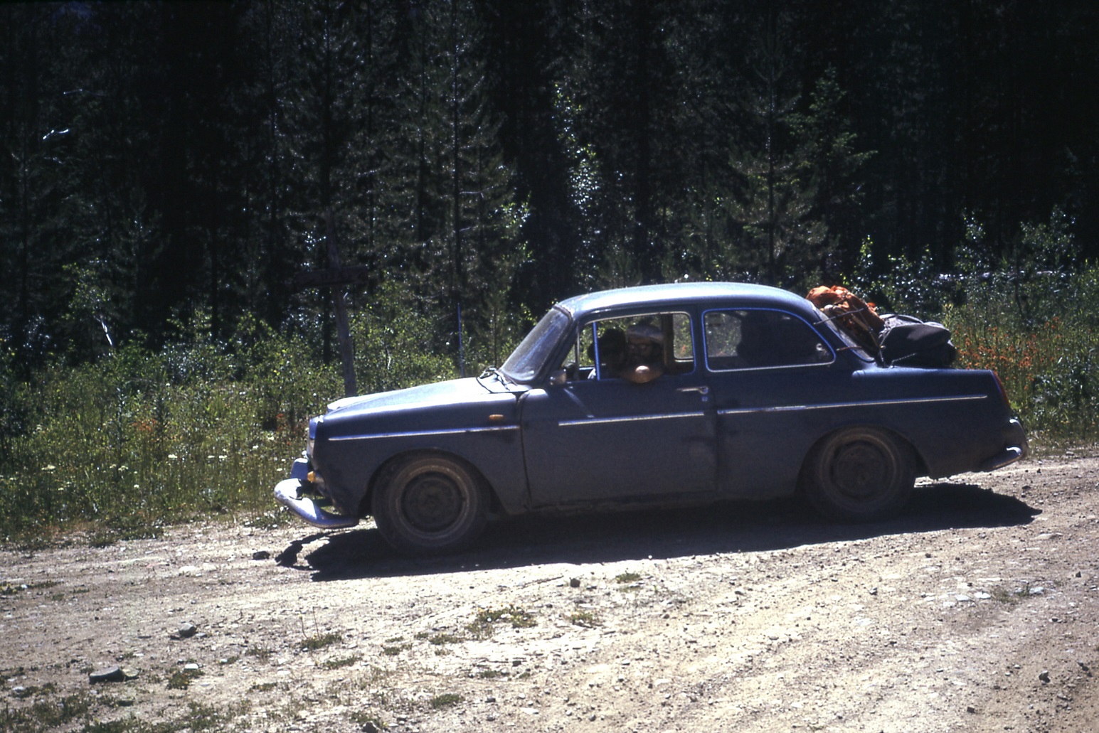
Looking (almost) ship shape!
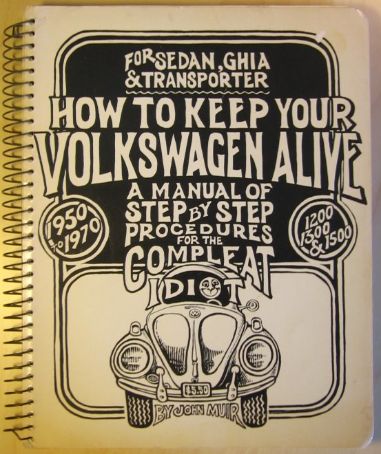
As luck would have it, Chris located and purchased what seemed like the ideal candidate: a sky-blue 1962 VW “notchback” sedan. A bit on the small side, maybe, but it had a killer feature: you could put packs in both the front AND rear trunks, or under both the bonnet and the boot if you happen to be English (the location of the engine wasn’t entirely obvious, at first). Chris also scrounged the most user-friendly maintenance manual I’ve ever seen, appropriately titled “How to Keep Your Volkswagen Alive, for the Compleat Idiot” – a thick tome filled with hand-drawn illustrations, earthy advice on love and the proper use of torque wrenches, and the admonition to “Be kind to your ass, for it bears you.”
A bit rusty here, there and everywhere, our new acquisition wasn’t in terrible shape – well, not after we patched a gaping hole in the floor with a piece of plywood. At least the engine ran, and the brakes and lights seemed to work, most of the time. Shifting the worn-out gearbox, however, required a new skill: “double-clutching,” a complex sequence of clutch-and-accelerator applications. But the good news? Chris underspent the budget by half!
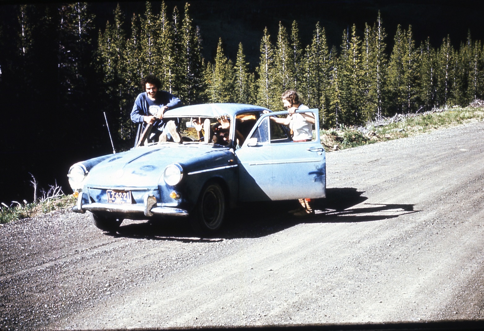
Confidence built when “Blue,” as Chris dubbed the car, made the trip from Calgary to Crowsnest Pass without trouble. Week One of the project found Jenny and me surveying the area just north of the Pass. We’d dropped off Chris and Dave in their assigned area a few days before, Chris warning me to take good care of Blue. We were descending the switchbacks of the old Vicary Mine access road, yours truly at the wheel. I didn’t think anything of it when Blue brushed the underside of a dead lodgepole pine overhanging the road in the same direction as our travel, and later that day we headed back up the steep road, in second gear with the engine roaring in complaint at the effort. Rounding a bend, I spotted the overhanging pine and, remembering how we’d slid neatly under it, kept going, pedal to the plywood. Not smart. The tree must have settled a bit lower from our previous passage, because this time the brittle tip caught on the windshield molding and broke right through with an enormous crash and spray of shattered glass and branch fragments!
When at last all was still, I glanced past the tree trunk in the direction of my partner, half-expecting the worst, and was relieved to see her staring back at me, albeit with an expression of pure shock on her face. “I didn’t want to look,” she exclaimed. “I thought your head would be missing!”
I almost replied no, I’d already lost it before we even got near the tree. But we’d been spared, this time at least. We quickly exited to survey the damage, shards of glass and piles of sticks and bark falling from our laps. It was NOT a pretty sight!
The long straight tree trunk had gone right through Blue! Or, more accurately, I had managed to skewer the car like a big chunk of beef bound for the grill. The top 2 metres of tree trunk protruded from the rear passenger side wheel well, right above the tire. What a sight! “I must’ve kept the gas on,” I explained, rather lamely. “I’m sorry!”
“Well, I’m just glad we’re both alive,” Jenny said with relief in her voice, “but Chris might want to kill you for wrecking his pride and joy!”
“Doesn’t look THAT bad,” I lied. “Maybe we can back it off the tree.” Fat chance, I thought, but worth a try anyway. So I got back in, and when Blue’s engine started right up I took it as a good sign. It was a bit more than the usual three minutes finding reverse, but then the car slowly extracted itself, assisted by gravity on the steep hill. Then it was just a matter of removing the remaining windshield fragments and cleaning up the mess, then driving to the meeting point to pick up Chris and Dave.
Jenny was right – Chris DID want to kill me. But I promised to buy a new windshield, and we amused ourselves on the way back down the Forestry Trunk Road to Crowsnest Pass by standing and waving at all the passing vehicles through the new opening, the person in the passenger side rear given the job of holding a towel over the other new opening to keep the dust to a minimum. In the Pass, however, it was raining so we turned on the wipers to (hopefully) avoid attracting the attention of passing RCMP cruisers, certain that if we were ever pulled over our precious car would be impounded as a hazard to other motorists.
Look Ma – no windshield! (On the way back to Coleman after the skewering)
That was only the start of the fun. The following week Blue’s generator had a meltdown (literally). At the local wrecking yard we found a dead Beetle and bought the generator. One small concern: it had a shaft sticking out of both ends, whereas Blue’s only stuck out one end. No huge problem – we took a hacksaw and cut the un-needed end off. But when we got it all installed and hooked up, the dashboard generator light still wouldn’t go out. It was then we noticed the direction arrow stamped on the generator housing – facing opposite to the way it was actually rotating. “Think we cut the wrong end off, Dave?” Chris snickered, and Jenny added, “Maybe you should’ve read the manual.” Good points, both, but luckily I’d made one of those electromagnets with a battery, wire and a nail in elementary school, and remembered that reversing the wires also reversed the magnet’s polarity, so with fingers crossed we took the generator apart and swapped the two large wires inside. Presto – back on the road again!
A week or two later the clutch cable snapped just as we pulled onto Highway 3, a couple of miles west of Fernie. We pushed the car the rest of the way into town, to the only garage that was open, only to have the mechanic tell us it would be at least a week before he could get a new cable, adding insult to injury by declaring, “Next time don’t buy a foreign car!” As the saying goes, necessity is the mother of invention – so we spliced in a piece of electrical wire, Western Union style, and went on our way.
By the end of July the rough roads had taken their toll on Blue’s already worn-out suspension, and both front wheels were constantly going into fits of violent shuddering. Bill Kinnear, at whose Coleman property our group was based, had one of his shop staff at Crowsnest Collieries weld something behind the front wheels, and that solved the shuddering problem – even if the car handled like a go-kart from that point on.
The one thing we could have put to very good use is duct tape, but in 1974 Red Green was still a couple of decades in the future. Instead we employed anything at hand, like boot laces and bungee cords, to keep Blue’s various bits and pieces from separating and disappearing for good. Still, by the middle of August the car was missing a headlight, a mirror, the front bumper, all four hubcaps, and who knows how many random nuts and bolts.
A little worse for wear!
Blue’s final mission at summer’s end was the inevitable trip to the junkyard in Calgary, but sadly it came up a bit short – a mile or so west of the city limits, a front wheel broke clean off and rolled into the ditch. The car had to finish its trip in humiliating fashion at the rear of a tow truck.
But Blue had nothing to be ashamed of – the plucky little VW had done everything we asked of it, like climbing to fire lookouts, crossing mountain passes, and fording dozens of creeks and rivers, often with water halfway up the doors. And with its rear-mounted engine, it had great traction in the mud. I can’t count how many times we drove right past stuck 4×4’s, huge smiles on our faces. Blue truly was an indispensable member of our survey team.
Blue near the Kananaskis Highway construction
Needless to say, I personally developed a real soft spot for Volkswagens and went on to own several over the succeeding years – although never again did I manage to run a tree through one! And I suppose time will tell if Volkswagen (the company) survives its own self-inflicted skewering as well as Blue did.