Life on the trail is full of the unexpected; weather and trail conditions can quickly change, there may be wildlife encounters, injuries, slips and falls, turn-arounds, fatigue, dehydration…the list goes on! If there’s one thing that a hiker can count on at the end of the day though, it’s that they’ve likely worked up an appetite for a well deserved, nutritious and tasty meal. While there are plenty of options for quick and convenient pre-made dehydrated and freeze dried meals, they can become quite costly. Oftentimes the sodium levels in pre-made meals are off the charts, the vegetables are skimpy, and they can lack serious flavour. By preparing and dehydrating our own meals, we have full control over what we’re fuelling our bodies with, and it can be really fun to get creative in the kitchen while planning our next big adventure – even if that big adventure is just a day hike.
A favourite go-to dehydrated meal that’s easy to prepare and allows for a lot of wiggle room in the recipe to add or omit different ingredients is a tried and true burrito bowl. Feel free to follow this recipe as it is, or use it as a loose guideline to create your own unique dish that suits your own palate and adheres to any dietary restrictions or preferences that you may have.
When making these burrito bowls, you can dehydrate each individual ingredient separately and then divide all ingredients into four servings; alternatively, you can mix all ingredients together before dehydrating. If you choose to dehydrate each ingredient on its own, it is best not to chop the spinach or cilantro. Instead, dehydrate them whole and once they’re dried, crumble them with your hands. For a bit of extra delicious fat, add some fresh avocado to your prepared meal once it’s time to eat. Enjoy!
Backpacker’s Best Burrito Bowls
Yield: 4 servings
Ingredients:
1 lb extra lean ground beef*, cooked
2 cups spinach, finely chopped
1 3/4 cup water
1 cup quinoa
1 cup of your favourite salsa
1/2 cup BBQ sauce**
1/2 can black beans, rinsed and flattened slightly with back of a spoon
2 medium sized tomatoes, finely chopped
2 red or orange bell peppers, finely chopped
1 yellow onion, finely chopped
1 bunch cilantro, chopped
1-2 jalapeno peppers, minced
3-4 cloves of garlic, minced
3 tbsp taco seasoning
1 tbsp olive oil
A few dashes of your favourite hot sauce for some extra heat
*this ingredient may be omitted; ground chicken or turkey may also be substituted
**any BBQ sauce will do, but Sweet Baby Ray’s Original is especially tasty in burrito bowls
Instructions:
Add oil to a skillet over medium heat. Once the pan is hot, add the onion and garlic and cook until fragrant, about 1-2 minutes. Remove from the pan and set aside.
Into the same pan, add the ground beef and cook thoroughly, stirring continuously. Once the meat has been cooked through, transfer to a strainer and run hot water over the meat to remove any residual fat. Removing as much fat as possible is important because dehydrated foods high in fat will typically spoil faster than those with lesser amounts.
Once the meat has been rinsed with hot water, transfer it into a bowl and add the taco seasoning and jalapeño peppers. Stir well to combine.
Combine the quinoa and water in a medium pot. Bring to a boil over medium heat, cover, and reduce the heat. Simmer for 15 minutes.
Remove the pot from the heat and let it sit, covered, for about 10 minutes. Remove the lid and fluff with a fork.
In a large bowl add cooked quinoa, cooked meat, and all remaining ingredients. Stir well.
Spread the mixture evenly and as thinly as possible over dehydrator trays lined with parchment paper.
Dehydrate at 145°F for 8-10 hours rotating the order of the trays every couple of hours to ensure even drying. As the mixture dries, it will become bark-like; break large pieces up to ensure it is completely dry.
Once completely dry, remove from the dehydrator and divide into four individual portions.
To rehydrate the meal, add enough boiling water to just cover the dehydrated mixture. Let it sit for about 20 minutes, or until all ingredients are soft and fully hydrated.
For best results, rehydrate food in an insulated container, such as a Hydroflask or Thermos. Usually, about 20 minutes is enough time to rehydrate a meal, but sometimes, depending on the size and type of food that has been dehydrated, it may take longer.
All pictures are by the author unless otherwise credited and along the GDT unless stated otherwise.
“Above all, do not lose your desire to walk. Every day I walk myself into a state of well-being and walk away from every illness. I have walked myself into my best thoughts, and I know of no thought so burdensome that one cannot walk away from it.” – Soren Kierkegaard
Since we were in high school together in the early 1970s in Kitchener, Ontario, Dave Higgins and I were aware of some of the health benefits of doing physical exercise outdoors in nature. Fortunately, we had an excellent “outdoor pursuits” component to our physical and health education courses at Cameron Heights Collegiate Institute with knowledgeable, skilled and inspirational teachers. The CHCI Outdoors Club that Dave led got us out hiking not just on local trails but also on the Bruce Trail along the Niagara Escarpment, our first exposure to the long-distance trail phenomenon. Dave and I became the youngest people to serve on the Board of Directors of the new Grand Valley Trail Association, which established a long-distance trail along the Grand River. Through these trail organizations, we met fit, healthy older folks who kindly took us out cross-country skiing and hiking, instilling in us a love of physical exercise in the great outdoors. This led to our interest in participating in the trails surveys in 1974 to find a route for the Great Divide Trail between Banff and Waterton Lakes national parks.
Dave Higgins surveys the Cataract Plateau for Project: Great Divide Trails in 1974 (Photo by Chris Hart)
The initial gains we experienced related to general physical fitness, particularly cardiovascular health, strength, and endurance. However, what we didn’t fully appreciate until years later were the benefits to our immune systems, our cognitive wellbeing, and even our spiritual health. Multiplied across the country, the benefits of being physically active outdoors in nature has led to positive societal repercussions for the health care system and the economy. On another level, people who experience wild places often, like us, become advocates for the protection and care of these areas. When governments conserve these wild places, clean air, clean water and natural biodiversity persists. Then the many ecosystem services these areas provide will endure, including those that ameliorate global climate disruption.
While we have individual personal experience relevant to this topic, it’s anecdotal. Scientists have been studying the health benefits of outdoor physical exercise, including long-distance walking in natural surroundings, for decades. Examining some of the articles and books about their research yields the following six physical benefits and seven mental and emotional benefits of long-distance hiking in natural areas, such as Canada’s Great Divide Trail.
Physical Benefits
1. Hiking Helps Heart Health
The most obvious benefit of long-distance hiking is its effect on your cardiovascular health. Hiking elevates one’s heart rate, which helps improve aerobic fitness and endurance. It strengthens your heart muscles. As with any physical activity, when you hike, your heart must work harder to pump blood and oxygen throughout your body and into all your muscles. Over time, this improves heart function. So, as you hike day after day, your body adjusts to new fitness levels and you will be able to hike longer distances, at a faster rate, over more challenging terrain, without feeling as breathless or fatigued.
These hikers along the GDT in the Oldman River headwaters in 1990 gained cardiovascular fitness
Studies demonstrate that going on regular moderate hikes over time significantly reduces hypertension, improves glucose tolerance, and decreases ‘bad’ cholesterol levels. Studies in Japan have also shown that walking in forests, especially coniferous forests, lowers both blood pressure and heart rate. Thus, long distance hiking can also improve cardiovascular health markers such as blood pressure, blood sugar levels, and cholesterol.
2. Hike to Live Long and Live Well
Research shows that not only does hiking at a brisk pace for at least 30 minutes each day help to drastically reduce one’s chances of developing heart disease, it also lowers the risk of contracting some cancers and developing dementia in older age. Besides improving short term health, hiking also helps build a foundation of health as we age. Sunlight kick starts the body’s production of Vitamin D, which alleviates stress, and gives some disease protection. While not a guarantee, hiking increases the likelihood that you will live a longer and healthier life.
Research on shinrin-yoku (orForest Bathing) in Japan revealed health secrets of trees stemming from the higher concentration of oxygen that exists in forests and the presence of plant chemicals called phytoncides, part of a plant’s defense system against bacteria, insects, and fungi. Exposure to these natural air-borne oils delivers measurable health benefits for humans, including enhanced immune functioning. Evergreen conifers, including pine, cedar, spruce, and fir produce the most phytoncides, so walking through the subalpine and montane forests that flank the GDT offers immense health benefits. Trees really are worth hugging!
James and Priscilla Prescott and Jenny Feick hug an ancient Engelmann spruce in the Hidden Creek headwaters along the GDT in September 2000 (Photo by Chris Junck)
3. Stride into Stability
As you stride along a trail, your leg and core muscles constantly engage, contracting to provide stability and helping you to balance yourself as you negotiate uneven terrain. As these core stabilizing muscles strengthen over time, your sense of balance improves. As you hike, informed by the nerve endings in the fascia of your feet and legs, your brain processes every log, rock, root, patch of mud, and puddle. It gauges what it will take to step over or around such obstacles. With practice, one’s brain becomes more adroit at assessing and responding to these barriers, and as a result, balance gets better. Thus, hiking helps boost proprioception, the mind’s awareness of the position and movement of the body in relation to its surroundings.
Strategic use of trekking poles can further improve one’s poise especially while crossing creeks or descending steep terrain. As one gets into middle-age, using them can also save wear and tear on knee, hip, and ankle joints, enabling one to hike well into one’s 60s, 70s, and beyond. Maintaining a good sense of balance is one of the most important skills needed as one grows older since falls account for the majority of reasons why elders enter long term care facilities.
Jenny Feick working on her balance while backpacking across logs over Lost Creek on the GDT in 2000 (Photo by Chris Junck)
4. March for Your Muscles
Besides building up the stabilizing muscles in the legs and core to enhance your balance, hiking also strengthens the other muscles of the body including the arms and back. Hiking exercises nearly every major muscle group in the body. Walking uphill engages big muscles on the front (quadriceps) and back of your legs (glutes, hamstrings, and calves) while hiking downhill engages the fine muscles around your ankles, the sides of your hips, and your inner core. If you use trekking poles and carry a moderate to heavy backpack, you will significantly strengthen your arm and back muscles. Long-distance hiking really is a full body workout! As such, to avoid strain and injury, one should physically train for a major backpacking trip with shorter trips, gradually building up your strength to carry weight and keeping your pack weight reasonable.
Jenny Feick and Ian Hatter backpacking on the GDT by Upper Kananaskis Lake in 2011
5. Hike Up to Build Up Your Bones
High impact, weight-bearing activities like hiking up a steep trail while carrying a pack on your back helps to improve bone density (the amount of bone mineral in your bones) by strengthening your actual bone tissue. By strengthening your bones they will be less likely to break under moderate stress and you reduce your risk for osteoporosis. The dose of vitamin D from sunlight will also help your bone health.
6. Hike for Healthy Weight
Doctors recommend that adults get at least 150 minutes (2.5 hours) of physical activity every week. However, when hiking the GDT, you will get far more than 2.5 hours of hiking per day. The number of calories burned while hiking depends on many factors, including one’s existing weight, Body Mass Index or BMI[1], gender, plus the aerobic intensity, distance, and duration of the hike, and the fuel (calories from food) that you consume. During multi-day long-distance hikes, people tend to replace excess fat with muscle. This can result in gradual weight loss, but not always. Muscle weighs more than fat, so with some people, they will look slimmer and feel better even though they may weigh a bit more. Skinny individuals lacking in muscle tone may also gain weight, becoming lean and strong.
Maintaining one’s energy levels with enough calories from nourishing food can prove challenging on long-distance trails and requires careful planning. Setting out to use long-distance hiking as a means to lose weight quickly could prove disastrous on wilderness routes like Canada’s GDT, especially during bouts of cold, inclement weather. One must also be wary of getting used to consuming a lot of calorie dense foods while on a long-distance trek. That habit needs to change after you complete the hike, or else the pounds will pile on and that hard-earned muscle will turn back to fat.
Mental & Emotional Benefits of Hiking
1. Hiking to Get Smart
Research reveals that what is good for the circulatory system is also good for the nervous system. When you hike, more blood flows to your brain, carrying with it oxygen and important nutrients. This increased blood flow improves connections between neurons in the parts of the brain that are in charge of memory and cognitive function.
Evidence shows that older adults who exercise regularly have improved memory compared to those that don’t. In a paper published in The Neurology Paper in 2008, older adults who never exercised showed clear signs of cognitive decline. After six months in a walking program, their mental decline reversed appreciably. Another study at the University of California measured the cognitive abilities of 6000 women over 65 years old. They discovered that the women who walked the most had the least mental decline.
Science proves that getting exercise, especially outside in nature, helps individuals focus and improves the ability to process information. Walking keeps your mind sharp and alert, which is a good thing on the GDT, which is prime bear country.
2. Wandering into Wonder and Mental Wellbeing
Many studies support the idea that connecting with nature improves mental health. Whether we are taking in the immensity of a dark sky filled with stars, waking up to the spectacular glow of a sunrise over the Rockies, or gazing out at a field of beautiful alpine wildflowers, these brief moments when we feel a sense of wonder and awe in nature help us feel happy and contented. Appreciating such beauty triggers the brain to relax and experience positive feelings like gratitude.
Ian Hatter takes time to appreciate nature as he hikes the GDT in the Healey Pass area
Given the existential threats in the world today, many people experience stress and suffering. The rates of mental illnesses like depression and anxiety have increased in the past decade. Evidence abounds that spending time in nature can help focus our attention on the present, be it the view we see, the red squirrel we hear chattering away, or the scent of conifer forests. This helps create a sense of conscious calm, providing an antidote to our otherwise hectic bad news bombarded lives. The feelings induced by hiking in nature can help dissolve chronic “rat race” type stress and induce optimism. Dr. Paul Piff, assistant professor of psychology and social behavior at University of California Irvine, asserts that spending time in nature can evoke “a reduced sense of self-importance relative to something larger and more powerful”. In particular, inhaling the phytoncides found in coniferous forests helps to calm our nervous systems, reducing both psychological and physiological stress.
Jenny Feick enjoying the fragrance of the subalpine forest along the GDT near Beehive Mountain, AB (Photo by Ian Hatter)
3. Trek Your Way to Confidence
A 2010 study found that even five minutes of vigorous outdoor exercise a day can help people feel more confident. This is because when one challenges oneself, that sense of accomplishment can lead to improved self-esteem. Travelling the GDT may not always feel great at the time, particularly as you slog up a steep grade while swatting mosquitoes. Yet trekking on a taxing long-distance route can lead to you feeling stronger, more capable, and self-sufficient, with the wherewithal to tackle whatever the world throws at you.
A related benefit of long distance trips on the remote sections of the GDT is to experience and appreciate solitude. Walking one step at a time forces you to slow down, calm your thoughts, and feel immersed in nature.
Lone hiker at Numa Pass along the GDT, Kootenay National Park
4. Saunter to Sleep Deeply
Numerous medical studies demonstrate that regular exercise can help improve sleep patterns and relieve insomnia. Moderate exercise increases the amount of slow wave sleep one gets. During this deep sleep, the brain and body rejuvenate. Human growth hormone is released, which supports healthy growth in the young and builds a healthy immune system in fully grown adults. Besides helping us to feel tired and in need of rest, exercise helps to stabilize one’s mood and decompress the busy mind chatter that can lead to negative thinking. This enables the mind and body to relax. Also, being outdoors and receiving natural light affects sleep patterns. As Shawn Stevenson explains in his book, Sleep Smarter, exposure to sunlight, especially in the morning, prompts the production of melatonin (the sleep hormone) at night. Exposure to phytoncides in coniferous forests also appears to induce better deeper sleep.
Fresh air and exercise helps us sleep well, which improves immune system function
In some people, vigorous, challenging exercise, particularly late in the day, can rev up one’s system, making it more difficult to fall asleep. Nervous anticipation about a particularly difficult section of trail the next day can also interfere with getting to sleep. This can be exacerbated if one feels cold and/or uncomfortable due to not having the right gear. Being well prepared and setting realistic daily distance goals should ensure you gain the sleep benefits of hiking the GDT.
5. Sound Healing
Parks and other wild areas can offer the opportunity to listen to natural sounds and avoid human-related noise, a rare combination in our increasingly urbanized world. A study published in 2021 in PNAS examined evidence of the health benefits of natural soundscapes in national parks across the United States and quantified the incidence of restorative acoustic environments there. The researchers found 36 publications examining the health benefits of natural sound. Meta-analyses of 18 of them revealed comprehensive evidence for decreased stress and annoyance and improved health and positive affective outcomes. Examples of beneficial results included decreased pain, reduced stress, boosted mood, and enhanced cognitive performance. The results confirmed that natural sounds improve health, increase positive affect[2], and lower stress and annoyance.
Ian Hatter listening to the rushing waters of the upper Kananaskis River in 2011
Their analyses revealed many national park sites that had a high abundance of natural sound and low human-generated, including mechanical and electronic sounds. Water sounds, such as a gurgling brook or a waterfall, tended to be the most effective at improving positive affect, while bird songs proved best for reducing stress. The study’s lead author, Dr. Rachel Buxton, a research associate and conservation biologist in the Department of Biology at Carleton University in Ottawa, suggests people close their eyes, and be mindful of the sounds they hear when visiting a favorite park. “These sounds are beautiful and good for our health – they deserve our protection,” she added. This research augments the substantial body of evidence that proximity to nature and time spent outdoors improves human health and well-being.
“Silence is a part of our human nature, which can no longer be heard by most people. Close your eyes and listen for only a few seconds to the world you live in, and you will hear this lack of true quiet, of silence. Refrigerators, air conditioning systems, and airplanes are a few of the things that have become part of the ambient sound and prevent us from listening to the natural sounds of our environment. It is our birthright to listen, quietly and undisturbed, to the natural environment and take whatever meanings we may from it. By listening to natural silence, we feel connected to the land, to our evolutionary past, and to ourselves.”
Ian Hatter meditates at the one square inch of silence site, Olympic National Park, Washington State
6. Hiking Offers a Chance for a Technology Fast
The average American spends 93% of their time indoors, and some ten hours a day on computers or other electronic screen devices engaging in social media, more time than they spend asleep. People hiking the GDT today rely more on technology than previous generations. The GDT app for iPhones makes finding the GDT route easier, especially in unmarked sections. Devices such as inReach and Spot give us peace of mind in case of emergencies. Our ability nowadays to make and post videos of our GDT trip allows us to widely share our experiences with a huge audience.
While there can be safety and other benefits to using technology on the trail, don’t let it interfere with the opportunity to mindfully enjoy nature (Photo by Ian Hatter)
However, these technologies bring unintended consequences. Continuing to live our on-trail lives through our iPhones and other devices takes time, time you could be mindfully experiencing nature or resting your mind. Too much focus on technology during a long-distance backpacking trip can lead to stress and anxiety. Keep in mind that software engineers design social media apps to be addictive. Make sure you have periods of time when you experience nature on her terms, without any device mediating what’s happening. Use your hike as an opportunity to disconnect from any addictive dependence on social media and to live in the moment. Don’t scroll when you stroll.
7. Ramblers Rule
Rambling through the Rockies on the GDT helps build a sense of community. If you enjoy hiking long distances over multiple days, chances are you will be traveling in the same direction as other walkers who you will end up getting to know while walking. Long distance walking offers a great way to socialize with these other hiking enthusiasts. Meeting fellow hikers can foster new friendships.
People connect when participating in GDTA work trips like this one in 2018 in the Blaeberry Valley, BC. (Photo by Jeremy Bateson)
Joining the GDTA and participating in group activities such as trail work trips, educational webinars, and live presentations creates social bonds that can help you feel a part of something worthwhile. If you need more community connections in your life, join the GDTA and consider hiking portions of the GDT. It’s a safe way to meet and befriend other people who enjoy hiking in nature and long-distance trails. They may end up being a friend for life, like Dave and me.
Dave Higgins and Jenny Feick in July 2017 on the GDT below Mount Erris, AB (Photo by Ian Hatter)
How Can We Give Back?
During the COVID-19 pandemic, numerous people learned about the health benefits of recreating outdoors in nature. While outdoor recreational spaces played an important role in keeping citizens healthy, local parks became overrun with people. Parking, toilet facilities, and trails became strained beyond capacity. Instead of viewing parks and protected areas and long-distance trails as a cost, we as a society, and our government representatives, need to see them as an important investment in the physical and mental wellbeing of Canadians. Trails and parks enable self-care that helps prevent or delay chronic illnesses such as heart disease, diabetes, and dementia. Facilitating long-distance hiking through natural areas should be considered as part of a Canadian health care strategy. All of us who benefit from hiking in nature can give back by supporting and encouraging the protection of natural areas and establishment and maintenance of trails for non-motorized users.
Jenny Feick backpacking through Valley of the Rocks, Mount Assiniboine Provincial Park, B.C. in 2010 (Photo by Ian Hatter)
[1] Body mass index (BMI) is a value derived from the mass (weight) and height of a person. The BMI is defined as the body mass (in kilograms) divided by the square of the body height (in metres). Body mass includes all body tissues – muscle, fat, bone, fascia, skin, organs, etc. It is expressed in units of kg/m2. Tables or charts that show BMI as a function of mass and height using contour lines or colours for different BMI categories are usually used to determine an individual’s BMI. The BMI can be used as a means to classify someone as underweight (under 18.5 kg/m2), normal weight (18.5 to 24.9), overweight (25 to 29.9), and obese (30 or more).
[2] Positive affect is the psychological term for a more positive outlook or disposition and the experience of joy and interest.
This edition of the Pathfinder Newsletter includes a few key announcements, and articles showcasing adventures on the GDT, accomplishments this year, volunteer recognition, trail crew fun, event reports, and special interest topics. Enjoy!
It is with great pleasure that we announce GearTrade‘s online GDT Store. GearTrade, one of the GDTA’s corporate supporters, has recently added a GDT Logo Merchandise product line.
Although starting small with stickers, patches, and buffs, this product line is set to expand over the coming months. Check it out at the SHOP button in the upper right of all GDTA webpages. Visit it regularly to watch for new items appearing.
Proceeds from the sale of all GDT Logo Merchandise at Geartrade, go to the GDTA to help protect, promote, and maintain the Great Divide Trail.
GearTrade was founded in 2012 in Okotoks, Alberta by an outdoor enthusiast and entrepreneur who saw a need for an outdoor gear marketplace. Over the years, this local business has flourished with online sales throughout North America.
“However, it is still the little touches, customer service, and professional advice that matter most to us. We strive to take the time needed to make sure our customers walk away with the right product for their next adventure.” — GearTrade
Save the Dates – Autumn Events
November 4-6 – Banff Film Festival We will have a booth at the Banff Film Festival. Details here. Come, swing by, say “Hi” and catch up on the latest news with the GDTA. Location: Banff.
December – 3rd Annual Trail Supporter Campaign Join us in enabling 2023 GDT projects – trails to clear, bridges to build, willows to whack, and other exciting key projects in the plans, by remembering the GDTA in your Holiday Season gifts.
For all our Southwest Alberta hikers / geography keeners….. which number is closest to the number of glaciers, or visible remnants thereof, contained in the most southerly drainage basin traversed by the GDT, the Oldman River drainage basin? Clue: this is a semi-trick question.
0
3
5
8
12
16
20
25
32
================================================
Closest answer – 25. While there are not any glaciers in the Oldman River’s ALBERTA section of its drainage basin, there are several in MONTANA’S Glacier National Park in the Oldman basin. Two Oldman tributaries flow northward from Montana into the Oldman River upstream of Lethbridge: the St. Mary River, at approximately 11 km upstream of Lethbridge, and the Belly River, an additional roughly 19 km upstream. A third river, Waterton River, empties into the Belly River south of Fort Macleod.
Glaciers (or remnants) in the Waterton River’s headwaters (perhaps others): Carter Glaciers (2+), Dixon, Thunderbird, Hudson, Herbst. Total – 6+
Herbst Glacier below Mt. Custer. Hudson Glacier between Lake Nooney and Lake Wurdeman on the wall just south of the lakes. Seen looking south into Glacier N.P., USA, from the Carthew-Alderson Trail in Waterton Lakes N.P., Canada.
Glaciers (or remnants) in the Belly River’s headwaters (perhaps others): Ahern, Ipasha, Chaney, Shepard, Whitecrow, Miche Wabun, Old Sun. Total – 7
Glaciers (or remnants) in the St. Mary River’s headwaters (others as well?): North Swiftcurrent, Swiftcurrent, Salamander, Grinnell, Gem, Siyeh, Sexton, Piegan, Red Eagle, Logan, Blackfoot, Jackson. Total – 12.
Swiftcurrent Glacier below Mt. Grinnell (left). Seen looking southwest from Swiftcurrent Pass Trail in Glacier N.P., USA.
Left to right: Gem, Grinnell, and Salamander Glaciers. Grinnell Glacier is mostly hidden from this angle, in its bowl. Seen looking southwest from near the Many Glacier entrance to Glacier N.P., USA.
Piegan Glacier. Seen along Piegan Pass Trail at the meadows just below Piegan Pass. Glacier N.P., USA.
Blackfoot Glacier and Jackson Glacier. Seen along Gunsight Pass Trail, Glacier N.P., USA.
Siyeh Glacier (extends out of the picture to the left) above Cracker Lake. Seen looking looking southwest from Cracker Lake Trail in Glacier N.P., USA.
Background:
My interest was aroused for further research when I read this about the Oldman River’s flow rates:
“Streamflows peak in early July, then recede steadily into late summer as the mountain snowpack disappears, and are sustained through the fall by run-off from glacier melt and whatever rain happens to fall”
Say what? Glacial meltwaters flow into the Oldman River? Not the Oldman River with which I’m familiar in Alberta! Ah yes …. but the Oldman River’s drainage basin extends into Montana. Why of course: Glacier National Park!
During lockdown in the UK, everyone became obsessed with something. From hoarding toilet paper to home fitness, anything to stay sane. My obsession of choice was the Great Divide Trail. A wild thru-hike over 1100 km from Waterton at the US border to Kakwa Lake, tracing the divide between British Columbia and Alberta. The fault line of the Rockies. It looked wilder and less well known than other long-distance trails and that was part of its appeal to me. I have a note on my phone from the 30th of December 2020 with a link to the Great Divide Trail Association and their wealth of resources on the trail, including detailed itineraries and first-hand accounts. My plan was, and still is, to hike the entire trail.
Fast forward to 2022, I saw a window of opportunity to volunteer, and trail build with the GDTA and fulfill a dream of mine to see the GDT for myself and walk at least some of it. The trip surpassed my cabin fever driven expectations and has renewed my desire to see more than the High Rock Trail section I worked on.
I flew from London to Calgary airport in early July and went via Jasper to see a friend and then onto Crowsnest Pass to begin trail building.
Doug and Kate welcomed us all with open arms. The first day of trail building presented a few language barriers. Tools such as a “rogue hoe” or a “‘mattock” were unfamiliar to me, don’t even get me started on the Pulaski. Doug’s practical demonstration fortunately bridged the gap. Every day began with a hike to our work spot and finished with a hike home. Sometimes we’d sneak a swim at Window Mountain Lake, if we still had fuel in the tank after a day of unearthing and then smoothing large volumes of dirt.
Window Mountain Lake
There was no greater feeling of satisfaction than completing even 5 metres of trail. To see it transformed from rough shrub to a red carpet for horse and hiker alike. I took pride in nailing this sign and GDT crest at the right height.
On the way up the HRT
We ate together each night, thanks to the excellent camp cook – Hailey. We would return from a swim in the Lake to bottomless bowls of Mac and cheese or chilli. This luxury isn’t part of every trip, but we were lucky enough to get the full glamping experience.
I am grateful to the GDTA and everyone on the trip for such a warm welcome to Canada. It’s a truly community-centred organisation with advocacy for the maintenance and promotion of the GDT at its heart. I am hoping to come back next year and hike the entire trail, and to reunite with old friends again at resupply points. I am also in the process of making a film on the history of the GDTA and would love to speak to anyone who has been involved. Please get in touch via email joeygompels@gmail.com.
Safety Meeting at Camp. 8am Sharp. Taken on film camera
Every summer for the past four, the mighty Lynnie Wonfor and myself have hiked a section of the GDT. It’s been awesome, something to look forward to every year, an opportunity to reconnect with the trail, hikers and volunteers. This summer we were planning to hike section A with Lynnie’s daughter, Sophie, and then Lynnie and I would go on to hike section B. A stretch goal, a mighty plan that didn’t quite work out. The day before we were meant to depart our driver, my husband, tested positive for Covid. So the plan was changed – Lynnie and Sophie would start section A and I would stay behind. Well, with my fear of missing out, the weather so nice, testing negative and feeling strong, I gave it four days and headed out. I was more than a bit conflicted though. I wanted Lynnie and Sophie to have the mother daughter experience and I didn’t want to give them Covid. My plan was to hike alone.
I went onto the GDT via Red Rock canyon in Waterton, bypassing the start of section A, as I’d hiked it before. My plan was to hike the Barnaby Ridge Alternate and then to finish section A at Coleman. I was excited about hiking on my own, as I wanted to give it a go. Sheesh, more on this below.
The first day, I rocked it. I took the Snowshoe Trail and was soon at Sage Pass. I ran into Lynnie and Sophie (photo below) some place before Font Creek campsite and kept going owing to the reasons above.
Sophie and Lynnie headed for Font Creek campsite.
Enroute to Jutland Creek campsite.
Still enroute to Jutland Creek campsite.
I stopped for dinner at Jutland Creek and went onto Scarpe Pass to spend the night. I’d seen no one since running into Lynnie and Sophie. I’m at Scarpe Pass at about 7pm and can’t find the water. I know there’s water there, from the guidebook and there are marmots around. I’m thinking I’m on my own, it’s getting late, my brains not working (a function of hiking alone) and so I opt to hike back to Jutland creek. It’s only 20 minutes, all good. Who should I meet there but Lynnie, Sophie and two thru hikers. After a day on my own (yup, that’s right after one day), it was great to see people!
The next day, it was off to La Coulotte Peak and Barnaby alternate.
Looking northbound towards La Coulotte peak.
A bit about the Barnaby Ridge Alternate.. it’s probably the most challenging section of the GDT that I’ve hiked (and I’ve completed sections C, D, E and G with lots of alternates including the Northover Ridge, Six Passes, Kiwetinok). There is scrambling with a backpack, walking along cliff edges, steep ups, steep downs and walking on dubious scree. The crux is getting down La Coulotte Peak but it doesn’t stop there, it was challenging through to joining Barnaby Ridge.
The trail thins out a bit after Scarpe Pass but there is a trail. The La Coulotte ridge can be narrow with steep up and downs. You have to watch your footing. Getting up La Coulotte peak, was absolutely fine. It’s a grind but nothing too tricky. There were lots of footsteps to follow.
Getting down La Coulotte peak was a different story. I checked the app and read about folks who walked towards the west and around the cliff band and did not scramble over it. I had a look and thought why not? The why not, is that the scree is very loose, if you lose your footing you’re going to slide for a bit and then head over a few cliff bands. As I did this route, at one point my front foot went loose. I steadied myself and then considered turning around but with a backpack, thought no way. So, I continued, walking like I was doing a river crossing, three points of contact and very slowly. It worked out but I wouldn’t recommend this route. The next challenge was to navigate two more cliff bands. I checked out going east around them but I didn’t like the loose rock underfoot. And as I’d seen a number of videos where people, scramble over, I thought I’d try it. The second rock band was fine and gave me confidence. I haven’t done a lot of scrambling with a backpack.
Looking back towards La Coulotte Peak.
The final rock band looked okay too or so I thought. On my last step down, I had to stretch to get to the ground. As I was reaching down, the rock I was balancing on gave way. I was going down. Somehow I managed to grab a small tree enroute and so didn’t slide far. But it did shake me up. I had a rest, stopped the bleeding, bandaged up my legs and elbow, and gave some thought to what now. I wasn’t ready to go back up La Coulotte and so I continued on.
The next bit of ridge after coming down La Coulotte peak.
I kept going along the ridge for maybe one and a half kilometers (got up the peak in the photo above) and thought what am I doing… I don’t know if I’ll see anyone else on this route, there are still many tricky bits to navigate and I do not even have a full first aid kit! SHEESH! So I turned around. It was going to be a long day but a known day. About a kilometer later, I met up with Lynnie and Sophie! They said join them, they had Polysporin and iodine! What a relief!! I had a short cry and joined them, keeping a distance for reasons explained above. The rest of the hike into Grizzly Lake seemed long (probably because I’d already walked part of it). There was one tricky bit with loose rock and then loose rock on rock to get down but it was okay. And then you see the first lake and think you’re almost there…. but you’re not. It’s further along the ridge. Finally arrived at Grizzly lake, it’s an awesome campsite!
Last peak to come down before Grizzly Lake. The rock was loose here. You can just make out Lynnie or Sophie on the top. Once down this, you can see the first lake.
The next day, the plan was to go to Barnaby Lake and navigate the two GDTA flagged routes to avoid serious scrambling. About 13.5 km, how hard can that be? Well very hard! It took us an average of a km/ hr. We rolled into Southfork Lakes at about 9:30 pm and called it a day. The GDT flagged sections were great. Thank you GDTA (and Dan Durston). It was nice to have the route clearly marked with flagging. The rest of the time we relied on the Far Out app for the most part. Sometimes there was trail and sometimes there wasn’t.
The top of the up scramble, the second GDTA flagged section.
We had one tricky bit this day. Rather than going up the last unnamed peak, we followed a clear trail around it. The scree was loose at times but it felt okay. But then as we came around and looked to hike down to the pass, there were cliff bands everywhere with loads of loose rock. It was a bit overwhelming for those of us who already took a tumble on this trip! And it was 7:30pm. Have to say, that Lynnie was amazing at this point and successfully found the trail using the app. When we looked back, this section scramble didn’t look that bad, you can see the weakness in the rocks. It was a different picture from above, late in the day with tired bodies.
Looking back at the down scramble from the unnamed peak.
As we walked the Barnaby Ridge Alternate, I kept wondering where is the very wide ridge that was featured in the GDTA marketing literature? Well, we finally found it at about 8pm on day two of the Barnaby ridge alternate. It’s the true Barnaby ridge and it is lovely!!
Barnaby Ridge.
If you are interested in only hiking the Barnaby Ridge and do not want to scramble in a backpack, I’d strongly recommend doing it as a short backcountry trip. The trailhead is where the GDT alternate route meets hwy 774 , AllTrails calls it the Syncline Barnaby staging area. Hike to either Barnaby Lake (awesome small campground by a lake with sheltered campsites) or Southfork Lakes (more random camping but closer to the ridge). With a base here, you can hike up to the ridge and Southfork Mt and go along the ridge for as long as you like.
After camping at Southfork Lakes, we separately decided to come off the trail. I woke up feeling run down and thought Covid might be hitting me (it wasn’t, it was just the result of lack of sleep in a wind blown tent). Sophie and Lynnie thought that they’d done the best of section A and it was time to get ready for Sophie’s next adventure. Lynnie and I planned to come back later in the summer to finish A.
I’m still wondering how I feel about the Barnaby Ridge Alternate route. I’m not someone who enjoys hiking with lots of exposure and I do think that there was a bit of exposure and you had to be careful with your foot placement on the steep ups and downs near the edge. It is a physically demanding section; I wouldn’t plan for your normal 25 km thru hike day on this section.
I have a great deal of respect for the folks who thru hike the trail alone. I can’t imagine a more difficult challenge! After this very small experience, I would give it another go. But only after an exhaustive search that turned up no one willing to go with me, and only if there was no scrambling. Been there, done that.
Postscript: Lynnie and I did go back to Waterton in September but as the weather was amazing, we opted to do the Rowe Alternate instead of the last part of section A. Zoe, Lynnie’s daughter, joined us for this short adventure. I loved it! With light backpacks, cooler weather (less need for water), bright blue skies, autumn colors, very little wind and strong bodies, I think it was my favorite hike all summer! I’ll write this up for the spring Pathfinder newsletter. Whoohoo!!!
Rowe Alternate from Mt Festubert, looking towards Mt Rowe. We walked along this entire ridge!
In February our group of six committed to 10 days of hiking SOBO from Kakwa Lake to the Blueberry Lake exit of the GDT. For me the push was to do the route before I hit 80 – I’m 77. We had no luck finding a ride up the Walker forest road so I decided to hire Robson Heli Magic and save up my pension cheques.
By August 17 one of our members had cancelled due to Covid. The skies were blue and as if by magic our pilot Sofie deposited us by the cabins at Kakwa Lake. Three lucky hikers got a flight out to McBride. We had a warm reception from Donna and Dan, the custodians, and by lunch time we headed up the flagged trail to the Mt Ruth/Providence alpine. That evening we watched the sunset beside a beautiful tarn and we couldn’t believe our good fortune.
The next day we took a tree line route to Providence Pass and hiked the Surprise Pass Alternate. On the descent from the plateau we saw a caribou and calf and had a fabulous dip in one of the tarns. We camped on a gravel flat before the descent to join the trail to Surprise Pass the next day.
Joining GDT from Surprise Pass Alternate route
The following two days were on trail – sort of. This involved bogs slogs, route finding and willow whacking. We met three NOBO solo hikers who were eager for the end. The camping at the cowboy camps was fine. We appreciated the cleared trails on the south side of Big Shale Hill and the north side of Little Shale.
Because of our continuing good weather and our extra days cushion we opted to tackle the Loren Lake High Route. Soon we were scrambling around Adventist Peak and skipping over lots of boulders in order to make a high camp before a thunder storm rolled in.
The next morning had us up at 5 am in anticipation of wet bushwhacking along the Divide route to Loren Pass and the steep climb through rhododendron to the alpine basin which leads to Perseverance Ridge. We had our only rest afternoon camping in this beautiful place.
Left to Right: Helen Sovdat, Marg Saul, Jim Baker, Heather Ware. Photo by Marg Gmoser
We woke up at 5 am again expecting a long day on the ridge. It took us 11 hours to travel 12 km up and down the ridge line. Some class 2 and 3 climbing was required and a comfort level with exposure. Near Perseverance Mountain we met Fly – a solo NOBO hiker. He had only three days of food left so we gave him things we could spare. We wondered how he’d manage on the long walk out the Walker road. We were relieved to camp by a tiny snow filled tarn at the end of the day.
Our last night was magical. We camped by one of the Holmes lakes which scored 11 out of 10 for a dip. One member went in three times.
August 26 was a 16 km push to Blueberry Lake and the steep trail down to the Holmes forest road where we had left a car. The trail had all the standard Kakwa features – mud, bog, bugs, bush, devils club and the reward of blueberries and huckleberries.
Thanks to all the trail maintenance crews and to my wonderful travel mates – Marg Saul, Helen Sovdat, Heather Ware and Jim Baker.
Chapter Two of Tales from the Great Divide, Vignettes on the Origins and Early History of Canada’s Great Divide Trail reveals the sources of the Great Divide Trail concept. It focuses on the pioneering work that established the vision for the GDT and that inspired and guided others to explore the idea and make it a reality. This chapter presents the recollections of Dr. James (Jim) Thorsell (affectionately nicknamed “Thor”) about his work during the 1960s and 1970s to initiate and promote the GDT concept in the Canadian mountain national parks in Alberta and British Columbia. Here is an excerpt from the Second Edition of Tales from the Great Divide that honours Thor’s vision and early survey work for a GDT route through Canada’s mountain parks.
Thor, aged 27, on Whistling Pass, Banff National Park, during his 1968 trail survey that led to the first GDT proposal (Photo from Banff Summit News, Jan. 9, 1969).
When and how did you first think about the concept of a hiking trail along the continental divide in Canada? What (and/or who) inspired you?
“I should mention that, in the beginning, about the same time as I started working at Parks in ’62, there were several individuals and groups that had suggested, in a much smaller forum and not in any official capacity, of a possibility of the trail going north from Banff or Lake Louise [See the Detailed Timeline in Appendix A]. So, things were starting to happen and starting to get assembled. “And it occurred to me, after a summer of hiking [in the Lake Louise area in 1962, and especially in 1963], that we had a longitudinal geography here, with the [potential for a] trail going north and south. “Also, [in] that summer [of 1965], I ended up working in Waterton [Lakes] National Park on my Master’s thesis, and part of my study down there was to look at the trail system in Waterton. That was a great summer and warmup for the [Great Divide Trail] GDT [work that began] in ’72. “I then moved on to the headquarters of Parks Canada in Ottawa, where I was assigned as a researcher and planner. And Isuggested that, when I gave them my report on the trails in Waterton, I suggested to the Director there that, “Why don’t we do something like that for Banff, Jasper, Yoho, [and] Kootenay [national parks]?” He agreed. I said, “That’s great. When do I leave?” “I then started this major two‑year study of the feasibility of a Great Divide Trail through the Rockies [1968/69]. The initial stage was from [Mount] Assiniboine to [Mount] Robson. It was two years of fieldwork I spent doing backpacking trips and looking for the best routes and going on a lot of horse trips with the wardens in their different districts and so on. “I did have one assistant on that whole study, Jim Green. He was a guy from Pincher Creek, and he was a good outdoor backpacker and he helped me do a lot of the interviews with people who were out hiking trails and filling in information on where they’re from and what do they think of the park trails and things like that. He was a handy guy to have with me on this trip, and he accompanied me on many of the backpacks. “I had a great two summers walking back and forth between [Mount] Robson and [Mount] Assiniboine, and they were really special experiences for me, with all the things that go on a backpacking trip and all the wildlife and everything we saw, including [mountain] caribou and wolverines and so on.”
“Thor” and his dog “Dawg” in 1970, Mt Robson, B.C. (Photo by Mike Misko).
How did those first thoughts evolve into the proposal you made to Parks Canada for a Great Divide Trail?
“So, the trail survey turned into quite a major report. It was a formal report to Parks Canada. It was about 80 or 90 pages long where I did a detailed proposal for the Great DivideTrail … They then hired me again that next summer [1970] where I refined the whole route and did another report on the potential management issues that the trail would face. “I think it was the report that I did, with lots of photos, lots of public relations and promotion of the concept. And it was a formal proposal. Parks [Canada] endorsed it as something that they were going to do, and I was delighted that they were going to go ahead with it.”
One of Thor’s early trail planning reports that proposed the GDT.
What work did you do to promote the concept of a Great Divide Trail and your proposal in particular? Can you share some of the highlights and challenges? Who helped you?
“I was doing a lot of promotion of the GDT proposal. I was giving slide shows here in [Banff] town at the Whyte [Museum] and another one up in Jasper and a couple others in Calgary and Edmonton, and so on. I wrote lots of articles about the potential of having the Great Divide Trail contiguous from north to south in the Rockies.
An article in the Globe & Mail newspaper on Nov. 30, 1968, included Thor’s first map of the GDT Route (“300 Mile Trail along Great Divide” by Pete Kiernan).
“At the same time, I started leading hikes for people, up to ten‑day hikes, on the Great Divide Trail and getting a lot of influential people going on those hikes and supporting the whole idea. At the same time, I got the authors on the Canadian Rockies Trail Guide [Brian Patton and Bart Robinson]. That was one of the recommendations in my report, that somebody write a trail guide to the Rockies. “So, Brian Patton and Bart Robinson wrote that trail guide, and I wrote a trail guide myself as well[1]. It was a fold‑out one, the initial one, that people could buy for 40 cents. And they ended up putting that in the first five issues of the trail guide, which then gave the Great Divide Trail a lot of publicity. And people started hiking it, even though it wasn’t quite ready.
The first trail guide to mention Thor’s GDT concept and provisional route.
Thor’s original six-page fold-out brochure detailing the GDT concept and route.
“Then, towards the end of that summer [1970], suddenly there was a newspaper article came out that Jean Chretien, who was the Minister for Parks[2][Canada] at the time, and he said he was announcing that Parks Canada was going to implement my proposal on the Great Divide Trail. And he was going to set aside funding, and he was quite excited about it.
Jean Chretien, former Minister in charge of Canadian national parks, endorsed Thor’s GDT vision in 1970.
“There were all sorts of newspaper articles and everything on it supporting what a great idea it was. In fact, I’ve got a scrapbook here of about 30 or 40 articles that came out in different newspapers and magazines and so on [See asterisked articles in Appendix C]. So, it looked like it was really rolling along at that point.”
In 1970, Parks Canada committed to fund Thor’s GDT’s proposal.
Thor Continues To Amaze
In his 1969 proposal, Thor recommended investigating the feasibility of extending the Great Divide Trail from Banff National Park south to Waterton Lakes National Park. This captured the imagination of Cliff White in Banff, Alberta. Upon Thor’s return to Banff after finishing his interdisciplinary PhD in parks management at UBC, he learned that Cliff and five other young people[3] funded by a federal Opportunities for Youth grant would conduct that feasibility study for a GDT route between Banff and Waterton in 1974. He provided what support he could while working at the University of Alberta Forestry Program and applauded the establishment of the Great Divide Trail Association in 1976.
Three years later, Thor left Canada to work in East Africa. In 1983, he moved to Geneva, Switzerland, beginning a 23-year career with the United Nations World Heritage Sites Program, working in and/or visiting over 600 national parks. Although his career with the IUCN kept him abroad for many years, Thor returned as often as he could to hike in the Rockies. He kept in touch with Cliff White and me, periodically checking on the status of the GDT.
Thor in 2007 above Lake O’Hara in Yoho National Park (Photo by Mike Misko).
Back in the Canadian Rockies for his retirement, Thor was pleased to learn about the revival of the GDTA in 2013. At age 76, in 2016, he backpacked his favourite section of the GDT, the Rockwall in Kootenay National Park, BC. Thor contributed content and resources to the development of the first edition of Tales from the Great Divide and he and his wife Nancy Knechtel expressed delight to see the final product in the autumn of 2019. He continued to assist from time to time with the second edition of Tales during his wife’s illness and following her death in January 2020. In 2022, he gave me additional articles in case I do a 3rd edition.
Thor at age 76 backpacking the Rockwall Trail in Kootenay National Park, B.C. in 2016 (Photo by Lyle Wilson).
During his retirement, Thor divided his time between three places he loves, Banff, Alberta, Wilmer, British Columbia, and Baja California, Mexico. Now, at 82-years old, he has decided to settle down in his beloved Banff. All of us who have experienced the joys and challenges of hiking the GDT owe him our sincere thanks for his pioneering proposal, his early work to inspire others to make the GDT vision a tangible reality, and his conservation work across the globe.
Thor in 2007 by the plaque in Banff about J. B Harkin, the first commissioner of the Dominion Parks Branch, shortly after CPAWS awarded Thor with the Harkin Conservation Medal (Photo by Mike Misko).
What is Tales from the Great Divide and How Can I Get a Copy?
Tales from the Great Divide, Vignettes on the Origins and Early History of Canada’s Great Divide Trail and Great Divide Trail Association is a self-published compendium of stories from individuals involved firsthand in the start and development of the GDT and the GDTA. First published in September 2019, Tales from the Great Divide brings to life the memories of many of the ‘originals’ whose vision, idealism, dedication, and hard work over five decades made Canada’s Great Divide Trail a reality. Transcripts of interviews and storytelling sessions, combined with excerpts from letters and other documents and hundreds of photographs and illustrations, reveal the adventurous, heartbreaking, and hilarious moments that characterized the early history of the GDT. Devising and establishing a route for this wilderness long-distance trail along the crest of the Canadian Rocky Mountains demonstrated naive courage and optimism. These pathfinders faced personal hardships and their trail work took place at a time before lightweight gear existed and without technological aids such as GPS, inReach, cell phones, or satellite phones. In their quest to establish the GDT with a protected corridor, they confronted numerous threats and challenges. The first edition is out of print but a pdf can be ordered from the Nature Wise Consulting website for $11.00.
The Second Edition of Tales from the Great Divide (416 pages, 300+ images) includes more than 100 pages of new material, over 100 additional images, and other enhancements. It also corrects errors found in the first edition after it was printed. The second edition was completed in 2021.
There are now five ways people can obtain a copy of the second edition of Tales from the Great Divide:
Order a print-on-demand version from Amazon for Cdn $85.00 (rate in US$ varies with the exchange rate) plus shipping (free for Amazon Prime members).
Arrange to purchase a printed copy directly in person from Jenny Feick, the editor, in the Invermere area or Dave Higgins in Calgary for Cdn $65.00 (shipping anywhere in Canada would cost $20.00). To set this up, please email jenny.feick@gmail.com .
[1] Editor’s Note: The first edition of the Canadian Rockies Trail Guide by Bart Robinson and Brian Patton was published in 1971 (see Appendix C). It and the subsequent five editions (published in 1978, 1986, 1990, 1992, 1994, 1995, and 2000) included a six-page summary of the Great Divide Trail concept and route written by Jim Thorsell.
[2] From 1968 until 1979, Parks Canada was one of three program areas within the Department of Indian Affairs and Northern Development (DIAND). Jean Chretien was the Minister of DIAND from 1968 to 1974 when he became President of the Treasury Board. (from Wikipedia)
[3] Jenny Feick, Mary Jane Cox, David Higgins, Dave Zevick, and Chris Hart joined Cliff White to carry out Project: Great Divide Trails in the summer of 1974. Their story is told in Chapter Three of Tales from the Great Divide.
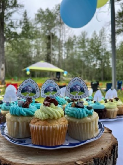
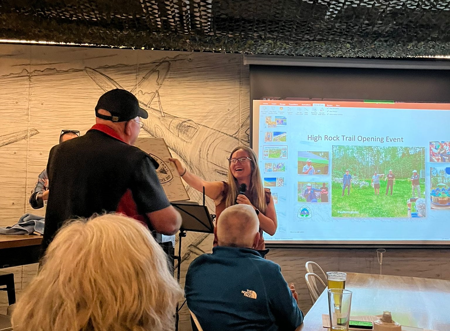
After 7 years in the making, this summer marked the official opening of the High Rock Trail (HRT)!
To celebrate, the GDTA organized an event at Chinook Lake Recreation Area in Coleman, AB, where the High Rock Trail section begins. In attendance were many of the long-term volunteers, new volunteers, and locals to the Crowsnest Pass. We were lucky to have perfect weather in addition to all the great company.
To start us off, Dave Higgins, who is one of the original 6 people to begin building the Great Divide Trail, spoke and introduced the trail, both the GDT in general, as well as the High Rock Trail. Listening to Dave speak about the history of the GDT is always fascinating and inspiring. For a lot of us it’s strange to imagine a time when the GDT didn’t exist, and that 6 university students pieced it all together.
Dave Higgins introduces the GDT and HRT to start off the HRT Opening Ceremony.
Crowsnest Pass Councillor Lisa Sygutek, and Livingstone McLeod MLA Roger Reid were in attendance. We appreciate them supporting the Great Divide Trail, and it was great to hear them speak to the importance of outdoor recreation, access to it, and how it has personally been important in their own lives. We are grateful that we have them to help spread the word about the GDT, and to encourage other local folks to get out and use it!
Left to right, GDTA volunteers Jeremy Bateson and Deb Yanchula, Livingstone McLeod MLA Roger Reid, Crowsnest Pass Councillor Lisa Sygutek, and others enjoy speeches and stories.
Board President Doug Borthwick took to the front and started by presenting a donation to the Crowsnest Bible Camp, who have started a scholarship fund in memory of Lanea Schroeder. Lanea was one of the many young people to volunteer on the Great Divide Trail. The Crowsnest Bible Camp has also become the first trail adopter group for the Great Divide Trail, taking on the High Rock Trail as their adopted section. The Trail Adopter Program is new to the GDTA, and we are very excited to see how it works out with Crowsnest Bible Camp, so we can extend the program to other locations on the trail.
Then Doug presented Awards of Recognition to Dave Hockey, Brad Vaillancourt, and Wayne Marshall. These three people were essential in the planning and building of the High Rock Trail. Thank you to all three of them for all the time, work, and effort they put into the trail.
The event ended with the cutting of the flagging tape to officially open the High Rock Trail. With great sentiment and symbolism, the flagging tape used for the ceremony had been tied together from tape that had already been used to scout and flag trail sections, during the construction of the trail.
Cutting the “ribbon”. Left to right Brad Vaillancourt, Doug Borthwick, Dave Hockey, and Wayne Marshall.
After the event, a number of folks headed to the Pass Brewery to enjoy the “High Rock Mango Ale”, a beer they designed just for the occasion!
We want to say a huge thank you to all the people, and organizations who made it possible for the High Rock Trail to come to be.
A huge thank you to the HRT Event Team for organizing this day.
Very well organized HRT Opening Ceremony – Thank You HRT Event Team!
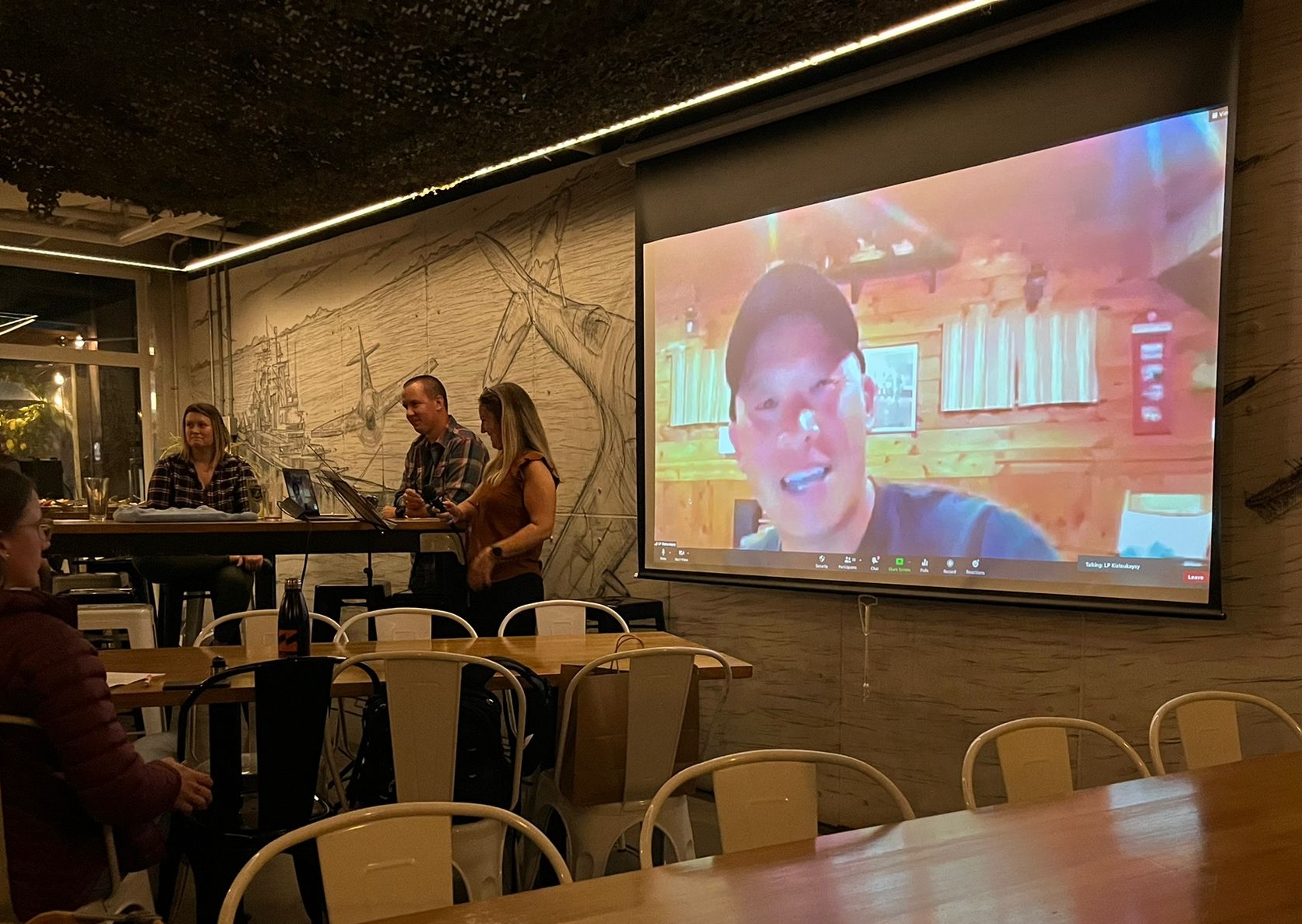
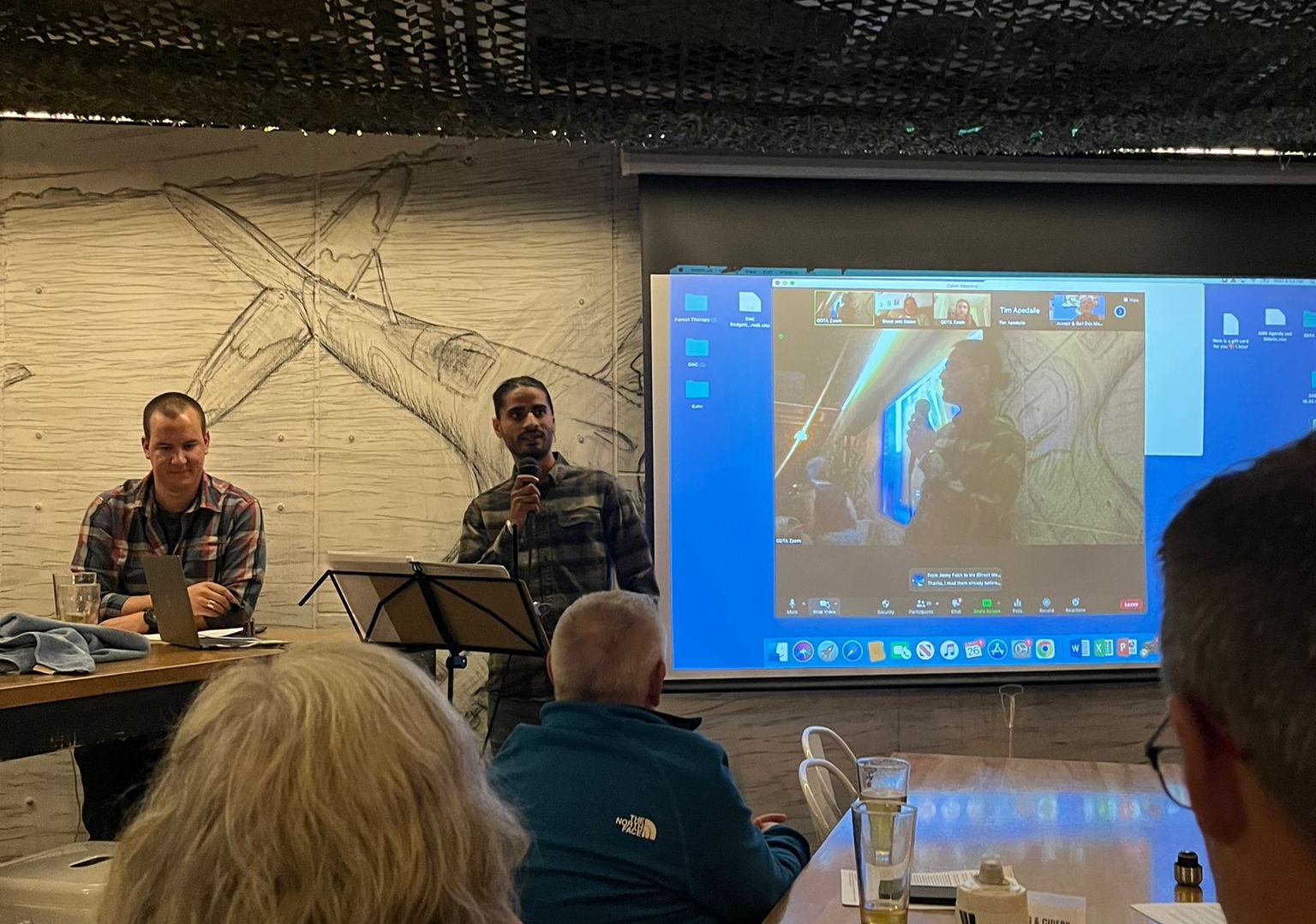
On September 26, 2022 the GDTA held their Annual General Meeting in Calgary, Alberta at Elite Brewing & Cidery. This hybrid version also had an online option so folks afar could Zoom in and take part. Approximately 75 people were in person, with another 20 online.
AGM attendees fully focused on the speakers.
Keynote Speaker
The evening started with the amazing keynote speaker, Lil’ Buddha. Lil’ Buddha was named a 2021 Outsider of the Year by Outside Magazine, a name he has more than earned. A Hmong-American, Lil’ Buddha arrived in the United States with his family when he was very young. They settled in Kansas where he grew up. Growing up, his family took trips to the Colorado Mountains where he developed a love for the outdoors and mountains. After college he went down the path of a typical corporate office career. But this didn’t settle well with him and he returned to hiking, big time, with goals of thru-hiking America’s long trails. Acting on this goal, Lil’ Budda has hiked the JMT (John Muir Trail), CDT (Continental Divide Trail) several times, AT (Appalachian Trail) more than once, PCT (Pacific Crest Trail) more than once, GDT (Great Divide Trail), and other long trails. Totalling over 45,000 miles. Here is an excellent video in Lil’ Buddha’s own words that vividly depicts his life journey.
During his talk, we were all in awe with inspiration, but not only that, Lil’ Buddha provoked thoughts how we can make the GDT a safe and inclusive space for everyone. He offered suggestions to the GDTA, suggestions that we are taking seriously, because the trail really is for everyone, and we want to do the absolutely best we can to ensure this. Thank you to @lilbuddhahikes for taking the time to share your story, thoughts and ideas, we appreciate you.
Keynote Speaker, Lil’ Budda presenting remotely on the big screen.
Treasurer’s Report
Moving into the meeting agenda, Treasurer Gina Guild (nee Van Haren) explained the GDTA’s financials. The GDTA is in a good position moving into the next fiscal year, and we are anticipating another great year.
Annual Report
Board President Doug took to the front to offer his President’s report. Doug took time to introduce all the Board Members, current and departing this year, thanking them all for their service and hard work. Doug also highlighted some of the larger events that took place after last year’s AGM, such as a very successful donor campaign, and the hiring of the GDTA’s first Executive Director, Kate Hamilton.
Next, Executive Director Kate Hamilton took the torch from Doug to talk about the remainder of the year. She talked about the new member benefits and highlighted some of the great work that the committees have been up to (there was too much great work to share everything!) Kate thanked all the GDTA’s supporters this past year, including the thousands of hours given by all of the volunteers. To read the full Annual Report, please click here.
Executive Director, Kate Hamilton delivers the GDTA Annual Report.
Votes
Voting came next. GDTA members in attendance, both in person and virtually, voted on filling open Board of Directors seats, proposed new membership options, and required financial votes.
Board Members Election
We were very lucky to have 10 amazing Board nominees this year to fill 6 open seats. The quality, enthusiasm, and skills of all the board nominees were exceptional, and the GDTA would have benefited from all candidates who were voted on. We want to extend our gratitude to all the nominees that put their names forward and look forward to working with everyone in the coming year.
In addition to Jeff Gruttz returning for another term, this year’s BOD vote welcomed 5 new Directors to the board; Lisa Belanger, Erin Colwell, Bhawan Waraich, Mandi Parkin, and Kristine O’Rielly. To get to know them, here are their candidate statements:
Jeff Gruttz – Jeff is a co-founder of the GDTA since its formation in 1975. He has served in many positions in that time; on the Trail Building and Maintenance Committee and Safety and Environment Committee since they were established. He prepared GDTA trail building and planning procedures that meet or exceed our Industry Best Practices.
Jeff is an incumbent Board Member. He has served in many roles on the Board including the position of Chair in 2018 and 2019. He brings a depth of knowledge and experience for trail building, safety and board processes. He has completed his current term and would like to continue as a Board member.
Bhawan Waraich – Hello my name is Bhawan Waraich, I currently work as commercial Insurance Advisor in Calgary Alberta. I’m originally from Punjab, India and moved to Canada in 2011. I hold an accounting diploma and have worked as an accounting technician in the past.
I also completed an outdoor field leader course this year from outdoor council of Canada.
Most of my interests are related to outdoor activities such as camping, hiking, mountain biking and arts such 35mm film photography, film developing and processing.
Being able to encourage someone to enjoy outdoor activities safely is what I love the most, whether it’s taking a group on their first ever camping trip or educating someone about hiking in bear country, I enjoy all aspects of the process.
Board nominee, Bhawan Waraich gives his candidate pitch.
Mandi Parkin – With a Bachelor of Ecotourism and Outdoor Leadership from Mount Royal University, Mandi Parkin has over 10 years of experience in the outdoor recreation industry. Throughout her experience Mandi has worked to promote access, inclusion and safety in the outdoors through a variety of professional and volunteer positions, including outdoor programming facilitation for a variety of organizations and participation in Calgary’s Search and Rescue Association.
Currently, Mandi works as the Outdoor Pursuits Team Lead at Prospect Human Services. One of Mandi’s key responsibilities is to manage Prospect’s Outdoor Risk Management Plan; through the collection and analysis of trip data, research and regular communication with other industry professionals, Mandi works with the Outdoor Pursuits team to ensure Prospect’s Outdoor Risk Management Plan is: in-line with current industry best practice, satisfies stakeholder needs and is effective in ensuring safety in Prospect’s programs.
On top of her regular responsibilities, Mandi is a key member of Prospect’s Safety Committee and trains Prospect staff in safety related courses such as Non-Violent Crisis Intervention and De-Escalating Potentially Violent Situations.
Mandi’s experience in outdoor risk management, paired with her proven ability to thrive in a collaborative team environment, will make her an asset to the Great Divide Trail Association and its members.
Lisa Belanger – Lisa really believes long trails are special, providing access to the wilderness while protecting the corridors they pass through. She’s always loved hiking, and all kinds of outdoor adventures. This summer, she thru-hiked the Pacific Crest Trail, developed a deeper appreciation for the immense dedication and work that goes into long trails, and resolved to be part of the mission in completing and protecting one close to home.
Her professional career is in the non-profit sector, currently as Director of Operations at the Rural Development Network, where she develops processes and strategies for effective community-focused operations, organizational growth, and financial resilience. Over the past 6 years since graduating with a Bachelor of Commerce from the U of A, she’s developed skills in areas relevant to the GDTA’s priorities. She’s involved in managing 50+ funding applications each year, increasing their likelihood of success, and ensuring they not only support projects but also the operational needs of the organization. She also develops policies and processes to help achieve operational goals and growth in staffing. She understands the importance of good governance, and would love to contribute not only her experience to the GDTA Board, but also her passion for achieving its broader vision.
Kristine O’Reilly – Born and raised in the small fishing village of St. Brendan’s, an island off the east coast of Newfoundland, Kristine attributes her rural upbringing for her love of nature. Kristine has been living in the GDT-region for the past 7 years. She is an apprentice hiking guide with the Association of Canadian Mountain Guides and can be found regularly hiking and skiing in the Canadian Rockies.
She is an active volunteer with the Calgary Zoo, Parks Canada, the Alpine Club of Canada and she was a member of Yellowstone to Yukon’s Team Thrive pilot volunteer program. Kristine holds a bachelor’s degree in mechanical engineering and a master’s in applied sustainability.
She has a background in project management, stakeholder engagement and grant/proposal writing. She also has an interest in community engagement and conservation education and has been known to put her hand up to support event-planning and social media campaigns.
Kristine served as the Access & Environment Chair for the Alpine Club of Canada – Calgary Section from 2016-2019. Her mantra is that conservation is a team sport; we can get further by partnering with like-minded organizations who are working toward our shared goal of preserving the wilderness of the GDT region.
Erin Colwell – Hello I’m Erin! I was born in Calgary and lived here most of my life, aside from a stint in Qatar with my family as a child, and completing my undergrad in Global Development Studies in Ontario. I moved back to Calgary after my undergrad in 2015 and have been here ever since.
I graduated law school at the University of Calgary in 2021, and will be called to the Alberta bar on September 16, 2022. I work in civil litigation at Norton Rose Fulbright Canada LLP.
When I am not chained to a desk, I love getting outdoors and am perpetually trying to get out more than I do. I grew up hiking, camping, and backpacking all around Kananaskis, Canmore, Banff, as well as areas south of Calgary. Last summer I managed to sneak in 6 backcountry trips and even managed to get onto a portion of the Great Divide Trail (Vista Lakes to Sunshine).
Since high school, I have always had volunteering as a part of my life. In my undergrad I volunteered extensively with Oxfam Canada, among other organizations. In law school I volunteered for our school’s legal clinic, Student Legal Assistance, as well as Pro Bono Students Canada, and various other free legal advice initiatives. I currently volunteer with Big Brothers Big Sisters and will continue to do so. This, however, would be the first Board of Directors that I would sit on.
I’m happy to chat or answer any questions about myself.
Membership Options
Membership was a hot topic of the night. Doug Borthwick presented the idea of offering lifetime memberships for $100, as well as free memberships for people under the age of 25. These ideas have been in the making for over a year, backed by research and a variety of other reasons. These motions made it through the Outreach Committee, and after a lot of scrutiny, through the Board. Both motions were voted on and approved by the membership and we look forward to seeing how this will support and grow the organization. We continue to offer individual annual membership ($30), couple annual membership ($50), and family annual membership ($70).
Finance Approvals
Treasurer Gina Guild (nee Van Haren) made two motions; the first to accept financial 2022 statements, and the second to approve the appointment Khalfans Chartered Professional Accountants for a review engagement for next year’s statements. Both motions were approved by the membership.
Volunteer Recognition
Lastly was the volunteer recognition. The GDTA volunteers are the most important part of the organization, without them, there would not be a Great Divide Trail. We have amazing, committed and skilled volunteers that work hard year round. All of our volunteers are important and have a significant impact to the organization. This year Deb Yanchula, Doug Borthwick and Kate Hamilton wanted to highlight 9 particular volunteers that stood out:
Besides all the AGM business, attendees enjoyed catching up with friends, old and new, over the Elite Brewing & Cidery food and beverages. GDTA corporate supporters’ hiker gear, food, and other offerings were on display and for sale. And opportunities to see and purchase GDT logo merchandise were available. One could also buy the highly acclaimed “Tales from the Great Divide, Second Edition”.
Hiker foods were available from GDTA corporate supporters Flat Out Feasts and Wild Mountain Eats.
GDTA logo merchandise, gear, books, and other related “goodies” were available to purchase through GearTrade.